- Usage in publication:
-
- Swope limestone member
- Modifications:
-
- Original reference
- Dominant lithology:
-
- Limestone
Summary:
Pg. 17 and table C. Swope limestone member of Bethany Falls limestone. Revised correlation by R.C. Moore, 1931 [unpublished?], divides Bethany Falls limestone in vicinity of Kansas City into (descending) Swope limestone, Sugar Creek shale, and Middle Creek limestone. Age is Late Pennsylvanian (Missouri age).
Source: US geologic names lexicon (USGS Bull. 896, p. 2101); GNC KS-NE Pennsylvanian Corr. Chart, sheet 2, Oct. 1936.
- Usage in publication:
-
- Swope formation
- Modifications:
-
- Revised
Summary:
Pg. 100. Base of Swope formation is variable, since the lower limestone members are less persistent than Bethany Falls limestone, the upper member. In all cases Swope formation includes strata from top of Bethany Falls limestone as defined in reports of Missouri Geol. Survey down to base of lowest lens of limestone, which is a few feet below the Bethany Falls and which is persistent over several miles. This excludes blue flaggy beds which are present a few feet below Swope formation in southern Linn and northern Bourbon Counties, eastern Kansas. Age is Late Pennsylvanian (Missouri age).
Source: US geologic names lexicon (USGS Bull. 896, p. 2101).
- Usage in publication:
-
- Swope limestone
- Modifications:
-
- Revised
Summary:
Pg. 90, 97. Swope limestone of Bronson group. The beds from top of Bethany Falls limestone down to base of Schubert Creek limestone (which overlies Ladore shale [restricted], clearly represent a single sedimentation cycle and are here named Swope formation. They are divided into (descending): Bethany Falls limestone [restriction of R.C. Moore's 1931 definition and replaces Swope limestone of his 1931 list of names], Hushpuckney shale [= Sugar Creek shale], Middle Creek limestone, Elm Branch shale, Sniabar limestone, Mound City shale, Critizer [Critzer] limestone, Tennison Creek shale, and Schubert Creek limestone (called "Hertha" by Hinds and Greene). Age is Late Pennsylvanian (Missouri age).
[Origin of name not stated.]
Source: US geologic names lexicon (USGS Bull. 896, p. 2101); GNC KS-NE Pennsylvanian Corr. Chart, sheet 2, Oct. 1936.
- Usage in publication:
-
- Swope limestone
- Modifications:
-
- Principal reference
- Dominant lithology:
-
- Limestone
- Shale
- AAPG geologic province:
-
- Forest City basin
- Cherokee basin
Summary:
Pg. 26-29. Swope limestone of Bronson group. Swope limestone is proposed by Moore and Newell for the persistent limestones and thin shales from top of Ladore shale [restricted] to top of Bethany Falls limestone. In Johnson and Miami Counties, northeastern Kansas, divided into (ascending) Middle Creek limestone, Hushpuckney shale, and Bethany Falls limestone. Age is Late Pennsylvanian (Missouri age). [On p. 26 he also stated that Ladore shale of southern Kansas may include representatives of Middle Creek limestone and Hushpuckney shale. Named from Swope Park, Kansas City, Missouri.]
Source: US geologic names lexicon (USGS Bull. 896, p. 2101); GNC KS-NE Pennsylvanian Corr. Chart, sheet 2, Oct. 1936.

- Usage in publication:
-
- Swope formation
- Modifications:
-
- Revised
Summary:
Pg. 37. Swope limestone of Bronson group. Definition of Swope formation is modified to exclude beds below Middle Creek limestone, because nowhere else in Missouri series has a well-defined "lower" limestone (in terms of Shawnee cycle) been found. [On p. 78 Moore stated Swope limestone of his 1932 definition (Kansas Geol. Soc. 6th Ann. Field Conf. Gdbk.) includes beds classed in his 1936 paper as Hertha limestone, Ladore shale, and Bethany Falls limestone.] Age is Late Pennsylvanian (Missouri age).
Source: US geologic names lexicon (USGS Bull. 896, p. 2101); GNC KS-NE Pennsylvanian Corr. Chart, sheet 2, Oct. 1936.
- Usage in publication:
-
- Swope limestone*
- Modifications:
-
- Revised
- AAPG geologic province:
-
- Forest City basin
Summary:
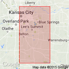
Pl. 1. Swope limestone included in Kansas City group (redefined). Underlies Galesburg shale; overlies Ladore shale. Age is Late Pennsylvanian (Missourian).
Source: US geologic names lexicon (USGS Bull. 1200, p. 3795).
- Usage in publication:
-
- Swope limestone
- Modifications:
-
- Overview
Summary:
Pg. 192-193. Swope limestone of Bronson group. Includes (ascending) Middle Creek limestone, Hushpuckney shale, and Bethany Falls limestone members. Average thickness 23 feet. Overlies Ladore shale; underlies Galesburg shale. Age is Late Pennsylvanian (Missourian).
Source: US geologic names lexicon (USGS Bull. 1200, p. 3795).
- Usage in publication:
-
- Swope limestone
- Modifications:
-
- Revised
Summary:
Pg. 2028-2029, 2031 (fig. 4). Swope limestone included in Kansas City group (redefined in Kansas and Nebraska). Comprises (ascending) Middle Creek limestone, Hushpuckney shale, and Bethany Falls limestone members. Overlies Ladore formation; underlies Galesburg formation. Bronson reduced to [informal] subgroup of Kansas City group (redefined). This is classification agreed upon by Geological Surveys of Iowa, Kansas, Missouri, Nebraska, and Oklahoma, May 1947. Age is Late Pennsylvanian (Missourian).
["Subgroup" not recognized as a formal stratigraphic rank term (CSN, 1933; ACSN, 1961, 1970; NACSN, 1983, 2005, 2021). Considered informal and should not be capitalized.]
Source: US geologic names lexicon (USGS Bull. 1200, p. 3795).
- Usage in publication:
-
- Swope formation*
- Modifications:
-
- Overview
- AAPG geologic province:
-
- Iowa shelf
Summary:
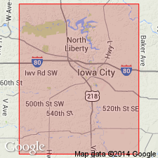
Pg. 418 (fig. 1), 421. Swope formation. Included in Kansas City group. Thickness about 27 feet. Comprises (ascending) Middle Creek limestone, Hushpuckney shale, and Bethany Falls limestone members. Overlies Ladore shale; underlies Galesburg shale. Age is Late Pennsylvanian (Missourian).
Source: US geologic names lexicon (USGS Bull. 1200, p. 3795).
For more information, please contact Nancy Stamm, Geologic Names Committee Secretary.
Asterisk (*) indicates published by U.S. Geological Survey authors.
"No current usage" (†) implies that a name has been abandoned or has fallen into disuse. Former usage and, if known, replacement name given in parentheses ( ).
Slash (/) indicates name conflicts with nomenclatural guidelines (CSN, 1933; ACSN, 1961, 1970; NACSN, 1983, 2005, 2021). May be explained within brackets ([ ]).

