

- Usage in publication:
-
- Swasey formation*
- Modifications:
-
- Biostratigraphic dating
- AAPG geologic province:
-
- Great Basin province
Summary:
Swasey formation is exposed on the southwest ridge of Swasey Peak. Consists of oolitic and arenaceous limestone in massive layers near top. Below, dark bluish-gray limestone, occasionally interbedded; also contains drab and reddish argillaceous shales. Thickness is 340 ft. Conformably overlies Dome limestone; conformably underlies Wheeler formation. Age is Middle Cambrian on the basis of fossils [trilobites, brachiopods].
Source: GNU records (USGS DDS-6; Menlo GNULEX).

- Usage in publication:
-
- Swasey formation*
- Modifications:
-
- Original reference
- Dominant lithology:
-
- Limestone
- Shale
- AAPG geologic province:
-
- Great Basin province
Summary:
Pg. 9, 11. Swasey formation. Bluish-gray oolitic and arenaceous limestones with some calcareous and argillaceous shales. Thickness 238 feet. Overlies Dome formation and underlies Wheeler formation. Age is Middle Cambrian.
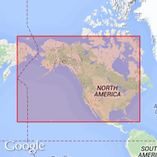
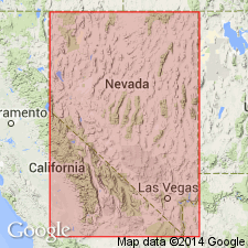
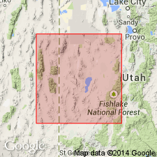
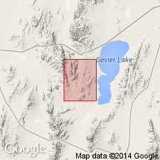
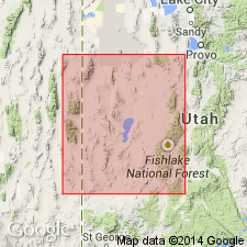
Type locality: slopes of Swasey Peak, House Range, [in T. 16 S., R. 13 W., Swasey Peak 7.5-min quadrangle, Millard Co.], western UT.
Source: US geologic names lexicon (USGS Bull. 896, p. 2097).

- Usage in publication:
-
- Swasey limestone
- Modifications:
-
- Revised
- Dominant lithology:
-
- Limestone
- Shale
- AAPG geologic province:
-
- Great Basin province
Summary:
Pg. 113-1134, 1141, 1145-1146. Swasey formation. Because Walcott's section of Swasey was not part of a continuous section and original definition was not sufficiently precise, Swasey is herein redefined and type section assigned. As emended, formation consists of a lower unit 117 feet thick and an upper unit 278 feet thick. Lower unit consists of 38 feet of interbedded dull-gray fine-grained platy argillaceous limestone and clay shale with well-preserved cranidia and pygidia of EHMANIA; 50 feet of dull- and dark-gray platy and a few arenaceous limestones with several beds of EHMANIA-coquina at top; and 29-foot zone of green micaceous chunky and fissile shale and interbedded gray thin-bedded limestones which increase in amount upward. Upper 278 feet consist of dark- and black-gray medium-grained massive and irregular-bedded limestone which contains oolites in the lower, and small algae (GIRVINELLA?) in upper part. Overlies Dome limestone (emended); underlies Wheeler shale (emended). [Age is Middle Cambrian.]
Type locality (emended): north side of Marjum Canyon, [in T. 18 S., R. 14 W., Notch Peak 7.5-min quadrangle, Millard Co.], House Range, western UT.
Source: US geologic names lexicon (USGS Bull. 1200, p. 3788-3789).
- Usage in publication:
-
- Swasey limestone
- Modifications:
-
- Revised
- AAPG geologic province:
-
- Great Basin province
Summary:
Swasey limestone is divided into two subunits (ascending): Condor member and an unnamed upper member. Condor member is recognized in southern NV. Thickness is 395 ft. Conformably overlies Dome limestone; conformably underlies Wheeler "shale". Age is Middle Cambrian on the basis of fossils [trilobites].
Source: GNU records (USGS DDS-6; Menlo GNULEX).
- Usage in publication:
-
- Swasey limestone
- Modifications:
-
- Revised
- AAPG geologic province:
-
- Great Basin province
Summary:
Lower contact revised in that the basal shaly unit is removed from the Swasey limestone and named Whirlwind formation. Swasey is restricted to the cliff-forming limestone; it overlies Whirlwind in the House and Wah Wah Ranges of Millard Co, UT, Great Basin province. Diagrammatic cross section. Correlation chart. Swasey underlies Wheeler [formation] in the House Range and an unnamed unit in the Wah Wah Range. Assigned to the BATHYURISCUS-ELRATHINA trilobite assemblage zone. Of Middle Cambrian age.
Source: GNU records (USGS DDS-6; Denver GNULEX).
- Usage in publication:
-
- Swasey Limestone*
- Modifications:
-
- Revised
- AAPG geologic province:
-
- Great Basin province
Summary:
Swasey Formation renamed Swasey Limestone in type area because it is mostly limestone. Age is Middle Cambrian.
Source: GNU records (USGS DDS-6; Menlo GNULEX).
- Usage in publication:
-
- Swasey Limestone
- Modifications:
-
- Revised
- AAPG geologic province:
-
- Great Basin province
Summary:
Revised in that unit underlies newly named Eye of Needle Limestone in Wah Wah, southern House and Cricket Ranges, western UT, Great Basin province. Overlies Whirlwind Formation. Contains diverse trilobite fauna informally referred to as GLYPHASPIS fauna. Assigned to BATHYURISCUS-ELRATHINA trilobite assemblage zone (Middle Cambrian).
Source: GNU records (USGS DDS-6; Denver GNULEX).
For more information, please contact Nancy Stamm, Geologic Names Committee Secretary.
Asterisk (*) indicates published by U.S. Geological Survey authors.
"No current usage" (†) implies that a name has been abandoned or has fallen into disuse. Former usage and, if known, replacement name given in parentheses ( ).
Slash (/) indicates name conflicts with nomenclatural guidelines (CSN, 1933; ACSN, 1961, 1970; NACSN, 1983, 2005, 2021). May be explained within brackets ([ ]).