The National Geologic Map Database is migrating to a new infrastructure. We apologize for any service disruptions during this process.
|
|---|


- Usage in publication:
-
- Survant Coal Member
- Modifications:
-
- Overview
- Dominant lithology:
-
- Coal
- AAPG geologic province:
-
- Illinois basin
Summary:
According to this compendium, name Survant coal was first applied by Fuller and Ashley (1902: USGS Geol. Atlas, Folio 84) to exposures near abandoned town of Survant, Pike Co., IN. Formal status was applied by Wier (1965: IN G.S. Mem. Rept. C-131 [not available]) who assigned the coal to the Linton Formation. Unit is highly variable in thickness, ranging from 0.2 to 8 ft, and commonly split. Top of coal is top of Linton Formation. Underlies sandstone or gray shale of the Petersburg Formation.
Source: GNU records (USGS DDS-6; Reston GNULEX).
- Usage in publication:
-
- Survant Coal Member/coal bed
- Modifications:
-
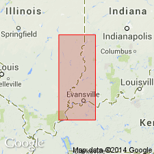
- Areal extent
- AAPG geologic province:
-
- Illinois basin
Summary:
Survant Coal recognized in IL as member of Carbondale Formation. In KY, remains informal coal bed. Unit is split in southeastern and east-central IL. Upper split previously called Shawneetown Coal. In north and west, corresponds to Lowell Coal Member.
Source: GNU records (USGS DDS-6; Reston GNULEX).

- Usage in publication:
-
- Survant Coal Member
- Modifications:
-
- Overview
- Reference
- AAPG geologic province:
-
- Illinois basin
Summary:
Indiana Geological Survey drillhole SDH 306 is herein designated the reference core for the Houchin Creek Coal Member of the Petersburg Formation; the Survant Coal, Velpen Limestone, Mecca Quarry Shale, and Colchester Coal Members of the Linton Formation; the Seelyville Coal Member of the Staunton Formation; and the boundary between the Petersburg and Linton Formations. SDH 306 is located near the type section of the Survant Coal Member, in SW1/4 NE1/4 sec. 2, T2S, R7W, Pike Co., southern IN. Unit described in reference core as 1.9 ft of moderately bright-banded coal with pyrite on cleats. Uppermost unit of Linton Formation.
Source: GNU records (USGS DDS-6; Reston GNULEX).
For more information, please contact Nancy Stamm, Geologic Names Committee Secretary.
Asterisk (*) indicates published by U.S. Geological Survey authors.
"No current usage" (†) implies that a name has been abandoned or has fallen into disuse. Former usage and, if known, replacement name given in parentheses ( ).
Slash (/) indicates name conflicts with nomenclatural guidelines (CSN, 1933; ACSN, 1961, 1970; NACSN, 1983, 2005, 2021). May be explained within brackets ([ ]).