

- Usage in publication:
-
- Sundance formation*
- Modifications:
-
- First used
- Dominant lithology:
-
- Shale
- Sandstone
- AAPG geologic province:
-
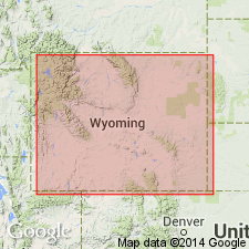
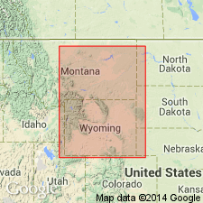
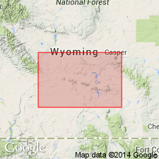
- Powder River basin
- Williston basin
- Chadron arch
Summary:
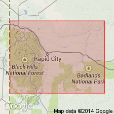
First use of name. Intent to name not stated, and no type locality designated. Probably named for Sundance, Crook Co, WY in the Powder River basin. Typical sections measured at 12 localities throughout the Black Hills. Extends continuously around the Black Hills uplift, Williston and Powder River basins and on Chadron arch. Is composed of green shales and thin-bedded sandstones, 60 to 400 ft thick, underlying Unkpapa sandstone (new) or Beulah shales [Morrison formation] and unconformably overlying Spearfish formation (new, redbeds) in Black Hills. Shales are mainly dark green and sandstones pale buff in color, but there is an intermediate member of sandy shales and sandstones of reddish color, and often a local basal member of red sandstone. The shales usually include thin layers of limestone which are always highly fossiliferous. Marine Jurassic fossils abundant. Is of Jurassic age.
Source: GNU records (USGS DDS-6; Denver GNULEX).
- Usage in publication:
-
- Sundance formation*
- Modifications:
-
- Areal extent
- Overview
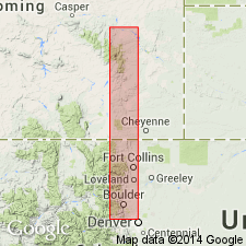
- AAPG geologic province:
-
- Denver basin
Summary:
Extended geographically from SD into Platte Co, WY in the Denver basin where it overlies Permian Spearfish sandstone and underlies Jurassic Morrison formation. Is about 200 ft thick. Consists of a lower buff to white flecked with red sandstone that is partly massive and partly clayey, and an upper 60 ft of slabby sandstone interbedded with marine Jurassic fauna found northeast of Cassia. Mapped at northwest edge of map. Columnar section.
Source: GNU records (USGS DDS-6; Denver GNULEX).
- Usage in publication:
-
- Sundance formation*
- Modifications:
-
- Areal extent
- Revised
- AAPG geologic province:
-
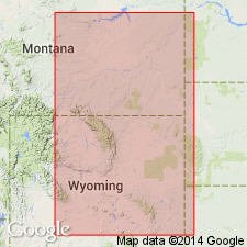
- Bighorn basin
- Powder River basin
Summary:
Extends continuously around Bighorn uplift, Bighorn and Powder River basins, where it averages 300 ft thick. Is a marine Jurassic unit with an abundant fauna. Has a basal sandy series, and a thick, greenish, fossiliferous shale series around the uplift. Locally at or near base, a 3-25 ft thick, hard, fossiliferous limestone is present. Overlies Triassic Chugwater formation (a new unit) and underlies Jurassic Morrison formation. Assigned a Jurassic age.
Source: GNU records (USGS DDS-6; Denver GNULEX).
- Usage in publication:
-
- Sundance formation*
- Modifications:
-
- Overview
- AAPG geologic province:
-
- Powder River basin
Summary:
Type locality is above Sundance, not far southeast of Belle Fourche quad, SD in Powder River basin. Is of Jurassic age.
Source: GNU records (USGS DDS-6; Denver GNULEX).
- Usage in publication:
-
- Sundance formation
- Modifications:
-
- Overview
- AAPG geologic province:
-
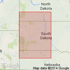
- Powder River basin
- Williston basin
Summary:
Divided into upper and lower Sundance in the Powder River basin, WY on the basis of a regional intraformational unconformity representing erosion during Divesian time. In a section measured on a hill 1/2 mi northeast of Spearfish, SD in the northeastern part of the Black Hills, Williston basin, upper Sundance is 128 ft thick and lower Sundance 141 ft thick; the contact between the two parts is at top of a sequence of red sandy shale overlain abruptly by light-gray shaly sandstone and gray and black shale. Is of Late Jurassic age.
Source: GNU records (USGS DDS-6; Denver GNULEX).
- Usage in publication:
-
- Sundance formation
- Modifications:
-
- Revised
- Areal extent
- AAPG geologic province:
-
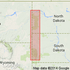
- Williston basin
Summary:
Extends name to Nesson anticline in central part of Williston basin, Williams Co., ND. Revises downward the contact with underlying Spearfish formation as determined by DeWolf and West (1939) on the Baker-Glendive [Cedar Creek] anticline, MT. Is Jurassic in age.
Source: GNU records (USGS DDS-6; Denver GNULEX).
- Usage in publication:
-
- Sundance formation*
- Modifications:
-
- Revised
- Reference
- Overview
- AAPG geologic province:
-
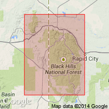
- Williston basin
Summary:
Subdivided (ascending) into Canyon Springs sandstone, Stockade Beaver shale, Hulett sandstone, Lak, and Redwater shale members (all new). Thickness 200-350 ft. Unconformably overlies Gypsum Spring formation, Nugget? sandstone, or Spearfish formation; conformably overlain by Morrison formation or Unkpapa sandstone. A thin, persistent, yellowish sandstone which Darton provisionally included in the top of Sundance along the northern, western, and southern sides of the Black Hills is placed in Morrison formation and considered to represent Unkpapa sandstone of the eastern Black Hills. Reference section measured about 1/4 mi north-northeast of center of Spearfish, SD, sec 3, T6N, R2E, Lawrence Co, in Williston basin. Is of Late Jurassic (Oxfordian and Callovian) age.
Source: GNU records (USGS DDS-6; Denver GNULEX).
- Usage in publication:
-
- Sundance formation
- Modifications:
-
- Biostratigraphic dating
- AAPG geologic province:
-
- Powder River basin
- Williston basin
- Chadron arch
Summary:
Describes FORAMINIFERA from 7 localities in MT, WY, ND, and SD, including localities in Weston Co., WY in Powder River basin, Ward Co, ND in Williston basin, and Custer Co, SD on Chadron arch. Collected from Rierdon formation in MT, from Stockade Beaver shale member of Sundance formation in WY and SD, and from Sundance formation in ND. Is Late Jurassic (Callovian) in age.
Source: GNU records (USGS DDS-6; Denver GNULEX).
- Usage in publication:
-
- Sundance group
- Modifications:
-
- Revised
- Overview
- AAPG geologic province:
-
- Denver basin
- Chadron arch
- Powder River basin
Summary:
Proposed that in eastern WY and western SD, Sundance formation be raised to rank of group, comprising two units of formational rank which are correlated with Swift and Rierdon formations of Ellis group of MT. Because of historical significance, term Sundance should be retained, and, despite its correlation with upper units of Ellis group, term Sundance group is here applied to marine Upper Jurassic rocks of the Black Hills and vicinity, northernmost part of CO, subsurface of northwestern NE, and all but westernmost WY. Is Late Jurassic (Callovian and Oxfordian) age.
Source: GNU records (USGS DDS-6; Denver GNULEX).
- Usage in publication:
-
- Sundance formation
- Modifications:
-
- Biostratigraphic dating
- AAPG geologic province:
-
- Central Montana uplift
- Powder River basin
- Williston basin
- Chadron arch
- Bighorn basin
- Wind River basin
- Montana folded belt
Summary:
Describes 22 species of Upper [Late] Jurassic (Callovian) OSTRACODA, collected from outcrops in MT, WY, and SD. Concludes that the "upper Sundance"-Swift (Oxfordian) OSTRACODA assemblage is distinctly different from the "lower Sundance"--Rierdon assemblage, and that the "lower Sundance" assemblage of eastern WY and the Black Hills is markedly different from that of Rierdon formation in MT.
Source: GNU records (USGS DDS-6; Denver GNULEX).
- Usage in publication:
-
- Sundance formation
- Modifications:
-
- Areal extent
- AAPG geologic province:
-
- Chadron arch
- Sioux uplift
- Williston basin
Summary:
Subdivided into the Lower Sundance consisting of the (ascending) Canyon Springs sandstone, Stockade Beaver shale, Hulett sandstone, and Lak members (Imlay, 1947). The two parts of the formation traced in the subsurface from the Black Hills southward as far as Box Butte Co, northwestern NE, Chadron arch, eastward as far as Hyde Co, central SD, Sioux uplift, and northward to Billings Co, southwestern ND, Williston basin. Swift and underlying Rierdon formation correlated with the Upper and Lower Sundance, respectively, in ND.
Source: GNU records (USGS DDS-6; Denver GNULEX).
- Usage in publication:
-
- Sundance Formation*
- Modifications:
-
- Revised
- AAPG geologic province:
-
- Williston basin
Summary:
Modifies definition of Imlay (1947) to include yellow-weathering sandstone 2-30 ft thick as top bed of formation. This bed assigned to overlying Morrison Formation in the reference section of the Sundance Formation at Spearfish and elsewhere in the Black Hills by Imlay (1947). Unconformably overlies Gypsum Spring or Spearfish Formations. Is Late Jurassic (Callovian and Oxfordian) in age.
Source: GNU records (USGS DDS-6; Denver GNULEX).
- Usage in publication:
-
- Sundance Formation*
- Modifications:
-
- Revised
- AAPG geologic province:
-
- Wind River basin
- Green River basin
Summary:
Divided into seven members in south-central WY in the Wind River and Greater Green River basins. These are: Canyon Springs Sandstone (base), Stockade Beaver Shale, Hulett Sandstone, Lak, Pine Butte (new), Redwater Shale, and Windy Hill (top) Members. Is separated from older rocks by a regional unconformity. The basal contact of Windy Hill is also an unconformity. Underlies Morrison Formation. Pine Butte is equivalent to about the lower 30 ft of the Redwater as defined by Imlay (1947) at Spearfish, Lawrence Co, SD. Windy Hill correlates with a yellowish-gray sandstone bed at least 5 ft thick overlying Redwater as defined by Imlay (1947) near Spearfish, SD. The unit considered to be equivalent to Windy Hill Sandstone Member was made part of Redwater Shale Member by Robinson, Mapel, and Bergendahl (1964). Is of Jurassic age. Cross sections.
Source: GNU records (USGS DDS-6; Denver GNULEX).
- Usage in publication:
-
- Sundance Formation*
- Modifications:
-
- Areal extent
- AAPG geologic province:
-
- Denver basin
- Powder River basin
Summary:
Divisible into (ascending order): Canyon Springs Sandstone, Pine Butte, and Windy Hill Sandstone Members from Horse Creek, Laramie Co, WY to southeast along east flank of Boulder, Boulder Co, CO in the Denver basin. Divisible into Canyon Springs Sandstone, Lak, Pine Butte, Redwater Shale, and Windy Hill Sandstone (top) Members north of Chugwater Creek, Laramie Co, to Douglas, Converse Co, WY in Powder River basin. Of Middle and Late Jurassic age. Measured sections shown graphically. Recognized throughout report area.
Source: GNU records (USGS DDS-6; Denver GNULEX).

- Usage in publication:
-
- Sundance Formation*
- Modifications:
-
- Principal reference
- Revised
- Age modified
- AAPG geologic province:
-
- Williston basin
- Powder River basin
- Chadron arch
Summary:
Includes (descending): Windy Hill Sandstone, Redwater Shale (revised), Pine Butte, Lak, Stockade Beaver, and Canyon Springs Sandstone Members in the Black Hills region in Crook and Weston Cos., WY (eastern Powder River basin); in Fall River Co., SD (northwestern Chadron arch); and in Lawrence Co., SD (southern Williston basin). Standard [Principal] reference section near Spearfish in Lawrence Co., SD (Imlay, 1947) partly redescribed to show Pine Butte Member, 32 ft thick, previously included at base of Redwater Shale Member, herein revised. An unconformity separates Middle (Callovian) from Upper (Oxfordian) Jurassic rocks at base of revised Redwater Shale Member. Summarizes lithology, basis for dating, distribution, and correlation.
Source: GNU records (USGS DDS-6; Denver GNULEX).

- Usage in publication:
-
- Sundance Formation*
- Modifications:
-
- Areal extent
- AAPG geologic province:
-
- Powder River basin
Summary:
Identified throughout the subsurface of the Powder River basin in MT and WY where it overlies Gypsum Spring Formation locally, or Chugwater Formation locally. Underlies Morrison Formation unconformably. Of Late Jurassic age. [This nomenclature shown on 22 cross sections in this OC series.]
Source: GNU records (USGS DDS-6; Denver GNULEX).
- Usage in publication:
-
- Sundance Formation*
- Modifications:
-
- Revised
- AAPG geologic province:
-
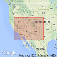
- Uinta basin
Summary:
Windy Hill Sandstone Member is removed from the Sundance Formation and reassigned as basal member of the Morrison Formation. "The Windy Hill Member was originally called the Windy Hill Sandstone Member and included in the Sundance Formation, which is largely but not entirely a marine formation. The extensive erosion surface at the base of the Windy Hill and its interfingering relations with lower Morrison strata indicate that it is more closely related to the Morrison than to the Sundance, even though it is a marine deposit. For these reasons, the Windy Hill Sandstone Member is here removed from the Sundance Formation, the lithologic name (sandstone) is deleted for simplicity and ease of use, and the member is reassigned to the Morrison Formation as the Windy Hill Member. This stratigraphic reassignment allows a clearer understanding, not only of the stratigraphic relations of the Windy Hill and correlative units in the Morrison, but also of the genesis of beds immediately above the J-5 unconformity." Correlation chart (fig. 3) shows Windy Hill above the J-5 unconformity in northeast UT, overlying the Redwater Member (Oxfordian) of the Sundance Formation (revised); the removal of the Windy Hill from the Sundance in this area leaves the Redwater as the only unit of the Sundance present in this area, where the Sundance unconformably overlies the Curtis Formation (Callovian, Middle Jurassic) above the J-4 unconformity.
Source: GNU records (USGS DDS-6; Denver GNULEX).
For more information, please contact Nancy Stamm, Geologic Names Committee Secretary.
Asterisk (*) indicates published by U.S. Geological Survey authors.
"No current usage" (†) implies that a name has been abandoned or has fallen into disuse. Former usage and, if known, replacement name given in parentheses ( ).
Slash (/) indicates name conflicts with nomenclatural guidelines (CSN, 1933; ACSN, 1961, 1970; NACSN, 1983, 2005, 2021). May be explained within brackets ([ ]).