


- Usage in publication:
-
- Sue Peaks Formation
- Modifications:
-
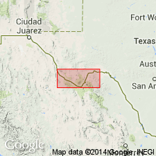
- Areal extent
- Overview
- AAPG geologic province:
-
- Permian basin
Summary:
Is Lower Cretaceous formation mapped only at western margin of sheet along Rio Grande in southern Terrell Co, TX (Permian basin). Overlies Del Carmen Limestone. Overlain by Santa Elena Limestone. Map unit described as [limestone], microgranular, thin-bedded, medium light-gray to medium dark-gray; occupies slope between escarpments formed by Santa Elena and Del Carmen Limestones; marine megafossils common; thickness 45 ft. Is not mapped east of Indian Creek, Terrell Co, TX. In map explanation, is schematically depicted to be equivalent to McKnight Formation, middle part of Devils River Limestone, upper part of Fort Terrett Member of Edwards Limestone, and lower part of Segovia Member of Edwards.
Source: GNU records (USGS DDS-6; Denver GNULEX).
- Usage in publication:
-
- Sue Peaks Formation
- Modifications:
-
- Mapped 1:250k
- Dominant lithology:
-
- Limestone
- Shale
- AAPG geologic province:
-
- Permian basin
Summary:
Sue Peaks Formation. Mapped in Terrell (along Rio Grande), Brewster, and Presidio Counties, Texas. Mapped (undifferentiated) with Santa Elena Limestone, Del Carmen Limestone, and Telephone Canyon Formation in Terlingua and Christmas-Rosillos Mountain areas, and Tascotal Mesa, Agua Fria, and Santiago Peak quadrangles. Upper part, mostly limestone, nodular, gray, some interbedded yellowish-gray shale, at base 20-foot ledge of limestone, massive, gray. Lower part, mostly shale, marly, some thin interbeds of limestone, marly, nodular, yellowish-gray to light brownish-gray; thickness 75 feet. Occupies slope between escarpments formed by Santa Elena and Del Carmen Limestones; marine megafossils common; thickness 250 feet in Big Bend National Park, 30 to 70 feet in Santiago Peak and Hood Spring quadrangles. Overlies Del Carmen Limestone. Underlies Santa Elena Limestone. Age is Early Cretaceous.
Source: Publication; supplemental information from GNU records (USGS DDS-6; Denver GNULEX).
For more information, please contact Nancy Stamm, Geologic Names Committee Secretary.
Asterisk (*) indicates published by U.S. Geological Survey authors.
"No current usage" (†) implies that a name has been abandoned or has fallen into disuse. Former usage and, if known, replacement name given in parentheses ( ).
Slash (/) indicates name conflicts with nomenclatural guidelines (CSN, 1933; ACSN, 1961, 1970; NACSN, 1983, 2005, 2021). May be explained within brackets ([ ]).