

- Usage in publication:
-
- Sturgis Formation*
- Modifications:
-
- Original reference
- Dominant lithology:
-
- Sandstone
- Siltstone
- Shale
- Limestone
- Coal
- AAPG geologic province:
-
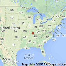
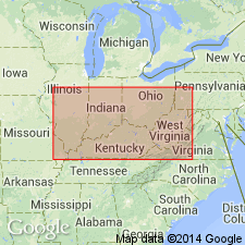
- Illinois basin
Summary:
Pg. B4-B8, B11+. Sturgis Formation. Light- to dark-gray sandstone interbedded with siltstone, shale, limestone, and coal. Thickness 1,678 feet. Includes (ascending) Providence Limestone Member, Anvil Rock Sandstone Member, Madisonville Limestone Member, Carthage Limestone Member, and Geiger Lake coal bed. Overlies and intergrades with Carbondale Formation; top of Sturgis is eroded. Rocks previously assigned to †Lisman and †Henshaw Formations (both abandoned). Age is Late Pennsylvanian.
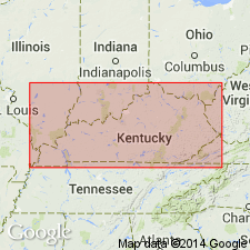
Type area and composite section (subsurface): Peabody Coal Company coreholes P-47 and P-49, about 5 mi northeast of Sturgis, Sturgis 7.5-min quadrangle, Union Co., western KY, and Cities Service Oil Company stratigraphic test hole 1801 at Camp Breckinridge, about 3 mi northeast of hole P-49, Bordley 7.5-min quadrangle, Union Co., western KY.
Source: Publication; US geologic names lexicon (USGS Bull. 1520, p. 297); GNU records (USGS DDS-6; Reston GNULEX).
- Usage in publication:
-
- Sturgis Formation*
- Modifications:
-
- Age modified
- AAPG geologic province:
-
- Illinois basin
Summary:
Age changed to Middle and Late Pennsylvanian and Early Permian. [Extension to Early Permian is based on fusulinids found by Douglass (written commun., 1977) in drill core samples from Bordley quad.]
Source: GNU records (USGS DDS-6; Reston GNULEX).
- Usage in publication:
-
- Sturgis Formation*
- Modifications:
-
- Age modified
- AAPG geologic province:
-
- Illinois basin
Summary:
Age changed to Middle and Late Pennsylvanian (Desmoinesian and Missourian) based on fusulinids. Providence Limestone, Anvil Rock Sandstone, and Madisonville Limestone Members are Middle Pennsylvanian; Carthage Limestone Member is Late Pennsylvanian.
Source: GNU records (USGS DDS-6; Reston GNULEX).
- Usage in publication:
-
- Sturgis Formation*
- Modifications:
-
- Revised
- AAPG geologic province:
-
- Illinois basin
Summary:
Sturgis Formation is stratigraphically restricted to exclude its Lower Permian upper part, which is now included in Mauzy Formation (new name). As redefined, Sturgis is about 2,039 ft thick. Pennsylvanian-Permian boundary now tentatively placed at proposed contact between Sturgis and Mauzy Formations. Age of Sturgis, therefore, is Middle and Late Pennsylvanian.
Source: GNU records (USGS DDS-6; Reston GNULEX).
- Usage in publication:
-
- Sturgis Formation†
- Modifications:
-
- Abandoned
- AAPG geologic province:
-
- Illinois basin
Summary:
Pg. 13-15, pl. 1. †Sturgis Formation [of Kehn, 1982] abandoned. Rocks reallocated to (descending) Mattoon, Bond, Patoka, and Shelburn Formations of McLeansboro Group. [See also entry under McLeansboro.]
Source: Publication.
For more information, please contact Nancy Stamm, Geologic Names Committee Secretary.
Asterisk (*) indicates published by U.S. Geological Survey authors.
"No current usage" (†) implies that a name has been abandoned or has fallen into disuse. Former usage and, if known, replacement name given in parentheses ( ).
Slash (/) indicates name conflicts with nomenclatural guidelines (CSN, 1933; ACSN, 1961, 1970; NACSN, 1983, 2005, 2021). May be explained within brackets ([ ]).