- Usage in publication:
-
- Stranger sandstone and shale
- Modifications:
-
- "First used"
Summary:
Correlation chart. Stranger sandstone and shale (new name), underlies Haskell limestone and unconformably overlies Lansing group redefined. Included in Douglas group redefined. Age is Late Pennsylvanian (Virgil).
Source: US geologic names lexicon (USGS Bull. 896, p. 2074); GNC KS-NE Pennsylvanian Corr. Chart, sheet 1, Oct. 1936.

- Usage in publication:
-
- Stranger formation
- Modifications:
-
- Areal extent
Summary:
Pg. 93, 96. Stranger formation of Douglas group. Age is Late Permian (Virgil). [See under Douglas group, Moore, 1932. On p. 46 Stranger formation is described as consisting of 15+ feet of buff, soft, cross-bedded sandstone underlain by 1 foot of brown limestone conglomerate. On p. 49 a thickness of 80+ feet is assigned to Stranger formation, the lower 40 feet being massive, buff, cross-bedded, soft sandstone and the upper 40 feet shale, sandstone, and coal beds.]
Source: US geologic names lexicon (USGS Bull. 896, p. 2074); GNC KS-NE Pennsylvanian Corr. Chart, sheet 2, Oct. 1936.

- Usage in publication:
-
- Stranger formation
- Modifications:
-
- Principal reference
- Dominant lithology:
-
- Sandstone
- Shale
- AAPG geologic province:
-
- Forest City basin
Summary:
Pg. 18, 79-80. At base of Virgil series is formation here called Stanger formation. It appears to be series of more or less disconnected channel deposits of sandstone and sandy shale extending from Leavenworth, Kansas, south into Oklahoma. It is proposed to place upper limit of Stranger at base of the thin limestone that underlies Lawrence shale at Lawrence, Kansas. This limestone has for many years been incorrectly called Iatan limestone. It was later named Haskell limestone by Moore. Hinds and Greene (1915, Missouri Bur. of Geol. and Mines Report, 2nd ser., v. 13) showed true Iatan is a much older limestone. From 8 to 10 feet below Haskell limestone is Sibley coal. The marine shale separating Haskell limestone and this coal has been named Vindland shale by J.M. Patterson, in unpublished thesis. The dominantly sandy and nonmarine beds from top of Sibley coal to base of Stranger formation were termed Tonganoxie by Patterson. The Stranger formation is unconformable on various parts of Pedee and Lansing groups.
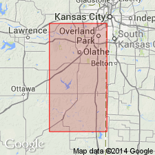
Named from Stranger Creek, near Tonganoxie, Kansas. Typically exposed along east side of sec. 3, T. 12 S., R. 21 E.
Source: US geologic names lexicon (USGS Bull. 896, p. 2074); GNC KS-NE Pennsylvanian Corr. Chart, sheet 2, Oct. 1936.

- Usage in publication:
-
- Stranger formation
- Modifications:
-
- Revised
Summary:
Pg. 146, 147. Stranger formation (redefined) of Douglas group. Stranger formation, as first defined embraced nonmarine channel sandstone at base of Virgil series and shaly beds up to base of Haskell limestone. This division is not a natural one. Upper boundary was arbitrarily selected. A more desirable top boundary is hiatus at base of Ireland sandstone. Detailed observations show this unconformity is commonly, if not invariably, at or near top of Haskell limestone in northeastern Kansas, so that redefinition of Lawrence shale at Lawrence, Kansas, is not necessary. In southern Kansas, the marine Robbins shale occurs between Haskell limestone and unconformity at base of Ireland sandstone, and Lawrence shale is restricted to beds above this unconformity. Age is Late Pennsylvanian (Virgil). Newell is author of name.
Source: US geologic names lexicon (USGS Bull. 896, p. 2074); GNC KS-NE Pennsylvanian Corr. Chart, sheet 2, Oct. 1936.
For more information, please contact Nancy Stamm, Geologic Names Committee Secretary.
Asterisk (*) indicates published by U.S. Geological Survey authors.
"No current usage" (†) implies that a name has been abandoned or has fallen into disuse. Former usage and, if known, replacement name given in parentheses ( ).
Slash (/) indicates name conflicts with nomenclatural guidelines (CSN, 1933; ACSN, 1961, 1970; NACSN, 1983, 2005, 2021). May be explained within brackets ([ ]).

