The National Geologic Map Database is migrating to a new infrastructure. We apologize for any service disruptions during this process.
|
|---|


- Usage in publication:
-
- Steamboat limestone
- Modifications:
-
- Original reference
- Dominant lithology:
-
- Limestone
- Shale
- AAPG geologic province:
-
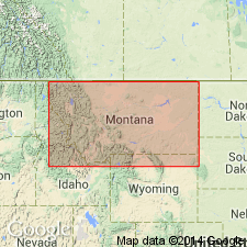
- Montana folded belt
Summary:
Pg. 37 and passim. Steamboat limestone. At type locality (on eastern and northern sides of Steamboat Mountain) can be divided into 3 natural zones (descending): (1) extremely massive tan-gray thick-bedded crumbly limestone with much yellow clay disseminated throughout, 40 feet; (2) interbedded green-gray micaceous calcareous sandy shales and tan argillaceous gray-weathering limestones with much buff clay in flakes, bands, and nodules, the upper 22 feet composed solely of green calcareous platy shale, 115 feet; (3) thick-bedded massive gray and tan-gray fine-grained limestone with nodules and flakes of buff clay, 70 feet. Underlies pagoda oolite and overlies Dearborn limestone. Age is Middle(?) Cambrian.
Type locality: on eastern and northern sides of Steamboat Mountain, [in T. 18 N., R. 8 W., Steamboat Mountain 7.5-min quadrangle, Lewis and Clark Co.], northwestern MT.
Source: US geologic names lexicon (USGS Bull. 896, p. 2057).

- Usage in publication:
-
- Steamboat limestone
- Modifications:
-
- Revised
- AAPG geologic province:
-
- Montana folded belt
Summary:
Pg. 1089-1090. Steamboat limestone. Middle Cambrian section in Lewis and Clark Range redefined. Steamboat limestone has proved to be part of upper Dearborn limestone which was repeated in Dearborn section by low angle overthrust. Therefore, rocks to which name Steamboat was applied do not exist, and this name is herein applied to limestone and shale formerly designated †Gordon Mountain limestone (abandoned) which lies betwen Pagoda or Pentagon and overlying Switchback formation. Thickness about 216 feet. [Age is Middle Cambrian (Albertan).]
Type locality (emended): crest of Prairie Reef, [in T. 21 N., R. 11 W., Prairie Reef 7.5-min quadrangle, Lewis and Clark Co., northwestern MT], from 54 feet below top of peak northwestward to base of Switchback shale. Named from Steamboat Mountain, which lies just north of Dearborn River [Lewis and Clark Co.], northwestern MT.
Source: US geologic names lexicon (USGS Bull. 1200, p. 3714).
- Usage in publication:
-
- Steamboat limestone
- Modifications:
-
- Overview
- AAPG geologic province:
-
- Montana folded belt
Summary:
Description of KOCHASPIS UPIS (Walcott) trilobite fauna in middle part of unit, Lewis and Clark Range area, northwestern MT, Montana folded belt province. Correlation charts. Measured sections. Middle Cambrian age.
Source: GNU records (USGS DDS-6; Denver GNULEX).
- Usage in publication:
-
- Steamboat limestone*
- Modifications:
-
- Revised
- Areal extent
- AAPG geologic province:
-
- Sweetgrass arch
Summary:
Extended into area of Arsenic Peak in Sawtooth Range, southwestern Teton Co, MT, Sweetgrass arch. Here, rocks underlying Steamboat tentatively assigned to Pagoda limestone, rather than Pentagon shale. Conformably underlies Switchback shale. Stratigraphic chart. Middle Cambrian age.
Source: GNU records (USGS DDS-6; Denver GNULEX).

- Usage in publication:
-
- Steamboat Limestone*
- Modifications:
-
- Overview
- AAPG geologic province:
-
- Montana folded belt
- Sweetgrass arch
Summary:
Outcrops at Nineteen Mountain, Prairie Reef and east face of Allan Mountain, Lewis and Clark Co, MT, Montana folded belt province; along west side of Big George Gulch and upper reaches of Blacktail Gulch, Cabin Creek, and Deep Creek, Teton Co, MT, Sweetgrass arch. Averages 230 ft thick in Pretty Prairie quad (GQ-454, Mudge, 1966); 240 ft in Glenn Creek quad (GQ-499, Mudge, 1966); 225 ft in Patrick Basin quad (GQ-453, Mudge, 1966); and ranges from 300-650 ft thick in Arsenic Peak quad (GQ-597, Mudge, 1967). Conformably overlies Pagoda Limestone; conformably underlies Switchback Shale. Correlates with upper part of Meagher Limestone in south-central MT. Contains abundant trilobites and some brachiopods. Geologic map, stratigraphic chart, measured section. Middle Cambrian age.
Source: GNU records (USGS DDS-6; Denver GNULEX).
For more information, please contact Nancy Stamm, Geologic Names Committee Secretary.
Asterisk (*) indicates published by U.S. Geological Survey authors.
"No current usage" (†) implies that a name has been abandoned or has fallen into disuse. Former usage and, if known, replacement name given in parentheses ( ).
Slash (/) indicates name conflicts with nomenclatural guidelines (CSN, 1933; ACSN, 1961, 1970; NACSN, 1983, 2005, 2021). May be explained within brackets ([ ]).