

- Usage in publication:
-
- State Bridge siltstone member
- Modifications:
-
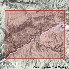
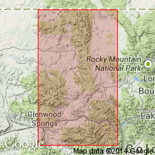
- Areal extent
- Dominant lithology:
-
- Siltstone
- Shale
- Sandstone
- AAPG geologic province:
-
- Eagle basin
Summary:
Pg. 1853, 1864. State Bridge siltstone member of Maroon formation. Overlies Rock Creek member (new). Chiefly thin-bedded micaceous brick-red siltstone, shale, and fine limy sandstone. Thickness 525 feet. Age is considered Permian(?).
Name credited to H.F. Donner, 1936 (Univ. Michigan unpub. PhD dissert.) [see also Donner, H.F., 1949, GSA Bull., v. 60, no. 8, p. 1215-1248].
Source: US geologic names lexicon (USGS Bull. 1200, p. 3711-3712).
- Usage in publication:
-
- State Bridge formation
- Modifications:
-
- Revised
- Dominant lithology:
-
- Siltstone
- Shale
- Sandstone
- AAPG geologic province:
-
- Eagle basin
Summary:
Pg. 1392-1393; [See also Donner, H.F., 1949, GSA Bull., v. 60, no. 8, p. 1215-1248.]
Donner's mauscript (1936 Univ. Michigan unpub. PhD dissert.) name State Bridge is used as formation and applied in Gore area to upper Pennsylvanian or Permian sediments which lie between Battle Mountain formation and the Triassic. Thickness on North Fork of Piney River 225 feet; 750 feet on Red and White Mountain. Donner's type locality stated; there formation is 525 feet thick, conformably overlies McCoy formation, and disconformably underlies Shinarump conglomerate.
[Type section: on south slope of Yarmony Mountain, 0.3 mi north of State Bridge, [in sec. 23, T. 2 S., R. 83 W., State Bridge 7.5-min quadrangle], Eagle Co., CO. Named from State Bridge, Eagle Co., CO.]
Source: US geologic names lexicon (USGS Bull. 1200, p. 3711-3712).
- Usage in publication:
-
- State Bridge formation
- Modifications:
-
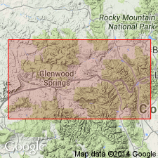
- Areal extent
- AAPG geologic province:
-
- Eagle basin
- Piceance basin
Summary:
Conformably overlies Weber quartzite. In sections where Weber is missing, it gradationally overlies Maroon formation. The base is placed where coarse clastics (Maroon) change to red and yellow siltstone and shale. Includes beds of tan, fine- and medium-grained sandstone; red, buff to tan siltstone; a few thin beds of conglomerate; and thin beds of arenaceous, gray-white algal limestone. Some beds are ripple marked; some are cross-bedded. Yellow sandstone, tan siltstone, and algal limestones serve as prominent markers in the State Bridge. Algal limestone identified at several sections 80 to 3800+ ft above formation base. Yellow, fine-grained sandstone present at Eiby Creek 5 ft above formation base. Is 400 to 700 ft thick in valleys of Eagle and Colorado Rivers; is 900+ ft thick at Gypsum Creek, 5,500+ ft thick at Fryingpan Creek, and 6,000+ ft thick at Woody Creek; is absent at Glenwood Springs and Rifle Falls; is 200 ft thick at King Mountain. No diagnostic fossils. Thought to be equivalent to the Phosphoria formation. Permian age implied. Cross sections, measured sections. Recognized from east of Meeker at Miller Creek, Rio Blanco Co, CO, Piceance basin, east to eastern Eagle Co, CO, Eagle basin.
Source: GNU records (USGS DDS-6; Denver GNULEX).
- Usage in publication:
-
- State Bridge siltstone
- Modifications:
-
- Redescribed
- Dominant lithology:
-
- Siltstone
- Shale
- Limestone
- AAPG geologic province:
-
- Eagle basin
Summary:
Redescribed as State Bridge siltstone, rather than State Bridge formation. Was named for excellent exposures on hillside behind State Bridge Hotel, sec 23, T2S, R83W, Eagle Co, CO in Eagle basin. Is exposed on east side of Yarmony Mountain and in small erosional remnants in west-central part of area (geologic map), Eagle Co. Conformably overlies McCoy formation (revised). Underlies unnamed Triassic conglomerate. Measured section in sec 4, T2S, R82W called type section where State Bridge composed of brick-red, purple gray, limy, micaceous, ripple marked siltstone, brick-red, locally bleached yellow and gray shale, some beds of which are thin, some are mottled purple, and one bed is of impure, resistant dense limestone 7 ft thick. Limestone bed is persistent and fossiliferous. May be equivalent to Permian Chubb or Pony Spring siltstone [members of Maroon formation]. Pelecypod molds identified in limestone bed. Pennsylvanian and Permian? age assigned on basis of position above McCoy. Columnar section.
Source: GNU records (USGS DDS-6; Denver GNULEX).
- Usage in publication:
-
- State Bridge formation
- Modifications:
-
- Revised
- AAPG geologic province:
-
- Eagle basin
Summary:
State Bridge formation. In McCoy area, includes Yarmony limestone member (new), a gray to brown sandy limestone, 2 to 10 feet thick, about 140 feet above base of formation [see also entry under Yarmony]. The Yarmony separates the formation into: a "Lower" State Bridge formation, red siltstones or mudstones, 39 to 367 feet thick; and an "Upper" State Bridge formation, red beds, 109 to 429 feet thick. Underlies Shinarump conglomerate; overlies Schoolhouse sandstone, or where Schoolhouse is absent, Pennsylvanian arkose. Age is considered Permian(?).
Source: US geologic names lexicon (USGS Bull. 1350, Yarmony entry p. 840); GNU records (USGS DDS-6; Denver GNULEX).
- Usage in publication:
-
- State Bridge formation
- Modifications:
-
- Revised
- AAPG geologic province:
-
- Eagle basin
Summary:
Overlies Maroon formation on eastern side of McCoy area and overlies Schoolhouse tongue (reassigned) of Weber sandstone on western side of McCoy area, Eagle Co, CO, Eagle basin. Ranges from 525 to 760 ft thick. A 6-ft thick fossiliferous limestone about 100 ft above top of Schoolhouse tongue is reassigned as South Canyon [should be South Canyon Creek dolomite member, the name given by Bass, Northrop, 1950] dolomite member of State Bridge formation. This limestone is probably the same unit as the calcareous, pelecypod-bearing sandstone that lies about 140 ft above the base of the State Bridge in the State Bridge area. Is probably Guadalupian, Permian age. Correlation chart.
Source: GNU records (USGS DDS-6; Denver GNULEX).
- Usage in publication:
-
- State Bridge Formation*
- Modifications:
-
- Revised
- AAPG geologic province:
-
- Eagle basin
Summary:
Divided in Eagle basin, CO into [only unnamed units described]: 1) sandstone of Fryingpan River of eolian origin, at base (moderate reddish-orange clay-free sandstone which is fairly well sorted (silt to medium sand size fragments), irregular shape, and with pore space filled by secondary quartz and minor calcite; is 400 ft thick on Fryingpan River and pinches out 3 mi to south, 4 mi to west, and 7 mi northwest; 2) unnamed sandstone and siltstone; 3) South Canyon Creek Member that pinches out 2 mi south of quad; 4) Sloane Peak Member (a new name -an offshore bar deposit); 5) unnamed red-brown siltstone and claystone unit; 6) coarse unit of Toner Creek at top (poorly to moderately sorted sandstones, pebbly sandstones, conglomerates with pebbles as much as 6 inches across, silty and sandy claystones that are micaceous and arkosic; cross-bedding and scour fills are common; probably a fluvial deposit). Is 650 to 2,400 ft thick in Woody Creek quad. Unconformably overlies Maroon Formation; unconformably underlies Chinle Formation. Permian-Triassic boundary difficult to select; South Canyon Creek Member is Permian; Sloane Peak is Lower Triassic. Assigned to Early Triassic and Permian. Distinguishable from underlying Maroon by its well-rounded spherical coarse sand grains, parallel symmetrical ripple marks with wavelengths of less than 2 inches, by thinner, even, and better sorting of beds.
Source: GNU records (USGS DDS-6; Denver GNULEX).
- Usage in publication:
-
- State Bridge Formation*
- Modifications:
-
- Revised
- AAPG geologic province:
-
- Eagle basin
Summary:
The eolian unit formerly called "sandstone of the Fryingpan River" and assigned to the State Bridge Formation as its basal member is removed from the State Bridge and reassigned to the Maroon as its upper member. The new member, named Fryingpan Sandstone Member, occurs in an area of about 80 sq km adjacent to the north flank of the Sawatch uplift in the Aspen sub-basin of the Central Colorado trough which is the southern extension of the Eagle basin. The reassignment results in a local and minor change in content of the Maroon. The member underlies a disconformity that is locally angular (as much as 60 deg). The Maroon beneath the Fryingpan contains extensive eolian deposits. The State Bridge above the Fryingpan was deposited in a shallow-water, marginal marine environment. Correlation chart. State Bridge ranges from Leonardian into Early Triassic.
Source: GNU records (USGS DDS-6; Denver GNULEX).
- Usage in publication:
-
- State Bridge Formation*
- Modifications:
-
- Revised
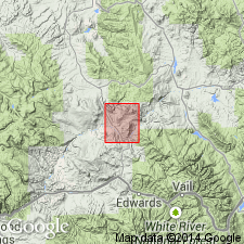
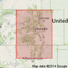
- Areal extent
- AAPG geologic province:
-
- Piceance basin
Summary:
In the area between the Eagle River on the east and Ripple, Fawn, and Miller Creeks on the west, CO in the Eagle and Piceance basins, the Permian and Lower Triassic State Bridge Formation rests unconformably on the Schoolhouse Member, upper member of the Maroon Formation. Schoolhouse is no longer assigned to the Weber Sandstone as its eastward thinning tongue. It is reassigned to the Maroon because of its lithologic character as a plane-bedded, low-angle bedded, and cross-bedded, fine-grained sandstone of eolian sand-sheet and fluvial origin, and part of the Maroon depositional sequence. Its distinctive character is attributed to acidic reducing basinal fluids that dissolved carbonate cement and hematitic grain coatings and bleached the sandstone. Correlation chart.
Source: GNU records (USGS DDS-6; Denver GNULEX).
For more information, please contact Nancy Stamm, Geologic Names Committee Secretary.
Asterisk (*) indicates published by U.S. Geological Survey authors.
"No current usage" (†) implies that a name has been abandoned or has fallen into disuse. Former usage and, if known, replacement name given in parentheses ( ).
Slash (/) indicates name conflicts with nomenclatural guidelines (CSN, 1933; ACSN, 1961, 1970; NACSN, 1983, 2005, 2021). May be explained within brackets ([ ]).