- Usage in publication:
-
- Stapp conglomerate member
- Modifications:
-
- Named
- Dominant lithology:
-
- Conglomerate
- AAPG geologic province:
-
- Arkoma basin
Summary:
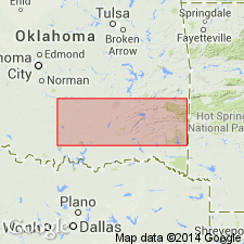
Named as a member at base of Union Valley formation of Springer group of Morrow series of the Bendian period; named for the town of Stapp, Le Flore Co, OK in Arkoma basin. No specific type locality designated. Excellent exposure in southeast OK in the Kansas City Southern Railway cut, 1 mi south of Stapp in SW1/4 SW1/4 sec 7, T3N, R26E, Le Flore Co where it consists of rounded pebbles and boulders of chert and limestone ranging from a fraction of an inch to 3 ft in diameter; bedding planes absent; intercalated thin lenses of sandstone and conglomeratic sandstone show cross-bedding; near top is thin black shale overlain by coarse loosely consolidated conglomerate. Thickness not stated. Good exposure also found in roadcut on State Hwy 2 in SE1/4 SW1/4 SW1/4 sec 27, T4N, R19E, Latimer Co, and in a creek about 100 yds east of same hwy at another locality in NE1/4 NW1/4 sec 14, T3N, R19E, Latimer Co where the conglomerate is shown exposed in a friction carpet and is still in contact with a fossiliferous fragmental limestone. Was formerly considered base of the Atoka. As a member at base of Union Valley, unconformably overlies Wesley shale (new) of Jackfork group (raised in rank) of Pushmataha series (new) of Bendian, in the southern and frontal Ouachitas; unconformably overlies Wesley shale north of Arbuckles. Of Carboniferous age.
Source: GNU records (USGS DDS-6; Denver GNULEX).
For more information, please contact Nancy Stamm, Geologic Names Committee Secretary.
Asterisk (*) indicates published by U.S. Geological Survey authors.
"No current usage" (†) implies that a name has been abandoned or has fallen into disuse. Former usage and, if known, replacement name given in parentheses ( ).
Slash (/) indicates name conflicts with nomenclatural guidelines (CSN, 1933; ACSN, 1961, 1970; NACSN, 1983, 2005, 2021). May be explained within brackets ([ ]).

