

- Usage in publication:
-
- St. Regis formation*
- Modifications:
-
- First used
- Dominant lithology:
-
- Sandstone
- Shale
- Quartzite
- AAPG geologic province:
-
- Northern Rocky Mountain region
Summary:
Intent to name not stated. Is thickest and best exposed in southeastern part of district, particularly about 3 mi northeast of Mullan, T47N, R5E, and in vicinity of St. Regis Pass [source of name], Shoshone Co, ID in the Northern Rocky Mountain region. No type locality designated. Consists of siliceous shales or argillites, shaly generally flaggy, fine-grained, indurated, green and purple sandstone, and impure, fine-grained quartzite. [Lithologic description in text and in generalized tabular section do not agree.] Shows lithologic variation in different parts of field. About 800+ ft thick. Characterized by shallow-water features. Overlies Revett quartzite (first used). Underlies Wallace formation (first used). Of Algonkian age. No fossils have been found.
Source: GNU records (USGS DDS-6; Denver GNULEX).

- Usage in publication:
-
- St. Regis Formation*
- Modifications:
-
- Overview
- AAPG geologic province:
-
- Northern Rocky Mountain region
Summary:
Recognized as the upper formation of the Ravalli Group of the Precambrian Belt Supergroup in the Northern Rocky Mountain region. See figures 4 and 5 for correlation with other formations of the Belt Supergroup in the Northern Rocky Mountain region, and of the Purcell Supergroup of Alberta and British Columbia, Canada.
Source: GNU records (USGS DDS-6; Denver GNULEX).
- Usage in publication:
-
- St. Regis Formation*
- Modifications:
-
- Age modified
- AAPG geologic province:
-
- Northern Rocky Mountain region
Summary:
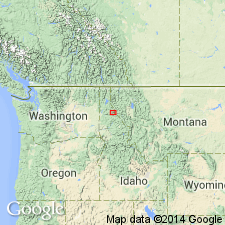
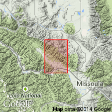
Is one of eleven formations of the Belt Supergroup mapped in the report area. Age changed from Precambrian to Precambrian Y, the age term used for rocks that range in age from 1,600 to 800 m.y. old. About 3,100 ft thick. Overlies Revett Formation of Belt; underlies Empire Formation of Belt. Mapped in north-west part of quad in Sanders and Missoula Cos, MT in the Northern Rocky Mountain region.
Source: GNU records (USGS DDS-6; Denver GNULEX).
For more information, please contact Nancy Stamm, Geologic Names Committee Secretary.
Asterisk (*) indicates published by U.S. Geological Survey authors.
"No current usage" (†) implies that a name has been abandoned or has fallen into disuse. Former usage and, if known, replacement name given in parentheses ( ).
Slash (/) indicates name conflicts with nomenclatural guidelines (CSN, 1933; ACSN, 1961, 1970; NACSN, 1983, 2005, 2021). May be explained within brackets ([ ]).