The National Geologic Map Database is migrating to a new infrastructure. We apologize for any service disruptions during this process.
|
|---|


- Usage in publication:
-
- Squaw Bay limestone
- Modifications:
-
- Named
- Dominant lithology:
-
- Limestone
- AAPG geologic province:
-
- Michigan basin
Summary:
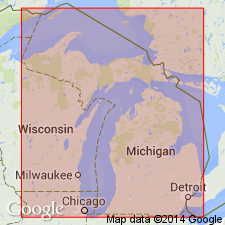
Named Squaw Bay limestone for Squaw Bay shore line of Partridge Point, center S line of sec. 11, T30N, R8E, Alpena Co., MI. Unit is part of Traverse group. The Squaw Bay consists of brown limestone, some beds dolomitic; contains STYLIOLINA and Upper Devonian goniatites. Exposed thickness is 3 feet with nearby wells indicating a total of 12 feet. It underlies the Antrim black shale and is separated from the underlying Partridge Point formation by a 3 foot covered interval. This paper includes a remark that states: "This formation probably should be excluded from the Traverse group."
[NOTE: In accordance with Department of Interior's Secretarial Order 3404, discontinuing use of derogatory term squaw, the Squaw Bay Limestone is in process of being formally renamed Birdsong Bay Limestone (RESERVED). The geographic feature Squaw Bay, from which the geologic name was taken (this report), was renamed Birdsong Bay by U.S. Board on Geographic Names, September 2022, USGS GNIS FeatureID 638662.]
Source: GNU records (USGS DDS-6; Reston GNULEX).

- Usage in publication:
-
- Squaw Bay Limestone*
- Modifications:
-
- Revised
- Age modified
- AAPG geologic province:
-
- Michigan basin
Summary:
Age of the Traverse Group in the Michigan Basin is changed from Middle and Late Devonian to Middle Devonian only. The upper unit of the Traverse, the Squaw Bay Limestone [See Note Below], is removed from the Traverse and its age is changed from Late Devonian to Middle and Late Devonian, spanning the Middle-Upper Devonian boundary. Lies between the Thunder Bay Limestone and the Antrim Shale.
[NOTE: In accordance with Department of Interior's Secretarial Order 3404, discontinuing use of derogatory term squaw, the Squaw Bay Limestone is in process of being formally renamed Birdsong Bay Limestone (RESERVED). The geographic feature Squaw Bay, from which the geologic name was taken (Warthin and Cooper, 1935), was renamed Birdsong Bay by U.S. Board on Geographic Names, September 2022, USGS GNIS FeatureID 638662.]
Source: GNU records (USGS DDS-6; Reston GNULEX).
For more information, please contact Nancy Stamm, Geologic Names Committee Secretary.
Asterisk (*) indicates published by U.S. Geological Survey authors.
"No current usage" (†) implies that a name has been abandoned or has fallen into disuse. Former usage and, if known, replacement name given in parentheses ( ).
Slash (/) indicates name conflicts with nomenclatural guidelines (CSN, 1933; ACSN, 1961, 1970; NACSN, 1983, 2005, 2021). May be explained within brackets ([ ]).