


- Usage in publication:
-
- Spoon formation
- Modifications:
-
- Original reference
- Dominant lithology:
-
- Sandstone
- Coal
- Limestone
- AAPG geologic province:
-
- Illinois basin
Summary:
Pg. 8 (fig. 1), 26 (fig. 4), 27, 32-33, 45-46 (table 1), pl. 1, geol. sections. Spoon formation of Kewanee group (new). Proposed for strata from top of Bernadotte sandstone member of Abbott formation (new) to base of Colchester (No. 2) coal member of Carbondale formation. Maximum thickness about 350 feet in southern Illinois; ranges from a few feet to nearly 100 feet in western Illinois. Age is Middle Pennsylvanian. Presentation of new rock-stratigraphic classification for Illinois. Cyclical classification retained but is independent of rock-stratigraphic classification.
Members (ascending):
Southeastern Illinois-- Bidwell coal (new), New Burnside coal (new), Curlew limestone, O'Nan coal (new), Granger sandstone (new), Creal Springs limestone, Mount Rorah coal (new), Wise Ridge coal (new), Stonefort limestone, Davis coal, DeKoven coal, and Palzo sandstone;
Southwestern Illinois-- Assumption, Litchfield, and Murphysboro coals, Vergennes sandstone, Seahorne limestone, Davis coal, DeKoven coal, and Cheltenham clay;
Western Illinois-- Rock Island (No. 1) coal, Seville limestone, Hermon coal (new), Brush coal (new), DeLong coal, Seahorne limestone, Wiley coal, Greenbush coal, Isabel sandstone, Abingdon coal, Browning sandstone, and Cheltenham clay;
Northern Illinois-- Cheltenham clay; and
Eastern Illinois-- Seeleyville coal.
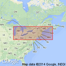
Type locality: Toledo, Peoria, and Western RR cut about 0.25 mi west of Spoon River, in [E/2] sec. 22, T. 6 N., R. 1 E., [western edge Smithfield 7.5-min quadrangle], Fulton Co., west-central IL. [Additional locality information from USGS historical topographic map collection TopoView, accessed on the Queen of England's 90th birthday, 2016.]
Source: Publication; US geologic names lexicon (USGS Bull. 1200, p. 3687).
- Usage in publication:
-
- Spoon Formation*
- Modifications:
-
- Areal extent
- AAPG geologic province:
-
- Illinois basin
Summary:
Spoon Formation of Kewanee Group geographically extended from IL into IN.
Source: GNU records (USGS DDS-6; Reston GNULEX).
- Usage in publication:
-
- "Spoon" Formation
- Modifications:
-
- Areal extent
- Dominant lithology:
-
- Sandstone
- AAPG geologic province:
-
- Iowa shelf
Summary:
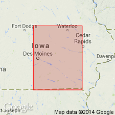
Pg. 7. "Spoon" Formation. The sandstone unconformably overlying Caseyville Formation in Scott and Muscatine Counties, Iowa, was correlated with the Spoon Formation of Illinois on basis of lithologic evidence (Fitzgerald, 1977, Univ. Iowa MS thesis). If this correlation is correct, the "Spoon" of Iowa is time-equivalent of Floris Formaiton of Cherokee Group of Western Interior. No biostratigraphic evidence yet to support this interpretation. As a result of this uncertainty the application of name "Spoon" Formation for this sandstone, although useful for communication must be regarded as tentative. Provisionally considered Desmoinesian [see Willman et al, 1975, Illinois Geol. Survey Bull. 95].
Source: Publication.

- Usage in publication:
-
- Spoon Formation
- Modifications:
-
- Revised
- Dominant lithology:
-
- Sandstone
- Siltstone
- Shale
- AAPG geologic province:
-
- Illinois basin
Summary:
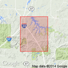
Abbott-Spoon contact mapped at the top of the highest ledge of thick-bedded Murray Bluff Sandstone. Upper boundary of the Spoon revised downward to the base of the Davis Coal Member, therefore excluding the Davis, the Dekoven Coal Member and the Palzo Sandstone Member from the Spoon. Thickness from boreholes north of the study area indicate original thickness of Spoon (as here defined) increased eastward from about 200 ft in the Creal Springs quad to 225 to 300 ft in parts of the Stonefort and Eddyville quads. Unit consists primarily of gray sandstone, siltstone, and shale. Sandstones classified as subgraywackes. Coarse mica flakes and carbonaceous plant fragment grains evident. Subdivided into the following formal and informal units (ascending): Oldtown Coal Bed (new), Delwood Coal Bed, New Burnside Coal Bed, Mitchellsville Limestone Bed (new), Golden sandstone (informal), Murphysboro(?) Coal Member, Creal Springs Limestone Member, Mount Rorah Coal Member, Wise Ridge Coal Bed, Stonefort Limestone Member, Carrier Mills Shale Member (new), and sub-Davis sandstone (informal). Age ranges from latest Atokan (Oldtown Coal Bed) to middle Desmoinesian. Stonefort Limestone Member is early middle Desmoinesian based on fusulinids (Douglass, 1987). [Kewanee Group not mentioned, though authors state they are using the nomenclature of Kosanke and others (1960).]
Source: GNU records (USGS DDS-6; Reston GNULEX).
- Usage in publication:
-
- Spoon Formation
- Modifications:
-
- Not used
- AAPG geologic province:
-
- Illinois basin
Summary:
Spoon Formation not used in this report. Tradewater Formation in the Goreville quadrangle is subdivided into two informal mapping units, the lower Tradewater and the upper. These two units were mapped originally as the Abbott and Spoon Formations, but this earlier nomenclature was abandoned midway through the COGEOMAP project. The term Tradewater was adopted from KY and applied to this interval of rocks in IL as part of an agreement with the IN and KY Surveys to standardize Pennsylvanian terminology in the Illinois basin.
Source: GNU records (USGS DDS-6; Reston GNULEX).

- Usage in publication:
-
- Spoon Formation
- Modifications:
-
- Not used
- AAPG geologic province:
-
- Illinois basin
Summary:
Rocks previously mapped as Spoon Formation in this area by Baxter (1965), Odom (1971), and Jacobs (1971) are now assigned to Tradewater Formation [following usage of Weibel and others (1991, Geologic map of the Waltersburg quadrangle, Pope County, Illinois: Illinois Geologic Quadrangle Map IGQ-8)].
Source: GNU records (USGS DDS-6; Reston GNULEX).
- Usage in publication:
-
- Spoon Formation*
- Modifications:
-
- Areal extent
- AAPG geologic province:
-
- Illinois basin
Summary:
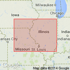
Cliffland Coal Member of Kalo Formation in Iowa has been correlated with Rock Island Coal Member of Spoon Formation in Illinois, but its stratigraphic position is still under debate.
Source: GNU records (USGS DDS-6; Reston GNULEX).
- Usage in publication:
-
- Spoon Formation†
- Modifications:
-
- Abandoned
- AAPG geologic province:
-
- Illinois basin
Summary:
Pg. 6, pl. 1. †Spoon Formation. Use of Spoon Formation abandoned and Tradewater Formation of western Kentucky (has priority) is reintroduced into Illinois. Recent mapping in southern Illinois has shown that differentiation of †Abbott (also abandoned) and Spoon Formations are impractical in many areas (Nelson and others, 1991, Illinois State Geol. Survey Bull., no. 96; Jacobson, 1992, Illinois State Geol. Survey Bull., no. 97). Classification proposed in this report agreed upon by State Geological Surveys of Illinois, Indiana, and Kentucky.
Source: Publication.
For more information, please contact Nancy Stamm, Geologic Names Committee Secretary.
Asterisk (*) indicates published by U.S. Geological Survey authors.
"No current usage" (†) implies that a name has been abandoned or has fallen into disuse. Former usage and, if known, replacement name given in parentheses ( ).
Slash (/) indicates name conflicts with nomenclatural guidelines (CSN, 1933; ACSN, 1961, 1970; NACSN, 1983, 2005, 2021). May be explained within brackets ([ ]).