

- Usage in publication:
-
- Sphinx conglomerate*
- Modifications:
-
- Original reference
- Dominant lithology:
-
- Conglomerate
- Sandstone
- AAPG geologic province:
-
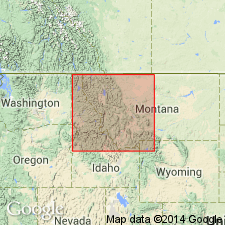
- Montana folded belt
Summary:
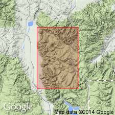
Sphinx conglomerate. In Sphinx Mountain is a group of beds which once may have spread over an extensive area, although now occupying only about 2 sq mi, Three Forks quadrangle, central southern Montana. This remnant consists of between 2,000 and 3,000 feet of reddish sandstones and coarse conglomerates of limestone pebbles and boulders cemented with reddish sand; compose entire mass of the peak. Beds are horizontal and distinctly stratified. No fossils. Arbitrarily referred to Eocene, but are certainly younger [older] than Bozeman lake beds (Neocene) and older [younger] than Livingston formation (Cretaceous?).
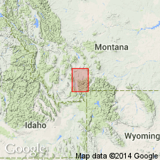
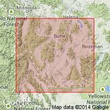
[Sphinx Mountain (The Sphynx), in T. 8 S., R. 2 E., Lat. 45 deg. 09 min. 26 sec. N., Long. 111 deg. 28 min. 50 sec. W., Sphinx Mountain 15-min quadrangle, Madison Co., Madison Range, central southern MT (USGS GNIS database, USGS historical topographic map collection TopoView; accessed March 8, 2013).]
Source: US geologic names lexicon (USGS Bull. 896, p. 2040).
- Usage in publication:
-
- Sphinx conglomerate*
- Modifications:
-
- Areal extent
- AAPG geologic province:
-
- Montana folded belt
Summary:
Pg. 6-7. Sphinx conglomerate. Unconformably overlies volcanic material which Peale correlated with Livingston formation and which, in turn, unconformably overlies upturned and folded Cretaceous strata. Age is Eocene.
Source: US geologic names lexicon (USGS Bull. 1200, p. 3683).
- Usage in publication:
-
- Sphinx conglomerate
- Modifications:
-
- Revised
- AAPG geologic province:
-
- Montana folded belt
Summary:
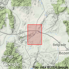
Assigned as basal formation of Bozeman group in the Montana folded belt province. Is mainly of subangular pebbles and cobbles of Paleozoic limestone. Includes clasts of siltstone, sandstone, gneiss and schist. Is poorly sorted, obscurely bedded and has a matrix that is earthy, porous, and generally reddish orange. Lies on Mission Canyon limestone. Is overlain by Milligan Creek formation (new) of Bozeman group (revised). May have formed as a widespread apron. Shown on geologic map in a small area in Milligan Canyon, Broadwater Co, MT. Assigned to the Eocene.
Source: GNU records (USGS DDS-6; Denver GNULEX).
- Usage in publication:
-
- Sphinx Conglomerate*
- Modifications:
-
- Revised
- Age modified
- Areal extent
- AAPG geologic province:
-
- Montana folded belt
Summary:
Sphinx Conglomerate. Removed from Bozeman Group. Conformably overlies Livingston Formation. Age is considered Late Cretaceous.
Geograhically restricted to type area, Sphinx Mountain and the Helmet, Madison County, Madison Range, central southern Montana.
Source: Modified from GNU records (USGS DDS-6; Denver GNULEX).
- Usage in publication:
-
- Sphinx Conglomerate*
- Modifications:
-
- Not used
- AAPG geologic province:
-
- Montana folded belt
Summary:
Historical use of formal stratigraphic nomenclature applied to Bozeman Group in southwest MT, Montana folded belt province described. Charts. Bozeman and its formations --Sphinx Conglomerate (oldest), Milligan Creek, Climbing Arrow, Dunbar Creek, Sixmile Creek of the Toston-Clarkson Valley areas, and the Renova (oldest) and Sixmile Creek Formations of the Jefferson-Beaverhead Valley areas not used. These Tertiary rocks considered to be basin-fill deposits separable on basis of sequence stratigraphic concepts, rather than on lithostratigraphic principles. Lithologic distinctions within the group are not distinctive due to abrupt lateral facies changes. These rocks are separable into 5 sequences, numbered 1 to 5, no. 1 is the oldest, no. 5 is post-Bozeman alluvium. Each sequence is separated by an unconformity. Term unconformity applied in this paper to surfaces of non-deposition or erosion, these surfaces have soils developed on them. Sequence 1 consists of calc-alkalic flows, flow tuffs, tuff, matrix-supported conglomerate, some massive sandstone about 157 m thick, and is of Eocene age. Sequence 2 is mostly fluvial channel conglomerate, sandstone, mudstone, siltstone, and minor tuff, lapilli tuff about 400 m thick, and is of Eocene and Oligocene age. Sequence 3 is fluvial sheet sandstone, some mudstone, siltstone, sandstone, lenses of conglomerate of flood plain origin about 214 m thick, and is of Oligocene and Miocene age. Sequence 4 is mudstone, siltstone, sandstone, lenses of conglomerate mostly of flood plain origin 1,000 m thick, and is of Miocene and Pliocene age. Sequence 5 unconformably overlies rocks that were assigned to the Bozeman. Map shows distribution of the 5 sequences. The unconformities can be traced into the subsurface seismically.
Source: GNU records (USGS DDS-6; Denver GNULEX).
For more information, please contact Nancy Stamm, Geologic Names Committee Secretary.
Asterisk (*) indicates published by U.S. Geological Survey authors.
"No current usage" (†) implies that a name has been abandoned or has fallen into disuse. Former usage and, if known, replacement name given in parentheses ( ).
Slash (/) indicates name conflicts with nomenclatural guidelines (CSN, 1933; ACSN, 1961, 1970; NACSN, 1983, 2005, 2021). May be explained within brackets ([ ]).