- Usage in publication:
-
- Spanish Trail Alloformation
- Modifications:
-
- Named
- Dominant lithology:
-
- Siltstone
- Claystone
- Sandstone
- AAPG geologic province:
-
- Great Basin province
Summary:
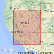
Named Spanish Trail Alloformation and assigned, along with (ascending) Greenwater Fan, Shoshone Springs, and Amargosa Alloformations (all new), to late Miocene to Pleistocene Lake Tecopa Allogroup (new). Name origin not stated. Found in vicinity of intermittent Amargosa River and towns of Shoshone and Tecopa, ancient Lake Tecopa area, eastern Mojave Desert, Inyo Co., east-central CA. Exposed only below 460 m altitude in southern part of Tecopa basin. Consists entirely of basin-lowland sediments (siltstone, claystone, and some very-fine sandstone) moderately to well-indurated. Sediments reflect lake cycles or lake recessions significant enough to separate into unnamed lacustrine or subaerial allomembers. Total thickness in type area at least 17 m determined by measurement below 2-Ma Huckleberry Ridge tephra layer (Hillhouse, 1987). Two USGS 1986 seismic-shot boreholes close to southern edge of Tecopa basin penetrated similar sediments to about 50 m. Unit affected by many more faults and local warps than Hillhouse (1987) mapped. Discontinuously underlies late Pliocene (2.02 Ma) Huckleberry Ridge tephra layer (of Greenwater Fan Alloformation), whose base marks top of Spanish Trail. Although base of unit is not exposed, lowest-known subsurface Spanish Trail sediments are late Miocene (>5 Ma); upper age limit is late Pliocene (2 Ma). Age control from well-dated tephra layers (Sarna-Wojcicki and others, 1987; and Chapter 6 in this volume; Sarna-Wojcicki, personal communication, 1990).
Source: GNU records (USGS DDS-6; Menlo GNULEX).
For more information, please contact Nancy Stamm, Geologic Names Committee Secretary.
Asterisk (*) indicates published by U.S. Geological Survey authors.
"No current usage" (†) implies that a name has been abandoned or has fallen into disuse. Former usage and, if known, replacement name given in parentheses ( ).
Slash (/) indicates name conflicts with nomenclatural guidelines (CSN, 1933; ACSN, 1961, 1970; NACSN, 1983, 2005, 2021). May be explained within brackets ([ ]).

