

- Usage in publication:
-
- Southward Pond formation
- Modifications:
-
- Named
- Dominant lithology:
-
- Limestone
- Shale
- AAPG geologic province:
-
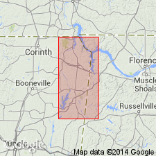
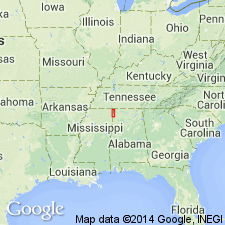
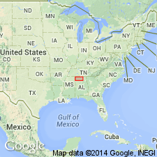
- Black Warrior basin
Morse, W.C., 1928, Paleozoic rocks of Mississippi: Journal of Geology, v. 36, no. 1, p. 31-43.
Summary:
Southward Pond formation named in Tishomingo Co., northeastern MS. Texture is oolitic and at many places unit contains asphalt. Entire formation is fossiliferous. Thickness 80 to 100 ft. Consists of four intervals of shale or shaly limestone and three intervening intervals of limestone referred to as Pond limestones A, B, and C. Underlies Southward Spring sandstone and overlies Allsboro sandstone.
Source: GNU records (USGS DDS-6; Reston GNULEX).
- Usage in publication:
-
- Southward Pond formation
- Modifications:
-
- Overview
- AAPG geologic province:
-
- Black Warrior basin
Summary:
Formation described in detail. Pond limestone "C" is about 3 ft thick and is composed of somewhat cross-bedded hard bluish-gray, coarsely crystalline fossiliferous limestone. Pond limestone "B" is 0 to 1 ft of very fossiliferous crystalline limestone. Pond limestone "A" ranges in thickness from 1 to 16.5 ft and is composed of massive, slightly reddish-gray oolitic or foraminiferal limestone, everywhere asphaltic. "C" lies 10 to 12 ft above "B," which lies 10 to 27.5 ft above "A." This last lies 6 to 25 ft above Allsboro sandstone.
Source: GNU records (USGS DDS-6; Reston GNULEX).
- Usage in publication:
-
- Southward Pond†
- Modifications:
-
- Abandoned
- AAPG geologic province:
-
- Black Warrior basin
Summary:
Southward Pond formation of Morse (1928) abandoned and replaced by Wagnon member of Pride Mountain formation (both new).
Source: GNU records (USGS DDS-6; Reston GNULEX).
For more information, please contact Nancy Stamm, Geologic Names Committee Secretary.
Asterisk (*) indicates published by U.S. Geological Survey authors.
"No current usage" (†) implies that a name has been abandoned or has fallen into disuse. Former usage and, if known, replacement name given in parentheses ( ).
Slash (/) indicates name conflicts with nomenclatural guidelines (CSN, 1933; ACSN, 1961, 1970; NACSN, 1983, 2005, 2021). May be explained within brackets ([ ]).