- Usage in publication:
-
- South Bend sandstone and shale [member]
- Modifications:
-
- First used
- Dominant lithology:
-
- Sandstone
- Shale
- AAPG geologic province:
-
- Bend arch
Summary:
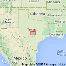
First used; intent to name not stated and no type locality designated. Called South Bend sandstone and shale [member] of newly named Graham formation of Cisco group (revised). In Colorado River Valley Graham formation is divided into following members (ascending): Bluff Creek shale, Gunsight limestone, and Wayland shale. In Brazos River Valley Graham is divided into following members (ascending): Finis shale and sandstone, Jacksboro limestone, Gonzales Creek shale and sandstone, Bunger limestone, South Bend shale and sandstone, Gunsight limestone, and Wayland shale. "Typically exposed" at South Bend, southern Young Co, TX on Bend arch, and thins southward. Consists of light-gray, fine-grained, lenticular, ripple-marked sandstones and blue-gray, sandy, fossiliferous shales. Is 50-110 ft thick. In Eastland Co the member has an average thickness of 60 ft and does not occur south of the Cretaceous overlap in the Colorado River Valley. In a small outlier 2 mi northeast of South Bend is a "typical exposure" of these beds which has been studied by many geologists in examining the structure of the South Bend oil field. Section measured 2 mi south of South Bend, Young Co, where unit is 107 ft thick. Stratigraphic chart. Pennsylvanian age.
Source: GNU records (USGS DDS-6; Denver GNULEX).

- Usage in publication:
-
- South Bend shale†
- Modifications:
-
- Abandoned
Summary:
Pg. 104, 113, 114. †South Bend is preoccupied and now replaced with Necessity shale.
Source: US geologic names lexicon (USGS Bull. 896, p. 2030).
For more information, please contact Nancy Stamm, Geologic Names Committee Secretary.
Asterisk (*) indicates published by U.S. Geological Survey authors.
"No current usage" (†) implies that a name has been abandoned or has fallen into disuse. Former usage and, if known, replacement name given in parentheses ( ).
Slash (/) indicates name conflicts with nomenclatural guidelines (CSN, 1933; ACSN, 1961, 1970; NACSN, 1983, 2005, 2021). May be explained within brackets ([ ]).

