- Usage in publication:
-
- Sonsela sandstone bed*
- Modifications:
-
- Named
- Dominant lithology:
-
- Sandstone
- Siltstone
- AAPG geologic province:
-
- Black Mesa basin
Summary:
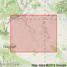
Named as a bed in the Petrified Forest member of Upper Triassic Chinle formation. Type section designated 3 1/2 mi north of western Sonsela Butte, east flank of Defiance uplift, Apache Co, AZ in the Black Mesa basin. Overlies lower part and underlies upper part of Petrified Forest. Composed of a lower 25-ft ledge-forming, gray sandstone of very fine to very coarse grained, subround to subangular, frosted, clear to stained quartz; a middle gray slope-forming siltstone; and an upper 60-ft thick sandstone similar to the lower sandstone except that it has much coarse-grained sand. Lower sandstone has also abundant mica and feldspar, quartz and limestone pebbles averaging 3/8 in diameter, and scattered lenses of quartz granules scattered throughout. Pebbles are more numerous and of larger diameter south of Rio Puerco than on the Defiance uplift. Cobbles are 5 to 6 inches in diameter at Petrified Forest. Gravel increases in amount and grain size northward. In many areas, Sonsela consists of a main sandstone bed and numerous sandstone tongues separated by mudstone. Ranges from 50 to 200 ft thick. North of Holbrook, Sonsela interval is a poorly defined banded red and gray sandy siltstone. Nomenclature chart. Fence diagram.
Source: GNU records (USGS DDS-6; Denver GNULEX).

- Usage in publication:
-
- Sonsela Sandstone Bed*
- Modifications:
-
- Overview
- Areal extent
- AAPG geologic province:
-
- Black Mesa basin
- San Juan basin
- Estancia basin
Summary:
Is a bed in the Upper Triassic Petrified Forest Member of the Chinle Formation known in northeast AZ and northwest NM from the Four Corners area to an east-west line that extends from south of Holbrook, Navajo Co, AZ, Black Mesa basin, east across the San Juan basin to Albuquerque, Bernalillo Co, NM, Estancia basin, an area of 24,000 sq miles. Areal distribution map. Bed is 30 to 40 ft thick at most localities, but may be more than 100 ft thick locally. Sonsela lies about 300 ft above the base and 800 ft below the top of the Petrified Forest. Composed of white, orange, or gray, fine- to coarse-grained, cross-stratified sandstone and conglomerate with planar and trough-crossbedding. Dip directions are north to northeast. Contains a few bentonitic siltstone and claystone layers <1 ft to 20 ft thick. Conglomerate consists of granules, pebbles, cobbles of chert, and some pebbles of quartz, quartzite, limestone, siltstone, and locally some volcanic rocks. Conglomerate occurs as layers and these layers are most abundant near the base. Stratigraphic chart. Cross section. Isopleth map of conglomerate. Measured section.
Source: GNU records (USGS DDS-6; Denver GNULEX).
For more information, please contact Nancy Stamm, Geologic Names Committee Secretary.
Asterisk (*) indicates published by U.S. Geological Survey authors.
"No current usage" (†) implies that a name has been abandoned or has fallen into disuse. Former usage and, if known, replacement name given in parentheses ( ).
Slash (/) indicates name conflicts with nomenclatural guidelines (CSN, 1933; ACSN, 1961, 1970; NACSN, 1983, 2005, 2021). May be explained within brackets ([ ]).

