- Usage in publication:
-
- Snowy Pass Supergroup, Group
- Modifications:
-
- First used
- AAPG geologic province:
-
- Northern Rocky Mountain region
Summary:
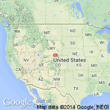
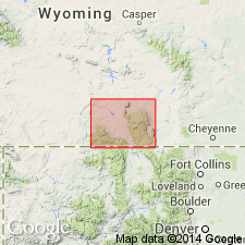
First published use of name Snowy Pass as a supergroup in the Medicine Bow Mountains of south-central WY where it is divided into Deep Lake Group (base) and Libby Creek Group (top). Snowy Pass unconformably overlies Archean Conical Peak Quartzite (first used) of Phantom Lake Metamorphic Suite. Deep Lake is divided into (ascending): Magnolia Formation, Lindsey Quartzite, Campbell Lake Formation, Cascade Quartzite, and Vagner Formation. Deep Lake is separated from overlying Libby Creek by a thrust fault. Libby Creek can be divided into two parts which are separated from each other by a thrust fault. Lower part of Libby Creek includes (ascending): Rock Knoll Formation (formerly considered part of Deep Creek--reassigned because its lower contact is a thrust fault and its upper contact is depositional), Headquarters and Heart Formations, Medicine Peak Quartzite, Lookout Schist, Sugarloaf Quartzite. Upper part divided into Nash Fork Formation, Towner Greenstone, French Slate. In the Sierra Madre where Snowy Pass is of group rank, it is divided into (ascending): Magnolia and Singer Peak Formations, Cascade Quartzite, and Bottle Creek Formation. Geologic map; stratigraphic chart. Is in Northern Rocky Mountain region. Of Proterozoic age.
Source: GNU records (USGS DDS-6; Denver GNULEX).

- Usage in publication:
-
- Snowy Pass Group*, Supergroup*
- Modifications:
-
- Overview
- Dominant lithology:
-
- Quartzite
- Conglomerate
- Phyllite
- Marble
- Dolomite
- Limestone
- AAPG geologic province:
-
- Northern Rocky Mountain region
Summary:
Named for Snowy Range Pass, T16N, R79W, Albany Co, Medicine Bow Mountains, WY in the Northern Rocky Mountain region. Assigned supergroup rank in the Medicine Bows where it is divided into Deep Lake (largely fluvial) and Libby Creek (largely marine) Groups. Deep Lake includes (ascending): Magnolia Formation, Lindsey Quartzite, Campbell Lake Formation, Cascade Quartzite, and Vagner Formation. Magnolia unconformably overlies Conical Peak Quartzite (new) of Phantom Lake Metamorphic Suite. Vagner is separated from Rock Knoll Formation of Libby Creek Group by a fault, the Reservoir Lake fault. Libby Creek includes (ascending): Rock Knoll, Headquarters, and Heart Formations, Medicine Peak Quartzite, Lookout Schist, Sugarloaf Quartzite, Nash Fork Formation, Towner Greenstone (the only unit with volcanic rocks), and French Slate. Assigned group rank in Sierra Madre where it includes Magnolia and Singer Peak Formations, Cascade Quartzite, Bottle Creek, Copperton, and Slaughterhouse Formations. Geologic map; stratigraphic tables. Type section is along WY Hwy 130, sec 14, T16N, R79W to sec 23, T16N, R80W where rocks between the French and Medicine Peak are exposed. The type continues into secs 14, 15, and 16, T16N, R80W where the rest of the formations are exposed. [See remarks with each formation for lithology.] Has a maximum thickness in the Medicine Bows of 10,555 m. Of Early Proterozoic age.
Source: GNU records (USGS DDS-6; Denver GNULEX).
For more information, please contact Nancy Stamm, Geologic Names Committee Secretary.
Asterisk (*) indicates published by U.S. Geological Survey authors.
"No current usage" (†) implies that a name has been abandoned or has fallen into disuse. Former usage and, if known, replacement name given in parentheses ( ).
Slash (/) indicates name conflicts with nomenclatural guidelines (CSN, 1933; ACSN, 1961, 1970; NACSN, 1983, 2005, 2021). May be explained within brackets ([ ]).

