

- Usage in publication:
-
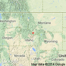
- Snowcrest Range Group*
- Modifications:
-
- Overview
- AAPG geologic province:
-
- Montana folded belt
Summary:
Divided in the Montana folded belt province into: Kibbey Sandstone (76 m thick), Lombard Limestone (118 m thick), and Conover Ranch Formation (32 m thick) (See Chapter B). Is 226 m thick. Overlies Mission Canyon Limestone east of northern Tendoy Mountains east to Horseshoe Hills. Is equivalent to and replaces use of Big Snowy Group and Amsden Formation in report area. Assigned to the Late Mississippian. Geologic map. Correlation chart. Composite section.
Source: GNU records (USGS DDS-6; Denver GNULEX).
- Usage in publication:
-
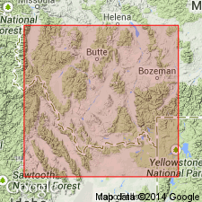
- Snowcrest Range Group*
- Modifications:
-
- Named
- Dominant lithology:
-
- Siltstone
- Sandstone
- Mudstone
- Limestone
- AAPG geologic province:
-
- Montana folded belt
Summary:
Named for Snowcrest Range (type area), Beaverhead Co, MT, Montana folded belt province. Present in southwest MT. Divided into Kibbey Sandstone, at base (reassigned in this area from Big Snowy Group), Lombard Limestone (new), and Conover Ranch Formation, at top (new). Kibbey has yellow siltstone, sandstone, and mudstone. Lombard has thin to thick, indistinctly bedded lime-mudstone, and packstone in lower part, and a fossiliferous, thin- to thick-bedded, skeletal lime-mudstone, wackestone, and packstone with interbeds and partings of silty limestone, siltstone, and shale in upper part. Conover Ranch is a red-brown to red-purple mudstone with some thin-bedded marine limestone, calcareous sandstone, and siltstone. Overlies McKenzie Canyon Limestone (new) of Tendoy Group (new) in Tendoy Range; elsewhere overlies Mission Canyon Limestone of Madison Group unconformably. Underlies and intertongues with Quadrant Sandstone of Mississippian and Pennsylvanian age in this area. Resulted from transgressive (Kibbey, Lombard) and regressive (Conover Ranch) deposition. Correlation chart. Stratigraphic columns. Late Mississippian, late Meramecian and Chesterian age. Fossils: brachiopods, corals.
Source: GNU records (USGS DDS-6; Denver GNULEX).
- Usage in publication:
-
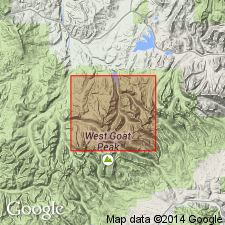
- Snowcrest Range Group*
- Modifications:
-
- Areal extent
- Age modified
- AAPG geologic province:
-
- Montana folded belt
Summary:
Extended into north-central part of Anaconda Range, Deerlodge and Granite Cos, MT, Montana folded belt province. Mapped undivided. Age modified to Late Mississippian? and Early Pennsylvanian because unit youngs to north in southwest MT (B.R. Wardlaw, personal communication, 1988) and may not contain Mississippian rocks in study area. Conformably overlies Madison Group; conformably underlies Quadrant Quartzite.
Source: GNU records (USGS DDS-6; Denver GNULEX).
For more information, please contact Nancy Stamm, Geologic Names Committee Secretary.
Asterisk (*) indicates published by U.S. Geological Survey authors.
"No current usage" (†) implies that a name has been abandoned or has fallen into disuse. Former usage and, if known, replacement name given in parentheses ( ).
Slash (/) indicates name conflicts with nomenclatural guidelines (CSN, 1933; ACSN, 1961, 1970; NACSN, 1983, 2005, 2021). May be explained within brackets ([ ]).