

- Usage in publication:
-
- Smoky Hill chalk
- Modifications:
-
- Named
- Dominant lithology:
-
- Limestone
- Chalk
- AAPG geologic province:
-
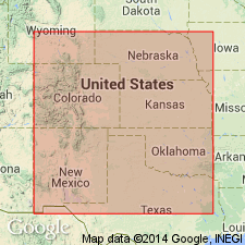
- Central Kansas uplift
- Anadarko basin
Summary:
Named as upper formation of the Niobrara division of the Platte series (new); named from Smoky Hill river in KS. No type locality designated. Occurs in KS from western Ellis Co, Central Kansas uplift, to vicinity of Ft. Wallace; thence chiefly northward and northeastward. Includes "Castle Rock" in Gove Co, Anadarko basin. Consists of chalky and marly limestones and chalk--bluish and marly in lower or "Trego zone," yellow to white, red, etc and more chalky in "Norton zone." "Trego zone" named from Trego Co, KS; "Norton zone" named for occurrence at Norton and Norton Co, KS. Near the upper limit consists of a horizon of jasper called the "Graham jasper," so-named from its occurrence in Graham Co, KS. Thickness not given. Overlies Osborne limestone (new) of Niobrara division, Platte series (new); underlies Lisbon shales (new) of Fort Pierre division, Platte series (new). Fossils listed. Late Cretaceous age.
Source: GNU records (USGS DDS-6; Denver GNULEX).

- Usage in publication:
-
- Smoky Hill shale member*
- Modifications:
-
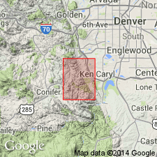
- Mapped 1:24k (Littleton quad, Arapahoe, Douglas, and Jefferson Cos, CO)
- Dominant lithology:
-
- Shale
- Limestone
- AAPG geologic province:
-
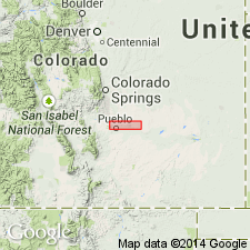
- Denver basin
Summary:
Is Upper Cretaceous member of Niobrara formation mapped in east-central Jefferson Co, CO (Denver basin). Outcrops in area of Deer Creek and south edge of quad. Is upper of two members of Niobrara. In lower 20 ft consists of yellowish-gray soft limy shale and thin beds of limestone of Fort Hays type; contains INOCERAMUS DEFORMIS. Remainder of lower part of member consists of yellowish-gray chalky platy speckled limestone and limy fissile shale containing bentonite beds. In middle part, about 135 ft above base, consists of very pale yellowish-orange thin-bedded speckled chalky ridge-forming limestone that contains CLIOSCAPHITES CHOTEAUENSIS Cobban, INOCERAMUS sp., OSTREA CONGESTA, and BACULITES sp. Upper part contains grayish-orange fissile to thick-bedded chalky shale. At top is yellowish-orange thick-bedded speckled chalky ridge-forming limestone that weathers to large irregular flakes and slabs; contains large smooth baculites, OSTREA CONGESTA, INOCERAMUS sp., STRAMENTUM HAWORTHI and fish scales and bones. Overlies Fort Hays limestone member of Niobrara; conformably underlies Pierre shale (Upper Cretaceous). Measured section (part). Thickness is about 500 ft.
Source: GNU records (USGS DDS-6; Denver GNULEX).
- Usage in publication:
-
- Smoky Hill Shale Member*
- Modifications:
-
- Biostratigraphic dating
- Overview
- AAPG geologic province:
-
- Denver basin
Summary:
Is the upper member of Niobrara Formation above Fort Hays Limestone Member of Niobrara and beneath Pierre Shale. Divided in the Pueblo area, Pueblo Co, CO in Denver basin, into 7 units described in ascending order: 1) shale and limestone unit is a 20 ft thick gray calcareous shale separated into 18 layers by gray shaly limestone, has INOCERAMUS DEFORMIS, is of early and middle Coniacian age; 2) lower shale is middle Coniacian, has INOCERAMUS INVOLUTUS Sowerby, is brown shale and gray limestone 56 ft thick; 3) lower limestone has 16 layers of gray, hard, slightly chalky limestone separated by brown shale, 2 persistent bentonites, is middle and late Coniacian, has INOCERAMUS INVOLUTUS; 4) middle shale is 280 ft thick, gray brown, platy, calcareous shale, late Coniacian to midddle Santonian age with SCAPHITES DEPRESSUS to CLIOSCAPHITES CHOTEAUENSIS; 5) middle chalk is 28 ft of gray chalk separated into thin layers by gray chalky shale of middle late Santonian age with INOCERAMUS PLATINUS; 6) upper chalky shale is brown to gray soft chalky with concretions, beds of chalk, bentonite limonite, of late Santonian and early Campanian age, has INOCERAMUS SIMPSONI Meek; 7) upper chalk is 8 ft thick, massive olive-black, early Campanian age, INOCERAMUS SIMPSONI. Measured sections. Stratigraphic chart. Geologic map. Upper 4 units replace Apishapa Member (abandoned) of Niobrara.
Source: GNU records (USGS DDS-6; Denver GNULEX).
- Usage in publication:
-
- Smoky Hill Shale Member*
- Modifications:
-
- Mapped 1:24k (Indian Hills quad, Jefferson Co, CO)
- Dominant lithology:
-
- Shale
- Limestone
- AAPG geologic province:
-
- Denver basin
Summary:
Is upper of two members of Upper Cretaceous Niobrara Formation mapped in central Jefferson Co, CO (Denver basin). Outcrops in northeast part of quad on east side of Hogback. Conformably overlies Fort Hays Limestone Member of Niobrara; conformably underlies Pierre Shale (Upper Cretaceous). Map unit described as yellowish-gray chalky shale and chalky limestone; upper half is grayish-orange fissile to thick-bedded chalky shale and has yellowish-orange thick-bedded fossiliferous chalky ridge-forming limestone at top; lower part is chalky platy limestone and calcareous shale with bentonite beds; about 135 ft above base is a harder yellowish-gray fossiliferous chalky ridge-forming limestone; limestone ridges are especially well developed along Ken Caryl Road near Massey Draw watergap; about 500 ft thick.
Source: GNU records (USGS DDS-6; Denver GNULEX).
For more information, please contact Nancy Stamm, Geologic Names Committee Secretary.
Asterisk (*) indicates published by U.S. Geological Survey authors.
"No current usage" (†) implies that a name has been abandoned or has fallen into disuse. Former usage and, if known, replacement name given in parentheses ( ).
Slash (/) indicates name conflicts with nomenclatural guidelines (CSN, 1933; ACSN, 1961, 1970; NACSN, 1983, 2005, 2021). May be explained within brackets ([ ]).