The National Geologic Map Database is migrating to a new infrastructure. We apologize for any service disruptions during this process.
|
|---|


- Usage in publication:
-
- Smithville Dolomite
- Modifications:
-
- Overview
- AAPG geologic province:
-
- Ozark uplift
Summary:
Ordovician (Canadian) Powell, Smithville, and Black Rock Dolomites are recognized in southeastern MO by some geologists but not by others. The three formations, originally defined in AR, are generally mapped as an undivided unit on source maps. Smithville overlies and intertongues with Powell; Black Rock overlies and intertongues with Smithville.
Source: GNU records (USGS DDS-6; Reston GNULEX).

- Usage in publication:
-
- Smithville Dolomite*
- Modifications:
-
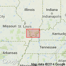
- Areal extent
- AAPG geologic province:
-
- Ozark uplift
Summary:
Ordovician (Canadian) Smithville Dolomite crops out near western edge of Paducah quad. Jefferson City, Cotter, Powell, and Smithville Dolomites not mapped consistently between adjacent 7.5-minutes quads within Paducah quad. All consist of more or less silty, sandy, and cherty dolomite. Indistinguishable in subsurface except possibly through study of insoluble residues. Sequence is equivalent to Shakopee Dolomite in IL and KY.
Source: GNU records (USGS DDS-6; Reston GNULEX).

- Usage in publication:
-
- Smithville Dolomite*
- Modifications:
-
- Areal extent
- AAPG geologic province:
-
- Upper Mississippi embayment
- Illinois basin
Summary:
Early Ordovician (Canadian) Smithville Dolomite mapped undivided with Powell Dolomite in subsurface of Upper Mississippi embayment of MO and Illinois basin in IL.
Source: GNU records (USGS DDS-6; Reston GNULEX).
For more information, please contact Nancy Stamm, Geologic Names Committee Secretary.
Asterisk (*) indicates published by U.S. Geological Survey authors.
"No current usage" (†) implies that a name has been abandoned or has fallen into disuse. Former usage and, if known, replacement name given in parentheses ( ).
Slash (/) indicates name conflicts with nomenclatural guidelines (CSN, 1933; ACSN, 1961, 1970; NACSN, 1983, 2005, 2021). May be explained within brackets ([ ]).