- Usage in publication:
-
- Smalls Falls Formation*
- Modifications:
-
- Age modified
- Areal extent
- Revised
- AAPG geologic province:
-
- New England province
Summary:
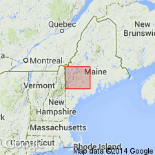
Age modified to Silurian, middle Wenlock to early Ludlow, eastern facies has early Ludlow graptolites. Divided into lower interbedded sulfidic shale and sandstone member, 600 m thick; upper calc-silicate member; 150 m thick; a grit member present locally. Thins to north and southeast. Also has been mapped in NH. Replaces use of Parkman Hill Formation, here abandoned.
Source: GNU records (USGS DDS-6; Reston GNULEX).

- Usage in publication:
-
- Smalls Falls Formation*
- Modifications:
-
- Revised
- Areal extent
- AAPG geologic province:
-
- New England province
Summary:
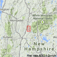
Stratigraphy differs radically from that of Hadley (1942, 1950), White and Billings (1952), in Mt. Cube and Woodsville 15-min quads, respectively, and revisions of Rumble (1942) east of Connecticut River. Fundamental difference is that Moench recognizes seven formations (plus members) that constitute Piermont allochthon. Hadley (1942) mapped all of these as Albee Formation, a name not used in this report. Rocks previously mapped as Albee are reassigned to stratigraphic equivalents of Quimby (Upper Ordovician?), Greenvale Cove (Lower Silurian), Rangeley (Lower Silurian), Perry Mountain (Silurian), Smalls Falls (Upper Silurian), Madrid (Upper Silurian?), and Littleton (Lower Devonian) Formations, whose type localities, except for Littleton, are near Rangeley, ME (Moench and Boudette, 1987). Thickness of Smalls Falls is about 100 m, compared with maximum thickness of 800 m in western ME. Consists of black sulfidic schist and minor quartzite. Report includes geologic map and correlation chart.
Source: GNU records (USGS DDS-6; Reston GNULEX).

- Usage in publication:
-
- Smalls Falls Formation*
- Modifications:
-
- Revised
- Areal extent
- Age modified
- Dominant lithology:
-
- Phyllite
- Quartzite
- Shale
Summary:
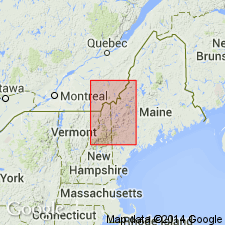
Geographically extended into VT in Guildhall area. Main body in Piermont-Frontenac allochthon is mapped extensively in Milan, Errol, Dixville, and Second Connecticut Lake 15-min quads, ME and NH, as well as in many small synclines from Littleton quad to Moose Bog quad. Previously mapped as Dixville Formation by Hatch (1963) and Green (1964, 1968) in Dixville, Errol, and Second Connecticut Lake quads. Elsewhere in NH, was previously mapped as Albee Formation by Billings (1956); in VT, was previously mapped as Partridge Formation by Johansson (1963); in Clinton River area in QUE, where queried on map, was previously mapped as unit IV-2 of formation of Chesham by Cheve (1990). Consists of rusty weathering, dark-gray to coaly black, graphitic-sulfidic phyllite sharply interbedded with sparse to abundant feldspathic quartzite, and local grit. Includes a separately mapped mixed volcanic and sedimentary facies, basalt lenses (previously mapped as Clear Stream Member of Dixville Formation by Green (1964)), felsic volcanic lenses, and polymict conglomerate lenses. In western sequence of central Maine trough, is divisible into unmapped upper calcareous member and lower black shale and quartzite member. In eastern sequence of central Maine trough, eastern facies of Smalls Falls is similar to lower black shale and quartzite of type Smalls Falls in Rangeley and Phillips 15-min quads, ME. Rocks here are dated by early Ludlovian graptolites just east of map area (Pankiwskyj and others, 1976; Moench and Pankiwskyj, 1988). Smalls Falls in Piermont-Frontenac allochthon and in western sequence of central Maine trough is Ludlovian(?) based on correlation with rocks of the eastern sequence. Wenlockian or Pridolian age for rocks of the Piermont sequence is not completely ruled out, but not included for overall age of unit in this report. Overall age is Silurian (Ludlovian).
Source: GNU records (USGS DDS-6; Reston GNULEX).

- Usage in publication:
-
- Smalls Falls Formation*
- Modifications:
-
- Overview
- AAPG geologic province:
-
- New England province
Summary:
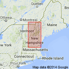
Used as Smalls Falls Formation of Silurian (Wenlockian and Ludlovian) age. Mapped as six unnamed subdivisions, and one undivided unit. Undivided unit consists of very rusty-weathering, thinly bedded sulfidic-graphitic schist and pyrhotitic calcsilicate granofels. Eastern facies equivalent of lower part of Fitch Formation. Locally mapped as Francestown Formation of Nielson (1981) in southern NH. Subdivisions include polymict metaconglomerate lentil; unnamed metaconglomerate member on Mud Pond Ridge in northern NH; tuffaceous argillite of Magalloway Mountain in northern NH; unnamed felsic volcanic member and metabasalt member; and a unit of mixed metavolcanics and metavolcanic sediments. Mapped undivided with Madrid Formation in places. Report includes geologic map, cross sections, correlation chart, and four 1:500,000-scale derivative maps.
Source: GNU records (USGS DDS-6; Reston GNULEX).
For more information, please contact Nancy Stamm, Geologic Names Committee Secretary.
Asterisk (*) indicates published by U.S. Geological Survey authors.
"No current usage" (†) implies that a name has been abandoned or has fallen into disuse. Former usage and, if known, replacement name given in parentheses ( ).
Slash (/) indicates name conflicts with nomenclatural guidelines (CSN, 1933; ACSN, 1961, 1970; NACSN, 1983, 2005, 2021). May be explained within brackets ([ ]).

