The National Geologic Map Database is migrating to a new infrastructure. We apologize for any service disruptions during this process.
|
|---|


- Usage in publication:
-
- Smackover limestone
- Modifications:
-
- Overview
- Dominant lithology:
-
- Limestone
- AAPG geologic province:
-
- Arkla basin
Summary:
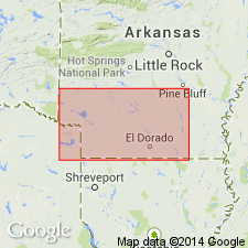
First? detailed published description. Named for [Smackover] oil field, Union and Ouachita Cos, AR in the Arkla basin. Overlies unconformably? the Eagle Mills formation (named). Conformably underlies Buckner formation (first? used). Is a subsurface unit recognized in southern AR where its greatest thickness is 880 ft. No type locality designated. Divisible into a lower part 300-450 ft thick of gray to brown, dense, cryptocrystalline limestone that is banded in many places with carbonaceous, argillaceous partings--basinward the limestone is darker and more argillaceous, and an upper part 400-500 ft thick of white chalky limestone with oolitic streaks and in upper 100 ft an oolitic, porous buff limestone known as the Reynolds oolite--basinward the upper part thickens, and chalky limestone is replaced by dense, cryptocrystalline, brown limestone with a faint oolitic structure at top. Cross section, columnar section. Mesozoic age.
Source: GNU records (USGS DDS-6; Denver GNULEX).
- Usage in publication:
-
- Smackover Formation*
- Modifications:
-
- Reference
- AAPG geologic province:
-
- East Texas basin
- Arkla basin
Summary:
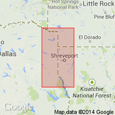
Name applied to a gray to brown dense oolitic limestone above the Norphlet Formation or disconformably above the Eagle Mills Formation, and beneath the Buckner Formation. Reference section designated between depths of 11,075 and 12,007 ft in the Pan-American Petroleum Corp. Giraud Gas Unit #1, Cass Co, TX in the East Texas basin. Isopach map shows unit in adjacent counties of AR and LA, Arkla basin. Has maximum thickness of 1,292 ft in Bossier Parish, LA. Thickens south from AR into LA. Divided into three members in reference well; lower member is a gray to brown, dense to platy laminated limestone 274 ft thick; middle member is brown to gray fossiliferous limestone that can be arenaceous 531 ft thick; upper member brown dense arenaceous limestone with a few oolites at base to gray oolitic pisolitic, dolomitic limestone 127 ft thick at top. Facies map of upper member. Only the lower member can be recognized throughout report area. Upper member is probably the same as the Reynolds oolite zone. In most updip areas, Bossier Formation overlies lower member of Smackover. Cross section, stratigraphic chart. Late Jurassic age.
Source: GNU records (USGS DDS-6; Denver GNULEX).
- Usage in publication:
-
- Smackover Formation
- Modifications:
-
- Revised
- AAPG geologic province:
-
- East Texas basin
Summary:
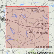
Upper contact of Smackover Formation of Louark Group revised in that it is unconformably overlain by the newly named Gilmer Limestone in the basinward area of the East Texas basin, TX. Gilmer of this report was referred to as the "Cotton Valley limestone" or the "Haynesville limestone" in earlier reports. Correlation chart. E-log cross section. Areal extent map of Gilmer. Overlies Norphlet Formation. Of Late Jurassic age. Is the basinward equivalent of the shelfward Buckner Formation of Louark.
Source: GNU records (USGS DDS-6; Denver GNULEX).
- Usage in publication:
-
- Smackover Formation
- Modifications:
-
- Overview
- Dominant lithology:
-
- Mudstone
- Limestone
Summary:
The Smackover is a regionally extensive Late Jurassic carbonate unit. Three distinct lithofacies are recognized: a thin lower laminated carbonate mudstone and peloidal and oncolitic wackestone and packstone; a thick middle carbonate mudstone interbedded with peloidal and skeletal wackestone and packstone; and a thick upper oolitic, oncolitic, and peloidal grainstone and packstone interbedded with laminated carbonate mudstone. Locally, algal boundstone is important component of the upper Smackover. Thickness may exceed 550 ft in the report area. Unit overlies the Norphlet Formation, the contact being either gradational or abrupt in the study area. Late Oxfordian age is based on ammonites from the lower portion of the Smackover (Salvador, 1987).
Source: GNU records (USGS DDS-6; Reston GNULEX).
- Usage in publication:
-
- Smackover Formation
- Modifications:
-
- Overview
- Dominant lithology:
-
- Dolostone
- Limestone
- Mudstone
- AAPG geologic province:
-
- Mid-Gulf Coast basin
Summary:
The Smackover has been well studied in the inner ramp area where it is divided into lower, middle, and upper members. In the outer ramp area, it is divided into four intervals referred to here as lower, middle, and upper outer-ramp lithofacies and coastal dolostone lithofacies. In the AL and FL coastal waters and adjacent federal waters areas, thickness reaches 1,400 ft. The lower outer-ramp lithofacies represents initial carbonate deposition associated with the Smackover transgression and consists of low-energy, finely laminated strata. Onshore this is micaceous, pyritic, laminated dolostone, and mudstone; offshore it is generally mudstone with abundant pyrite, lime mudstone and dolomudstone, dolomite-cemented shelf sandstone, and peloid ooid packstone to grainstone. The middle outer-ramp lithofacies is characterized by low-energy rocks which represent progressive relative sea-level rise. It consists of anoxic, organic-rich, laminated mudstone interfingering with laminated micaceous fine-grained sandstone. The upper outer-ramp lithofacies represents progradation of high energy deposits in association with regression and relative sea-level fall. It consists of packstone to grainstone with very fine to fine-grained micaceous sandstone interbeds. The coastal dolostone lithofacies includes dolomitized upper outer-ramp and possibly, middle outer-ramp lithofacies. It is not present in the downdip portion of the study area. For the most part, it consists of dolomitized upper outer-ramp lithofacies, and is described as very fine to medium crystalline, subhedral to euhedral dolomite.
Source: GNU records (USGS DDS-6; Reston GNULEX).
For more information, please contact Nancy Stamm, Geologic Names Committee Secretary.
Asterisk (*) indicates published by U.S. Geological Survey authors.
"No current usage" (†) implies that a name has been abandoned or has fallen into disuse. Former usage and, if known, replacement name given in parentheses ( ).
Slash (/) indicates name conflicts with nomenclatural guidelines (CSN, 1933; ACSN, 1961, 1970; NACSN, 1983, 2005, 2021). May be explained within brackets ([ ]).