

- Usage in publication:
-
- Slim Buttes formation
- Modifications:
-
- Original reference
- Dominant lithology:
-
- Sandstone
- AAPG geologic province:
-
- Williston basin
Summary:
Pg. 263-274. Slim Buttes formation. Massive medium- to very fine-grained sandstone which varies in color throughout area. Predominantly white, but light green, red brown, yellow, and lilac in places. Conglomerate present at top locally. Green channel fill sandstone present at top in area of Finger Butte in sec. 35, T. 17 N., R. 9 E. Thickness as much as 39 feet. Underlies Arikaree formation. Overlies Ludlow formation. Has been mapped as Chadron. No true Chadron believed to crop out in area. [Vertebrate fossils.] Age is late Eocene (Duchesnean NALMA).
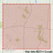
Type section: Slim Buttes, Harding Co., northwestern SD.
Standard section: [along Rock Spring Trail], Slim Buttes, in NW/4 SE/4 sec. 11, T. 16 N., R. 8 E., Sheep Mountain 7.5-min quadrangle, Harding Co., Custer National Forest, northwestern SD.
Source: US geologic names lexicon (USGS Bull. 1350, p. 701-702).
- Usage in publication:
-
- Slim Buttes Formation
- Modifications:
-
- Areal extent
- AAPG geologic province:
-
- Williston basin
Summary:
Is a stream deposit of late Eocene age or of the so-called late Duchnesean land mammal age in the Williston basin and Sioux uplift that was derived from nearby hills, filling valley bottoms at least 25 m below ridges of weathered Cretaceous rocks. The hilly landscape in Slim Butte time was controlled by subsidence in a broad asymmetric graben. Has large root traces. Was probably deposited in a subtropical and warm climate when permanent streams were widespread but elevated parts of landscape were dry. Has a major paleosol at the top. Diagram shows paleosol occurrences. Unconformably overlies Fox Hills? Formation. Unconformably underlies Chadron Formation.
Source: GNU records (USGS DDS-6; Denver GNULEX).
For more information, please contact Nancy Stamm, Geologic Names Committee Secretary.
Asterisk (*) indicates published by U.S. Geological Survey authors.
"No current usage" (†) implies that a name has been abandoned or has fallen into disuse. Former usage and, if known, replacement name given in parentheses ( ).
Slash (/) indicates name conflicts with nomenclatural guidelines (CSN, 1933; ACSN, 1961, 1970; NACSN, 1983, 2005, 2021). May be explained within brackets ([ ]).