- Usage in publication:
-
- Slatestone group
- Modifications:
-
- Named
- Dominant lithology:
-
- Sandstone
- Shale
- Coal
- AAPG geologic province:
-
- Appalachian basin
Summary:
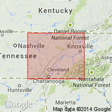
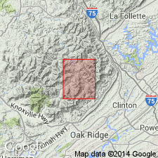
Named for town of Slatestone, 1 mi west-northwest of Briceville, Anderson Co., eastern TN. Type section is between The Wye and Cross Mountain in Lake City quad. Section begins with Poplar Creek coal along railroad tracks and the road at The Wye, and ends on Militia Hill, marked by the Jellico coal. Occupies foothills and lower slopes of Cumberland Mountains. Includes Stephens sandstone, Petros sandstone, Sand Gap sandstone, Newcomb sandstone, and several unnamed shale intervals. Consists of sandstone, shale, and coal. Thickness at type section is 635 ft; ranges from 300 to 720 ft. Overlies Crooked Fork group; underlies Indian Bluff group. Report includes geologic map, correlation chart, measured sections, and columnar sections. Age is Pennsylvanian (Pottsville series).
Source: GNU records (USGS DDS-6; Reston GNULEX).

- Usage in publication:
-
- Slatestone Formation
- Modifications:
-
- [Revised]
- Mapped
- AAPG geologic province:
-
- Appalachian basin
Summary:
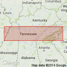
(East-central and East sheets.) Slatestone Formation. Shale, sandstone, siltstone, and several important coals; from Jellico coal to Poplar Creek coal. Thickness 500 to 720 feet in east-central Tennessee; 500 to 650 feet in eastern Tennessee. Lies below Indian Bluff Formation and above Wartburg Sandstone of Crooked Fork Group. Age is Pennsylvanian.
[The Slatestone Group of Wilson and others (1956) is reduced to formation rank. Its constituent formations, the Newcomb, Sand Gap, Petros, and Stephens, are also reduced in rank to members (not incl. on State geol. map). See also under Indian Bluff.]
Source: Publication.

- Usage in publication:
-
- Slatestone Formation
- Modifications:
-
- Overview
- Dominant lithology:
-
- Sandstone
- Shale
- Siltstone
- Coal
- AAPG geologic province:
-
- Appalachian basin
Summary:
Consists of clayey to sandy, light-brown to dark-gray shale with coal beds and minor intercalated sandstone and siltstone; and yellowish-gray to yellowish-brown, fine- to medium-grained, thin-to thick-bedded sandstone, cross-bedded in part, lenticular. Base of formation not exposed.
Source: GNU records (USGS DDS-6; Reston GNULEX).

- Usage in publication:
-
- Slatestone Formation*
- Modifications:
-
- Revised
- AAPG geologic province:
-
- Appalachian basin
Summary:
Used as Slatestone Formation in eastern TN. Includes all strata from top of Poplar Creek coal to top of Jellico coal. Includes Stephens, Petros, Sand Gap, and Newcomb Sandstone Members and Betsie Shale Member (newly assigned). Lower part of Slatestone includes strata previously assigned to Briceville Formation (abandoned herein). Also includes part of strata previously assigned to Jellico and Hance Formations (both abandoned herein).
Source: GNU records (USGS DDS-6; Reston GNULEX).
For more information, please contact Nancy Stamm, Geologic Names Committee Secretary.
Asterisk (*) indicates published by U.S. Geological Survey authors.
"No current usage" (†) implies that a name has been abandoned or has fallen into disuse. Former usage and, if known, replacement name given in parentheses ( ).
Slash (/) indicates name conflicts with nomenclatural guidelines (CSN, 1933; ACSN, 1961, 1970; NACSN, 1983, 2005, 2021). May be explained within brackets ([ ]).

