

- Usage in publication:
-
- Skunk Ranch conglomerate*
- Modifications:
-
- Named
- Dominant lithology:
-
- Conglomerate
- Basalt
- Shale
- AAPG geologic province:
-
- Pedregosa basin
Summary:
Pg. 534, figs. 2, 4; USGS Prof. Paper 208, p. 25-26, pl. 1, 1947. Skunk Ranch conglomerate of Bisbee group. Consists largely of coarse conglomerate composed of red boulders and pebble in a matrix of red sandstone and shale. Boulders and slabs as much as 20 inches across comparatively common, and average diameter about 4 inches. Lateral gradations from the red bouldery conglomerate to gray and finer grained limestone conglomerate and to coarse-grained sandstone exposed locally. Layers of yellow clay-shale and soft sandstone present at several horizons. Large part of upper half of formation consists of alternating beds of red clay-shale and massive red conglomerate in members 5 to 60 feet in thickness. A 200-foot layer of augite basalt exposed at one place. Maximum exposed thickness 3,400 feet. Topmost part of formation covered by Miocene(?) volcanic rocks. Overlies Corbett sandstone (new), and in places disconformably overlies Playas Peak formation, both of Bisbee group. Age is Early Cretaceous (Trinity). Report includes geologic map.
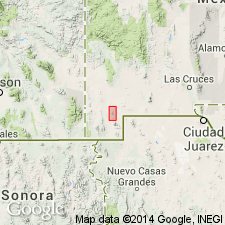
Crops out only west and south of Skunk Ranch in Eureka section of Little Hatchet Mountains, southwestern NM (Pedregosa basin and Basin-and-Range province). Named from Skunk Ranch, in sec. 9, T. 28 S., R. 16 W. [According to GNU records (USGS DDS-6; Denver GNULEX, Mar. 18, 1986), type locality not designated.]
Source: US geologic names lexicon (USGS Bull. 1200, p. 3627); supplemental information from GNU records (USGS DDS-6; Denver GNULEX).

- Usage in publication:
-
- Skunk Ranch Conglomerate*
- Modifications:
-
- Age modified
- Revised
- Overview
- AAPG geologic province:
-
- Pedregosa basin
- Basin-and-Range province
Summary:
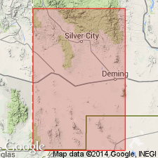
Is formation in Little Hatchet Mountains, Hidalgo and Grant Cos, NM in the Pedregosa basin and Basin-and-Range province. Is not considered part of Bisbee Group; changed from previous work by Lasky (1947). Bisbee Group not used locally in this paper. Overlies Playas Peak Formation (Lower Cretaceous) in southern part of Little Hatchet Mountains with erosional unconformity; contains debris derived from Lower Cretaceous and Paleozoic rocks. May be a thick equivalent of conglomerates at base of Ringbone Shale (Upper Cretaceous). Underlies Ringbone; nature of contact uncertain. Considered generally correlative with Fort Crittenden Formation (Upper Cretaceous) in southeastern AZ. Age changed from Early Cretaceous (Lasky, 1947) to Late Cretaceous on basis of correlation using lithologic similarity. [See fig. 5 for regional correlation.]
Source: GNU records (USGS DDS-6; Denver GNULEX).
- Usage in publication:
-
- Skunk Ranch Conglomerate
- Modifications:
-
- Not used
Summary:
As used by Lasky (1938) here included in Ringbone Formation and considered to be of Late Cretaceous age. [According to GNU records (USGS DDS-6; Denver GNULEX), "...probably a good move. Inasmuch as Skunk Ranch is almost certainly the same unit as Ringbone and the two occur in the same mountain range, Skunk Ranch should probably be dropped from usage…"]
Source: GNU records (USGS DDS-6; Denver GNULEX).
For more information, please contact Nancy Stamm, Geologic Names Committee Secretary.
Asterisk (*) indicates published by U.S. Geological Survey authors.
"No current usage" (†) implies that a name has been abandoned or has fallen into disuse. Former usage and, if known, replacement name given in parentheses ( ).
Slash (/) indicates name conflicts with nomenclatural guidelines (CSN, 1933; ACSN, 1961, 1970; NACSN, 1983, 2005, 2021). May be explained within brackets ([ ]).