

- Usage in publication:
-
- Skaneateles shales
- Modifications:
-
- Named
- Dominant lithology:
-
- Shale
- AAPG geologic province:
-
- Appalachian basin
Summary:
Named Skaneateles shales for outcrops that cover north end of Skaneateles Lake, NY. Consists of highly fossiliferous shales underlying Hamilton group and overlying the upper shales of Marcellus, which are less highly colored than underlying deep black Marcellus shales.
Source: GNU records (USGS DDS-6; Reston GNULEX).

- Usage in publication:
-
- Skaneateles Shale*
- Modifications:
-
- Areal extent
- AAPG geologic province:
-
- Appalachian basin
Summary:
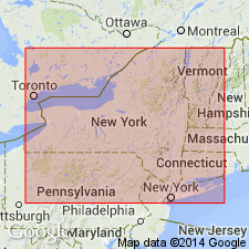
Skaneateles Shale of Hamilton Group extended from southwestern NY, western PA, and eastern OH into the subsurface of northern WV and far western MD (Garrett Co.). Unit consists mostly of dark- to medium-gray fossiliferous shale and mudrock. Contains a black shale facies that resembles the Marcellus Shale. Includes the Stafford Limestone Member at its base. The Stafford is thin but extensive and can be traced in the subsurface as far southwest as north-central WV and southeastern OH. The Skaneateles loses its identity to the west where the Hamilton is undivided. Grades into the Plum Brook Shale of northern OH or the lower part of the Olentangy Shale.
Source: GNU records (USGS DDS-6; Reston GNULEX).
For more information, please contact Nancy Stamm, Geologic Names Committee Secretary.
Asterisk (*) indicates published by U.S. Geological Survey authors.
"No current usage" (†) implies that a name has been abandoned or has fallen into disuse. Former usage and, if known, replacement name given in parentheses ( ).
Slash (/) indicates name conflicts with nomenclatural guidelines (CSN, 1933; ACSN, 1961, 1970; NACSN, 1983, 2005, 2021). May be explained within brackets ([ ]).