The National Geologic Map Database is migrating to a new infrastructure. We apologize for any service disruptions during this process.
|
|---|


- Usage in publication:
-
- Sixty Mile Formation
- Modifications:
-
- First used
- AAPG geologic province:
-
- Plateau sedimentary province
Summary:
First use of the Sixty Mile [Sixtymile] Formation of the Chuar Group. Age is late Precambrian.
Source: GNU records (USGS DDS-6; Menlo GNULEX).
- Usage in publication:
-
- Sixty Mile Formation
- Modifications:
-
- Original reference
- Dominant lithology:
-
- Sandstone
- Breccia
- AAPG geologic province:
-
- Plateau sedimentary province
- Southern Rocky Mountain region
Summary:
Pg. 1244 (table 1), 1252-1255, geol. map (fig. 1), columnar section (fig. 2). Sixty Mile Formation [Sixtymile Formation]. Consists of (ascending): (1) basal breccia, about 20 to 50 feet thick, with clasts derived from underlying Walcott Member (new) of Kwagunt Formation (new) of Chuar Group; (2) red fine-grained sandstone (up to 100 feet) that contains 1-foot-thick lenses of breccia and sometimes is massive with slump structures; and (3) a second layer of breccia up to 20 feet thick. Is top formation of Chuar Group [chart accompanying geol. map (fig. 1) incorrectly shows the Sixtymile excluded from Chuar Group]. Appears = Walcott's topmost division 1 of Chuar terrane [USGS Ann. Rpt. 14, p. 508-509, 1894], and Hinds' division 8 of Chuar Group [Carnegie Inst. Washington Pub. 463, p. 105-106, 1936]. Unconformably underlies Cambrian Tapeats Sandstone. Rocks were previously considered a local outlier of Tapeats Sandstone by some workers (e.g., Van Gundy, 1951, GSA Bull., v. 30, p. 953-959; and Maxson, 1967, Geol. map Grand Canyon and vicinity, Arizona (eastern section), Grand Canyon Nat. Hist. Assoc.). Overlies shales of Walcott Member of Kwagunt Formation; separated by an erosional unconformity. Age is considered late Precambrian.
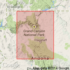
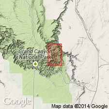
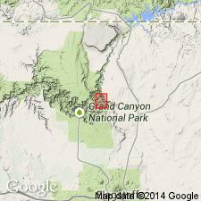
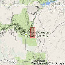
Type section: Sixty Mile section H, cliffs on north side of upper part of Sixtymile Canyon [approx. Lat. 36 deg. 12 min. 30 sec., N., Long. 111 deg. 50 min. 42 sec. W., Cape Solitude 7.5-min quadrangle], eastern Grand Canyon, Grand Canyon National Park, Coconino Co., northern AZ.
Alternate type section: accessibility to type section from Colorado River is not easy; formation also well exposed at top of Nankoweap Butte where it is about 120 ft (36 m) thick, [about 4.5 mi (7 km) north-northwest of type, approx. Lat. 36 deg. 15 min. 49 sec. N., Long. 111 deg. 53 min. 02 sec. W., Point Imperial 7.5-min quadrangle], eastern Grand Canyon, Grand Canyon National Park, Coconino Co., northern AZ.
Named from Sixty Mile [Sixtymile] Canyon, [Cape Solitude 7.5-min quadrangle], eastern Grand Canyon, Grand Canyon National Park, Coconino Co., northern AZ.
[Additional locality information from USGS GNIS database and USGS historical topographic map collection TopoView, accessed on October 10, 2024.]
Source: GNU records (USGS DDS-6; Denver GNULEX).
- Usage in publication:
-
- Sixtymile Formation*
- Modifications:
-
- Revised
- Overview
- AAPG geologic province:
-
- Southern Rocky Mountain region
Summary:
Upper formation of Chuar Group of Grand Canyon Supergroup. Spelling [geographic part of name] revised from Sixty Mile to Sixtymile to agree with spelling of canyon on Vishnu Temple quad. Type section measured in north fork Sixtymile Canyon 36 deg 12' 42" N, 111 deg 50' 45" W, Coconino Co, AZ, Southern Rocky Mountain region where Sixtymile 57-64 m thick. Overlies Kwagunt Formation of Chuar. Unconformably underlies Tapeats Sandstone. Lower member of purple, red and pink beds of (in sequence): 1) quartzose, very fine grained, hematitic laminated sandstone; 2) thin-bedded, micaceous, fine to very fine grained sandstone; 3) monomict and polymict breccia; 4) crudely bedded, fine- to coarse-grained, poorly sorted sandstone with grains angular to subrounded; 5) monomict and polymict breccia; 6) finely laminated to very thin bedded, soft, sandy siltstone. Middle member red to pink, very fine grained to silt sized quartzite. Upper member has sandstone facies in southwest axis syncline of red and brown, fluvial, cross-bedded sandstone with white chert fragments, and conglomerate facies fine to coarse grained with angular to subangular granule-, pebble-, and scattered boulder-size fragments. Cross sections; columnar section; geologic map. Deposited in deepening trough of north-trending Chuar syncline as a result of regional uplift, tilting, and faulting. Of continental origin. Correlated with Windermere. Is about 830 m.y. and younger.
Source: GNU records (USGS DDS-6; Denver GNULEX).
- Usage in publication:
-
- Sixtymile Formation*
- Modifications:
-
- Revised
- Overview
- AAPG geologic province:
-
- Southern Rocky Mountain region
Summary:
Retained in the Proterozoic Grand Canyon Supergroup but removed from the Chuar Group because of its lithology (very fine to coarse grained landslides and breccia-bearing red beds of continental origin) which contrast with the dark-gray marine shale of the underlying Kwagunt and Galeros Formations of the Chuar. Deposition was continuous across the Kwagunt-Sixtymile Formation boundary; a 10-cm thick transition zone records a time of marine emergence. Section at Nankoweap Butte which differs in some details from Sixtymile Canyon (Elston, 1979). Sixtymile at the butte conformably and gradationally overlies Kwagunt Formation. The transition zone at the butte contains a layer of unreworked airfall tuff at base. The zone is overlain by very fine grained red laminated sandstone belonging to the Sixtymile. Sandstone of the lower member of the Sixtymile was folded, eroded, and followed by deposition of breccia-bearing sandstone and landslides. The landslides consist of chaotic polymict breccia derived from Chuar rocks. Breccia layers occur in all three members; the lower two in the lower member show no evidence of reworking; the two breccias in the middle member show the effect of transportation and sorting; the breccia at the base of the upper member is unreworked and unsorted. Cross sections; columnar sections. Report area lies in the Southern Rocky Mountain region.
Source: GNU records (USGS DDS-6; Denver GNULEX).
- Usage in publication:
-
- Sixtymile Formation*
- Modifications:
-
- Overview
- Paleomagnetics
- AAPG geologic province:
-
- Southern Rocky Mountain region
Summary:
Is the uppermost unit in the Grand Canyon Supergroup. Unconformably overlies Tanner Member of Kwagunt Formation of Chuar Group. Unconformably (called the "great unconformity) underlies the Tapeats Sandstone. Is 59 to 64+ m thick. Divided into lower, middle, and upper members which are separated from each other by unconformities. Age is Late Proterozoic. Represents interval from slightly older than 825 Ma to about 570 Ma. Sixtymile pole has a westerly position, probably representing a shift form Nankoweap and Chuar time. The pole indicates correlation of underlying Chuar with part of the Mackenzie Mountains Supergroup. A sill in the Tsezotene Formation of the Mackenzie Mountains Supergroup dated at 770 Ma has a pole identical with Sixtymile pole. Is in the Southern Rocky Mountain region of northern AZ.
Source: GNU records (USGS DDS-6; Denver GNULEX).
For more information, please contact Nancy Stamm, Geologic Names Committee Secretary.
Asterisk (*) indicates published by U.S. Geological Survey authors.
"No current usage" (†) implies that a name has been abandoned or has fallen into disuse. Former usage and, if known, replacement name given in parentheses ( ).
Slash (/) indicates name conflicts with nomenclatural guidelines (CSN, 1933; ACSN, 1961, 1970; NACSN, 1983, 2005, 2021). May be explained within brackets ([ ]).