- Usage in publication:
-
- Sipe Springs formation
- Modifications:
-
- Original reference
- Dominant lithology:
-
- Limestone
- Shale
- AAPG geologic province:
-
- Bend arch
Summary:
Pg. 84 (fig. 5), 85. Sipe Springs formation, upper formation (of 2) of Big Saline group (new). Sequence of limestone and shale. Includes "limestone D" of Plummer and Moore's (1922) type log of the Ranger district. Underlies Eastland Lake formation (new) of Smithwick group; overlies De Leon formation (new). Age is Pennsylvanian (Lampasas). Report includes stratigraphic chart.
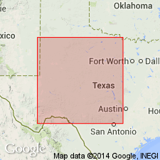
Type section (subsurface): depth-interval 3,760 to 3,870 ft, Roxana Petroleum Company Seaman No. 1 test well, northwest Palo Pinto Co., north-central TX. Named from town of Sipe Springs in northern Comanche Co., TX.
Source: US geologic names lexicon (USGS Bull. 1200, p. 3615); supplemental information from GNU records (USGS DDS-6; Denver GNULEX).
For more information, please contact Nancy Stamm, Geologic Names Committee Secretary.
Asterisk (*) indicates published by U.S. Geological Survey authors.
"No current usage" (†) implies that a name has been abandoned or has fallen into disuse. Former usage and, if known, replacement name given in parentheses ( ).
Slash (/) indicates name conflicts with nomenclatural guidelines (CSN, 1933; ACSN, 1961, 1970; NACSN, 1983, 2005, 2021). May be explained within brackets ([ ]).

