

- Usage in publication:
-
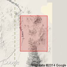
- Simonson dolomite*
- Modifications:
-
- Named
- Dominant lithology:
-
- Dolomite
- Conglomerate
- AAPG geologic province:
-
- Great Basin province
Summary:
Named for Simonson Canyon, west side of Deep Creek Range, Tooele Co, UT in the Great Basin province. No type locality designated. Is characteristically a dark to medium-gray, finely laminated dolomite. Individual beds are 1-2 ft thick. Two non-persistent dolomite conglomerates found within formation, and a third conglomerate found that marks the upper boundary with the Guilmette formation (new). Is nearly 1,000 ft thick. Middle Devonian fossils. Overlies Sevy dolomite (new).
Source: GNU records (USGS DDS-6; Denver GNULEX).
- Usage in publication:
-
- Simonson Dolomite*
- Modifications:
-
- Areal extent
- AAPG geologic province:
-
- Great Basin province
Summary:
Red Warrior Limestone abandoned. Its rocks reassigned, in the Star Range, Beaver Co, UT in the Great Basin province, to the lower part of the Upper Devonian Pinyon Peak Limestone, the Devonian Sevy Dolomite, Simonson Dolomite, and Guilmette Formation, and to the Silurian Laketown Dolomite. [Of Devonian age.]
Source: GNU records (USGS DDS-6; Denver GNULEX).
- Usage in publication:
-
- Simonson Dolomite*
- Modifications:
-
- Areal extent
- AAPG geologic province:
-
- Great Basin province
Summary:
Areally extended to the Dog Valley Mountain area in the northeast part of the quad in the Great Basin province, where it is younger than the Early and Middle Devonian Sevy Dolomite and older than the Late Devonian Cove Fort Quartzite. Assigned a Middle Devonian age.
Source: GNU records (USGS DDS-6; Denver GNULEX).

- Usage in publication:
-
- Simonson Dolomite*
- Modifications:
-
- Areal extent
- Dominant lithology:
-
- Dolomite
- AAPG geologic province:
-
- Great Basin province
Summary:
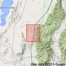
Is Middle Devonian formation shown only in cross sections in southern part of the Mountain Home Range in western Millard and Beaver Cos, southwest UT (Great Basin province). Is shown to overlie Sevy Dolomite (Lower Devonian). Is shown below Guilmette Formation (Middle? and Upper Devonian). Is described as dark-brownish-gray medium- to coarsely crystalline dolomite containing abundant poorly preserved stromatoporoidal fossil fragments. Regional thickness about 200 m. In subsurface only (see cross sections).
Source: GNU records (USGS DDS-6; Denver GNULEX).
- Usage in publication:
-
- Simonson Dolostone*
- Modifications:
-
- Redescribed
- Dominant lithology:
-
- Dolostone
- AAPG geologic province:
-
- Great Basin province
Summary:
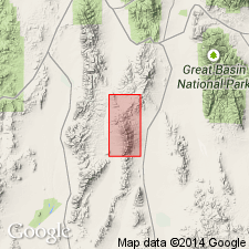
Redescribed on basis of change in lithic designation from dolomite to dolostone (more appropriate term). Is mapped undivided with Sevy Dolostone in study area, Lincoln and White Pine Cos, NV in east-central part of Great Basin province. No complete section present in area. Uppermost part has been displaced by faulting. Uppermost beds present are brown-weathering, cliff-forming, fine- to medium-grained, dark- to medium-gray fossiliferous dolostones. Underlying brown cliff-former is series of alternating dark-brownish-gray, finely crystalline dolostone and medium- to light-gray aphanitic dolostone. Alternating units vary in thickness from 3-5 ft. Darker beds are commonly fetid. Thickness of this incomplete section ranges from 250 to 400 ft. Is in fault contact with overlying Middle and Upper Devonian Guilmette Limestone. Overlies Lower and Middle Devonian Sevy Dolostone. Age is Middle Devonian.
Source: GNU records (USGS DDS-6; Denver GNULEX).
- Usage in publication:
-
- Simonson Dolostone*
- Modifications:
-
- Redescribed
- Overview
- Dominant lithology:
-
- Dolostone
- AAPG geologic province:
-
- Great Basin province
Summary:
Is redescribed as dolostone. The name "dolostone" is used for rocks composed predominantly of the mineral "dolomite" on Figure 2 and throughout this chapter, although in the literature it has been common practice to use dolomite rather than dolostone in formal names of dolomitic formations and members. Occurs in stratigraphic column for west-central UT (Great Basin province); unconformably above Sevy Dolostone (redescribed) (Lower Devonian); conformably below Guilmette Formation (Middle and Upper Devonian). In stratigraphic column for east-central NV (Great Basin province); unconformably above McColley Canyon Formation (Lower Devonian); conformably below Guilmette Limestone. Assigned to Eifelian and Givetian (Middle Devonian).
Source: GNU records (USGS DDS-6; Denver GNULEX).
For more information, please contact Nancy Stamm, Geologic Names Committee Secretary.
Asterisk (*) indicates published by U.S. Geological Survey authors.
"No current usage" (†) implies that a name has been abandoned or has fallen into disuse. Former usage and, if known, replacement name given in parentheses ( ).
Slash (/) indicates name conflicts with nomenclatural guidelines (CSN, 1933; ACSN, 1961, 1970; NACSN, 1983, 2005, 2021). May be explained within brackets ([ ]).