

- Usage in publication:
-
- Silverton series*
- Modifications:
-
- Original reference
- AAPG geologic province:
-
- San Juan Mountains province
Summary:
Pg. 29-39. Silverton series. Complex of andesitic flows and tuffs alternating with rhyolitic flows, flow breccia, and tuff. In Telluride quadrangle, and at most places in Silverton quadrangle, the lowest member is a rhyolitic flow or flow breccia of peculiar character. This complex as a whole contrasts markedly with underlying San Juan series (which is purely andesitic and entirely fragmental) and with overlying Potosi series (which is almost entirely rhyolitic). In Telluride folio was called "Intermediate series." Rests unconformably on San Juan series. Covers greater part of Silverton quadrangle. Thickness 300 to 5,000 feet. [Age is Miocene.]
[Named after Silverton quadrangle, where units have their greatest development, Ouray, San Juan, and Hinsdale Cos., southwestern CO.]
Source: US geologic names lexicons (USGS Bull. 896, p. 2001; supplemental information from USGS Bull. 1200, p. 3609-3610).
- Usage in publication:
-
- Silverton volcanic series*
- Modifications:
-
- Revised
- AAPG geologic province:
-
- San Juan Mountains province
Summary:
Called these rocks Silverton volcanic series, and divided them into several units. [Age is Miocene.]
Source: US geologic names lexicon (USGS Bull. 896, p. 2001).
- Usage in publication:
-
- Silverton volcanic series*
- Modifications:
-
- Revised
- AAPG geologic province:
-
- San Juan Mountains province
Summary:
Introduced new name Henson tuff for uppermost formation of Silverton volcanic series and stated that in Silverton folio the upper part of Henson tuff was included in overlying Potosi volcanic series and that lower part was included in the underlying pyroxene andesite, which was then called uppermost part of Silverton volcanic series. [Age is Miocene.]
Source: US geologic names lexicon (USGS Bull. 896, p. 2001).

- Usage in publication:
-
- Silverton volcanic series*
- Modifications:
-
- Overview
- AAPG geologic province:
-
- San Juan Mountains province
Summary:
Silverton volcanic series. Includes Henson tuff, Burns latite tuff, Eureka rhyolite, and Picayune volcanic group, also unnamed pyroxene andesite. Age is Miocene.
Recognized in southwestern CO.
Source: US geologic names lexicon (USGS Bull. 896, p. 2001).
- Usage in publication:
-
- Silverton Volcanic Group*
- Modifications:
-
- Revised
- Age modified
- AAPG geologic province:
-
- San Juan Mountains province
Summary:
Basal contact revised to include an unnamed quartz latite. Name changed from Silverton Volcanic Series to Silverton Volcanic Group [in accord with Article 9f, Code of Stratigraphic Nomenclature, 1961]. Divided into (ascending): Picayune Formation (formerly Picayune Quartz Latite), Eureka Tuff (formerly Eureka Quartz Latite), Burns Formation (formerly Burns Quartz Latite), and Henson Formation (formerly Henson Tuff). Is confined to a 425 sq mi area in the San Juan volcanic depression in the San Juan Mountain province, southwestern CO. Assigned to the middle and late Tertiary.
Source: GNU records (USGS DDS-6; Denver GNULEX).
- Usage in publication:
-
- Silverton Volcanic Group*
- Modifications:
-
- Mapped 1:24k (Hinsdale and Ouray Cos, CO)
- Dominant lithology:
-
- Breccia
- Tuff
- Mudstone
- Shale
- Siltstone
- AAPG geologic province:
-
- San Juan Mountains province
Summary:
Is Oligocene volcanic group comprised of two formations: Burns (lower) and Henson (upper), separately mapped in southeast part of quadrangle in southeast Ouray and western Hinsdale Cos, CO (San Juan Mountain province). See detailed remarks under specific formations.
Source: GNU records (USGS DDS-6; Denver GNULEX).
- Usage in publication:
-
- Silverton Volcanic Group†
- Modifications:
-
- Abandoned
- AAPG geologic province:
-
- San Juan Mountains province
Summary:
†Silverton Volcanic Group abandoned. Previously included (ascending) Picayune Formation, Eureka Tuff, Burns Formation, and Henson Formation (none of which is now included in any named group). Units do not have a close genetic association. Picayune = San Juan and Lake Fork Formations; Eureka = part of Sapinero Mesa Tuff; Burns and Henson are post-collapse accumulations within San Juan caldera. [Adopted by the USGS (see Changes in stratigraphic nomenclature, 1973, USGS Bull. 1395-A, p. A38-A39).]
Source: Changes in stratigraphic nomenclature, 1973 (USGS Bull. 1395-A, p. A38-A39); supplemental information from GNU records (USGS DDS-6; Denver GNULEX).
- Usage in publication:
-
- Silverton Volcanics*
- Modifications:
-
- Reinstated
- AAPG geologic province:
-
- San Juan Mountains province
Summary:
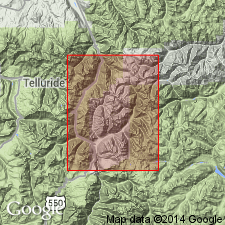
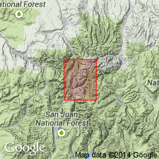
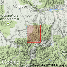
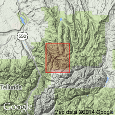
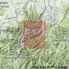
Formerly an abandoned term. Reinstated as Silverton Volcanics but is restricted. Two lower formations--Picayune Andesite and Eureka Rhyolite--formerly included in Silverton Volcanic Group are excluded because they are recognized as Picayune Megabreccia and Eureka Members of regional Sapinero Mesa Tuff. Divided into a completely interfingering sequence, Henson and Burns Members (formerly formations), and pyroxene andesite member. Silverton and its members constitute post-subsidence caldera fill. They are areally restricted to largely intracaldera accumulation. Composed of lava flows of intermediate to silicic composition and related volcaniclastic sediments that accumulated with and adjacent to the San Juan and Uncompahgre calderas after their collapse, but before subsidence of Silverton caldera. Oligocene age. Report area shows units in Ts41 to 44N, Rs4 and 5W, Hinsdale Co, CO in the San Juan Mountain province.
Source: GNU records (USGS DDS-6; Denver GNULEX).
For more information, please contact Nancy Stamm, Geologic Names Committee Secretary.
Asterisk (*) indicates published by U.S. Geological Survey authors.
"No current usage" (†) implies that a name has been abandoned or has fallen into disuse. Former usage and, if known, replacement name given in parentheses ( ).
Slash (/) indicates name conflicts with nomenclatural guidelines (CSN, 1933; ACSN, 1961, 1970; NACSN, 1983, 2005, 2021). May be explained within brackets ([ ]).