- Usage in publication:
-
- Silver Creek hydraulic limestone
- Modifications:
-
- Named
- Dominant lithology:
-
- Limestone
- AAPG geologic province:
-
- Cincinnati arch
Summary:
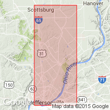
Named Silver Creek hydraulic limestone. Described as a homogeneous, fine-grained, bluish to drab argillaceous magnesian limestone. Thickness range cited is from 0 to 16 ft. Underlain by Jeffersonville limestone; overlain by Sellersburg limestone as restricted from original definition of Kindle (1899).
Source: GNU records (USGS DDS-6; Reston GNULEX).

- Usage in publication:
-
- Silver Creek limestone member
- Modifications:
-
- Revised
- AAPG geologic province:
-
- Cincinnati arch
Summary:
Silver Creek reduced in rank and assigned as lower member of Sellersburg limestone. Consists of thick-bedded, fine-grained, dark-gray, cherty, fossiliferous, low to high magnesian, siliceous, and aluminous limestone. Thickness is 0 to 16 ft. Underlain by Jeffersonville limestone; overlain by Beechwood limestone member of Sellersburg limestone. Age is Middle Devonian.
Source: GNU records (USGS DDS-6; Reston GNULEX).

- Usage in publication:
-
- Silver Creek Member
- Modifications:
-
- Revised
- AAPG geologic province:
-
- Cincinnati arch
Summary:
Designated Silver Creek Member (lower member) of North Vernon Limestone. Silver Creek is assigned as lower member of Sellersburg Limestone across Ohio River in KY (Butts, 1915), but Indiana Geological Survey has discontinued use of Sellersburg in Indiana and uses instead North Vernon Limestone which has precedence.
Source: GNU records (USGS DDS-6; Reston GNULEX).

- Usage in publication:
-
- Silver Creek Member
- Modifications:
-
- Overview
- AAPG geologic province:
-
- Cincinnati arch
Summary:
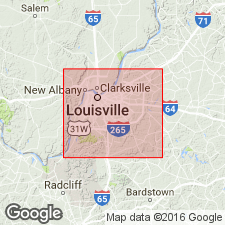
Characteristically, the Silver Creek Member of the North Vernon Limestone (Muscatatuck Group) is gray dense massive argillaceous dolomitic limestone, but in some places chert is present. Where both the Speed and Silver Creek Members are seen in single exposures, the Silver Creek overlies the Speed, but the contact is a transitional one involving gray granular shaly fossiliferous limestone of the Speed type interbedded with rocks of the Silver Creek type. The Silver Creek is about 15 ft thick at the Falls of the Ohio in southern Clark Co., but the Speed is absent. Northward, the Speed appears and thickens as the Silver Creek thins. In southern Scott Co., the Silver Creek is absent and the Speed composes the entire lower North Vernon. Maximum reported thickness of the Silver Creek is 26 ft in central Clark Co. Where the Speed Member is absent, the Silver Creek unconformably overlies the Jeffersonville Limestone. Unit unconformably underlies the Beechwood Member of the North Vernon. Correlates with the lower part of the Traverse Formation of northern IN, a lower part of the Lingle Formation of IL, and a part of the section in southern IN and northwestern OH ranging from the Dundee and Delaware Limestones into the lower part of the Traverse Group. In KY, this unit has been recognized only in the Louisville area (south of the Falls) by Powell (1970) and by Burger and Patton (1970). Conodont studies indicate a Middle Devonian (early Givetian) age.
Source: GNU records (USGS DDS-6; Reston GNULEX).
For more information, please contact Nancy Stamm, Geologic Names Committee Secretary.
Asterisk (*) indicates published by U.S. Geological Survey authors.
"No current usage" (†) implies that a name has been abandoned or has fallen into disuse. Former usage and, if known, replacement name given in parentheses ( ).
Slash (/) indicates name conflicts with nomenclatural guidelines (CSN, 1933; ACSN, 1961, 1970; NACSN, 1983, 2005, 2021). May be explained within brackets ([ ]).

