

- Usage in publication:
-
- Silver Bell formation
- Modifications:
-
- Named
- Dominant lithology:
-
- Andesite
- Porphyry
- AAPG geologic province:
-
- Basin-and-Range province
Summary:
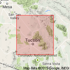
Probably named for Silver Bell mine [location not stated; presumably near town of Silver Bell, northwest of Tucson, Pima Co, AZ, Basin-and-Range province]. No type locality designated. Cross section shows unit to occur at Silver Bell mine and rocks resembling Silver Bell occur in Twin Buttes area to southeast and in Stanley and Winkleman-Christmas areas to northeast; similar rocks also occur to west in Reward mine area. Consists of angular to sub-rounded fragments of dark gray to purplish andesite porphyry enclosed in matrix of gritty andesitic mudstone; diameter of fragments are 1-6 in, but large blocks or boulders several feet in diameter occasionally are present. Thickness ranges up to 200 feet at Silver Bell and 2000 feet at Twin Buttes, Stanley, and Winkleman-Christmas. Unconformably overlies Cretaceous and older sediments; underlies Cat Mountain Rhyolite or equivalents. Unconformable surface represents an important interval of erosion within Laramide Revolution; deposition of Silver Bell marked beginning of a major period of volcanic activity. Assigned Late Cretaceous or early Tertiary age.
Source: GNU records (USGS DDS-6; Denver GNULEX).

- Usage in publication:
-
- Silver Bell Formation*
- Modifications:
-
- Overview
- AAPG geologic province:
-
- Basin-and-Range province
Summary:
Is formation consisting mostly of andesite breccias in Silver Bell Mountains area (Pima Co, AZ) in Basin-and-Range province. Overlies Claflin Ranch Formation (Campanian) of Richard and Courtright (1960). Underlies unnamed "pyroclastics and ignimbrites" that were correlated by Richard and Courtright (1960) with the Cat Mountain Rhyolite of Brown (1939). Is probably generally correlative with Salero Formation in Santa Rita Mountains. Age is shown to be Campanian (Late Cretaceous) on correlation chart (fig. 5).
Source: GNU records (USGS DDS-6; Denver GNULEX).
For more information, please contact Nancy Stamm, Geologic Names Committee Secretary.
Asterisk (*) indicates published by U.S. Geological Survey authors.
"No current usage" (†) implies that a name has been abandoned or has fallen into disuse. Former usage and, if known, replacement name given in parentheses ( ).
Slash (/) indicates name conflicts with nomenclatural guidelines (CSN, 1933; ACSN, 1961, 1970; NACSN, 1983, 2005, 2021). May be explained within brackets ([ ]).