

- Usage in publication:
-
- Shurtz sandstone tongue*
- Modifications:
-
- Named
- Dominant lithology:
-
- Sandstone
- AAPG geologic province:
-
- Great Basin province
Summary:
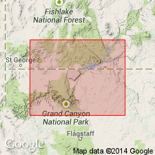
Named as a tongue of the Navajo sandstone of the Glen Canyon group for exposures in Shurtz canyon south of Cedar City, Iron Co, UT in the Great Basin province. Lies between 410 and 720 ft below the base of the Navajo, being separated from the Navajo by the Kayenta formation [supposedly the Cedar City tongue, though not clearly stated]. Overlies lower part of Kayenta. Consists of fine- to medium-grained, moderate-orange sandstone in beds 5 to 10 ft thick. Units 26 and 27 of Thomas and Taylor's (1946) Coal Creek measured section are the Shurtz. Units 21 and 22 of Gregory's (1950) republished Coal Creek measured section are the Shurtz. [These units not described in this report.] Thins southward from 345 ft at Coal Creek to 110 ft at Shurtz Canyon to 62 ft in Muries Creek. These three creeks occur in sequence as listed south of Cedar City. Navajo and Shurtz [inferred] assigned a Jurassic and Jurassic? age. [No stratigraphic figures.]
Source: GNU records (USGS DDS-6; Denver GNULEX).
- Usage in publication:
-
- Shurtz sandstone tongue*
- Modifications:
-
- Overview
- AAPG geologic province:
-
- Great Basin province
Summary:
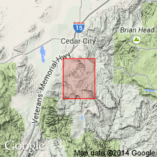
As a tongue of the Navajo sandstone of the Glen Canyon group, forms a prominent ridge in the Cedar City area, Iron Co, UT in the Great Basin province. The sandstone is mapped (geologic map) in the north-central to west-central part of quad above the lower member of the Kayenta and below the Cedar City tongue of the Kayenta. Thins south of Shurtz Canyon. Not observed to join the main body of the Navajo to the north as it is cut off by faulting along the mountain front. Is generally fine to medium grained, moderate red-orange, massive, in beds 2 to 5 ft thick. Middle part is coarser grained than the top or the base. Is even bedded and cross-bedded. Assigned a Jurassic? age.
Source: GNU records (USGS DDS-6; Denver GNULEX).
- Usage in publication:
-
- Shurtz sandstone tongue*
- Modifications:
-
- Age modified
- AAPG geologic province:
-
- Great Basin province
Summary:
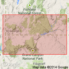
Age of Navajo Sandstone of Glen Canyon Group shown on a stratigraphic diagram as Pliensbachian and Toarcian, or Early Jurassic, rather than as Triassic? and Jurassic as previously assigned. Age modification of Navajo and hence of Shurtz as a tongue of the Navajo based on identification of Early Jurassic palynomorphs in the older Whitmore Point Member of the Moenave Formation. [Age of Shurtz, though name not used in this report, must also be Early Jurassic. Shurtz mapped in the Cedar City area of Iron Co, UT in the Great Basin province.]
Source: GNU records (USGS DDS-6; Denver GNULEX).
For more information, please contact Nancy Stamm, Geologic Names Committee Secretary.
Asterisk (*) indicates published by U.S. Geological Survey authors.
"No current usage" (†) implies that a name has been abandoned or has fallen into disuse. Former usage and, if known, replacement name given in parentheses ( ).
Slash (/) indicates name conflicts with nomenclatural guidelines (CSN, 1933; ACSN, 1961, 1970; NACSN, 1983, 2005, 2021). May be explained within brackets ([ ]).