

- Usage in publication:
-
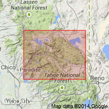
- Shoo Fly beds
- Modifications:
-
- Original reference
- Dominant lithology:
-
- Limestone
- AAPG geologic province:
-
- Sierra Nevada province
Summary:
Pg. 370-394. Shoo Fly beds. Thickness 8,600 feet. Contains a limestone which crops out on Clear Creek, about 2 miles southeast of Shoo Fly Bridge. Probably either Triassic or Carboniferous, with slight presumption in favor of latter.
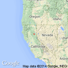
[Named from exposures in road btw. Shoo Fly Bridge and Spanish Creek, Taylorsville region, northern CA.]
Source: US geologic names lexicon (USGS Bull. 896, p. 1990).
- Usage in publication:
-
- Shoo Fly formation*
- Modifications:
-
- Principal reference
- Dominant lithology:
-
- Slate
- Quartzite
- Limestone
- AAPG geologic province:
-
- Sierra Nevada province
Summary:
Pg. 23, pls. 2, 3. Shoo Fly formation of Calaveras group. Mainly clay slates above and quartzite below. The slates are light to dark gray, generally dull but sometimes silky, and in places slightly micaceous and contain occasional films of gray or black flinty material as well as thin beds of sandstone and fine conglomerate of quartz pebbles. Here and there are traces of beds composed exclusively of volcanic fragments, some of which are clearly vesicular. Near middle are limestone lentils, some over 50 feet thick. The quartzites that prevail in upper part are thin-bedded, somewhat slaty, and indistinctly schistose, with micaceous partings. Thickness 6,800+/- feet. Everywhere separated from underlying Arlington formation by Taylor meta-andesite. Is older than Peale formation, but relations not determined. [Age is Mississippian.]
Named from a locality on the stage road between Crescent Mills and Quincy, near the bridge crossing Indian Creek, where the beds are well exposed.
Source: Publication; US geologic names lexicon (USGS Bull. 896, p. 1990).
- Usage in publication:
-
- Calaveras formation*
- Modifications:
-
- Revised
- Areal extent
- AAPG geologic province:
-
- Sierra Nevada province
Summary:
Formations which lie between base and top of Calaveras formation as mapped in Colfax and Downieville folios are regarded as Carboniferous age. Map legend shows Blue Canyon formation, Tightner formation, and Kanaka formation correspond to Calaverous formation of previous reports. [Calaveras group thus is no longer used].
Source: GNU records (USGS DDS-6; Menlo GNULEX).
- Usage in publication:
-
- Shoo Fly Formation*
- Modifications:
-
- Revised
- AAPG geologic province:
-
- Sierra Nevada province
Summary:
Name Shoo Fly is used for rocks of belt more than 100 mi long which includes rocks called Shoo Fly Formation (Diller, 1895, 1908), Calaveras Formation (Turner, 1897, 1898; Turner and Lindgren, 1894; Lindgren, 1896), and Blue Canyon Formation (Lindgren, 1900). Name Blue Canyon is here abandoned. Name Calaveras Formation is restricted from Shoo Fly Formation as herein used. Silurian(?) age suggested for at least part of formation, based on stratigraphic relations.
Source: GNU records (USGS DDS-6; Menlo GNULEX).
- Usage in publication:
-
- Shoo Fly Formation
- Modifications:
-
- Revised
- Age modified
- AAPG geologic province:
-
- Sierra Nevada province
Summary:
Taylorsville Formation (Diller, 1892) is here provisionally lowered to member status within Shoo Fly Formation. Shoo Fly divided into 3 lithic units within upper 10,000 ft of unit in lower Taylorsville thrust plate: lower (5000 ft thick) of interbedded sandstone, middle (2000 ft thick) of laminated slate and phyllite, and graywacke, and upper (3000 ft) of greenstone; below these 3 units, very thick undifferentiated slate, phyllite, chert, tuff, graywacke and greenstone. Shoo Fly Formation in upper Taylorsville thrust plate includes in addition to Taylorsville Member, most of lithic types found in lower plate, dikes, sills, and small plutons. Although no fossils present in lower plate are diagnostic of its age, Taylorsville Member is intercalated with Middle(?) Silurian Montgomery Limestone of Diller (1892). Thus Shoo Fly is at least in part Silurian and probably includes rocks as old as Ordovician.
Source: GNU records (USGS DDS-6; Menlo GNULEX).
- Usage in publication:
-
- Shoo Fly Formation*
- Modifications:
-
- Areal extent
- AAPG geologic province:
-
- Sierra Nevada province
Summary:
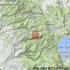
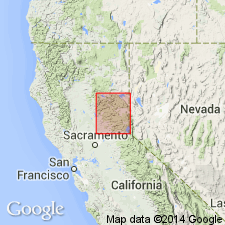
Six lithologies of unit shown on map of Bucks Lake 15' quad and part of Almanor 15' quad, Plumas Co, CA. Recognized only northeast of Melones fault. Detailed petrographic description included. Age shown as Silurian(?).
Source: GNU records (USGS DDS-6; Menlo GNULEX).
- Usage in publication:
-
- Shoo Fly Formation*
- Modifications:
-
- Age modified
- AAPG geologic province:
-
- Sierra Nevada province
Summary:
Shown on geologic map of northwestern Sierra Nevada, CA. Is chiefly feldspathic quartz-rich sandstone shown separately from dark-gray slate lithology and dolomitic limestone lens (which occurs only near Middle Fork of Feather River). Formation is at least 5000 ft and probably more than 10,000 ft thick. Detailed lithologic description included. Is in fault contact with underlying rocks exposed to west. Owing to complex folding, upper contact is pronounced angular unconformity with rocks of late Paleozoic and Triassic(?) age. Age of Shoo Fly is considered Silurian based on McMath's (1966) correlation.
Source: GNU records (USGS DDS-6; Menlo GNULEX).
- Usage in publication:
-
- Shoo Fly Complex*
- Modifications:
-
- Revised
- Age modified
- AAPG geologic province:
-
- Sierra Nevada province
Summary:
Shoo Fly Formation south of "type" locality of Diller (1908) is composed of at least 4 imbricate thrust slices (D'Allura and others, 1977; Schweikert, 1981). Because of its tectonic complexity, Shoo Fly Formation is here revised as Shoo Fly Complex. Shown on geologic sketch maps of part of northern Sierra Nevada and of Big Valley area (Cisco Grove and Duncan Peak 7.5' quads. Also is referred to as 'Shoo Fly Tectonic Complex" in stratigraphic column. Diller's (1908) Montgomery Limestone is believed to be megaclast in melange of Shoo Fly Complex. Its fossils are reinterpreted to be Late Ordovician in age (D'Allura and others, 1977). Shoo Fly is unconformably overlain by Late Devonian Sierra Buttes Formation. Therefore age of Shoo Fly is considered to be Ordovician(?) to Devonian(?).
Source: GNU records (USGS DDS-6; Menlo GNULEX).
- Usage in publication:
-
- Shoo Fly Complex*
- Modifications:
-
- Age modified
- Revised
- AAPG geologic province:
-
- Sierra Nevada province
Summary:
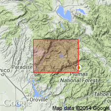
Type locality of Diller (1908) is clarified as stage road between Quincy and Crescent Mills near [Shoo Fly] bridge crossing Indian Creek, NE/4 NE/4 sec.10 T25N R9E, Crescent Mills 7.5' quad [Plumas Co, CA]. Unit mapped to include rocks formerly assigned to Taylorsville Formation and Montgomery Limestone [these rocks herein assigned to the Sierra City melange]. North of 39th Parallel Shoo Fly Complex is divided into following thrust blocks (ascending) Lang sequence, Duncan Peak allochthon, Culbertson Lake allochthon, and Sierra City melange. Lang sequence is locally divided into (ascending); Antoine Canyon Formation, Big Valley Bluff Formation, Barney Cavanah Ridge Formation; and Screwauger Breccia (formations of Harwood and others, in press). Tectonic age given as late Early Silurian to Late Devonian; protolith age is Ordovician(?) to Devonian(?).
Source: GNU records (USGS DDS-6; Menlo GNULEX).
For more information, please contact Nancy Stamm, Geologic Names Committee Secretary.
Asterisk (*) indicates published by U.S. Geological Survey authors.
"No current usage" (†) implies that a name has been abandoned or has fallen into disuse. Former usage and, if known, replacement name given in parentheses ( ).
Slash (/) indicates name conflicts with nomenclatural guidelines (CSN, 1933; ACSN, 1961, 1970; NACSN, 1983, 2005, 2021). May be explained within brackets ([ ]).