The National Geologic Map Database is migrating to a new infrastructure. We apologize for any service disruptions during this process.
|
|---|


- Usage in publication:
-
- Shea diabase
- Shea basalt
- Modifications:
-
- Original reference
- Dominant lithology:
-
- Basalt
- AAPG geologic province:
-
- Southwestern Basin-and-Range region
Summary:
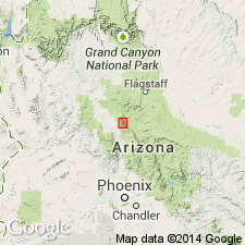
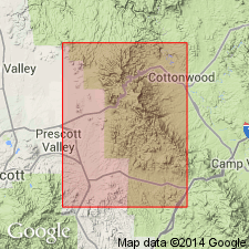
Pg. 58, 61, pl. 8. Shea diabase; Shea basalt. A dark moderately fine-grained dioritic rock in vicinity of Shea Mine [just south of Copper Chief Mine, Cottonwood 7.5-min quadrangle], Jerome district, Yavapai County, central Arizona. Occurs as a vein. Age is pre-Cambrian.
Source: US geologic names lexicon (USGS Bull. 1200, p. 3558); supplemental information from GNU records (USGS DDS-6; Denver GNULEX).
- Usage in publication:
-
- Shea basalt*
- Modifications:
-
- Revised
- Redescribed
- Mapped
- Adopted
- Dominant lithology:
-
- Basalt
- AAPG geologic province:
-
- Southwestern Basin-and-Range region
Summary:
Pg. 12-13, pl. 1. Shea basalt of Ash Creek group. Term Shea diabase modified to Shea basalt. Included in Ash Creek group (new). Composed mostly of lava flows and intercalated tuffaceous beds, and in Black Canyon, many coarse fragmental deposits contain vesicular fragments as much as 6 inches in diameter. Basalt is a dark-green to black rock. Flows commonly contain quartz and chlorite amygdules and, in a few places, pillow lavas. Interbedded tuffaceous sedimentary rocks commonly thin, from 2 to 4 feet thick. In northern exposures, tuffaceous rocks range from 20 to 40 feet in thickness. These sedimentary rocks are dark green to greenish gray. Massive lava from thick flows has diabasic texture. Overall thickness on north side of Black Canyon about 2,000 feet. Underlies Deception rhyolite; overlies Buzzard rhyolite (new). Age is Precambrian (Yavapai).
[Location of Shea Mine shown on geologic map (pl. 1). Shea Basalt of Ash Creek Group adopted by the USGS.]
Source: US geologic names lexicon (USGS Bull. 1200, p. 3558); GNC index card files (USGS-Reston).
For more information, please contact Nancy Stamm, Geologic Names Committee Secretary.
Asterisk (*) indicates published by U.S. Geological Survey authors.
"No current usage" (†) implies that a name has been abandoned or has fallen into disuse. Former usage and, if known, replacement name given in parentheses ( ).
Slash (/) indicates name conflicts with nomenclatural guidelines (CSN, 1933; ACSN, 1961, 1970; NACSN, 1983, 2005, 2021). May be explained within brackets ([ ]).