The National Geologic Map Database is migrating to a new infrastructure. We apologize for any service disruptions during this process.
|
|---|


- Usage in publication:
-
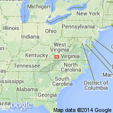
- Shannondale limestone member
- Modifications:
-
- Named
- Dominant lithology:
-
- Limestone
- AAPG geologic province:
-
- Appalachian basin
Summary:
Named the Shannondale limestone member of the Benbolt formation for Shannondale, Tazewell Co., southwestern VA. Consists of coarse-grained limestone and OPIKINA beds. Thickness is 79 feet at type section and reaches a maximum of 125 feet. The Chazyan and Blackriveran was previously divided into 29 zones; the Shannondale represents zones 11 and 12. Unit overlies the Peery limestone member of the Cliffield formation and underlies the Burkes Garden member of the Benbolt formation. The Shannondale limestone member is of Middle Ordovician age.
Source: GNU records (USGS DDS-6; Reston GNULEX).
For more information, please contact Nancy Stamm, Geologic Names Committee Secretary.
Asterisk (*) indicates published by U.S. Geological Survey authors.
"No current usage" (†) implies that a name has been abandoned or has fallen into disuse. Former usage and, if known, replacement name given in parentheses ( ).
Slash (/) indicates name conflicts with nomenclatural guidelines (CSN, 1933; ACSN, 1961, 1970; NACSN, 1983, 2005, 2021). May be explained within brackets ([ ]).