

- Usage in publication:
-
- Sevy dolomite*
- Modifications:
-
- Original reference
- Dominant lithology:
-
- Dolomite
- AAPG geologic province:
-
- Great Basin province
Summary:
Pg. 421-432. Sevy dolomite. Remarkably homogeneous throughout. Typical rock a well-bedded light mouse-gray dolomite in layers 6 to 12 inches thick, which weathers very light gray; extremely dense; breaks with conchoidal fracture; most beds show faint lamination parallel to bedding. The formation contains a few beds of darker dolomite near top and locally beds containing tiny nodules of light-colored chert. Basal bed is conglomeratic. Thickness 450 +/- feet. No diagnostic fossils. Overlies, unconformably, Laketown dolomite, of Silurian age.
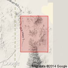
Named from exposures in Sevy Canyon, on west side of Deep Creek Range, Gold Hill district, [Gold Hill quadrangle, Tooele Co.], western UT.
[See also Nolan's USGS Prof. Paper 177, 1935.]
Source: GNU records (USGS DDS-6; Denver GNULEX).
- Usage in publication:
-
- Sevy dolomite*
- Modifications:
-
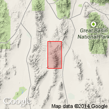
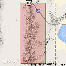
- Areal extent
- AAPG geologic province:
-
- Great Basin province
Summary:
Pg. 8, 29-31, pl. 1. Sevy dolomite. Described in Juab County, Utah, where it is 1,122 feet thick; overlies Thursday dolomite (new) and underlies Simonson dolomite and Guilmette formations, undifferentiated. [Age is Devonian.]
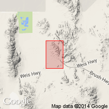
[Measured section: at point 5,540 ft N. 78 deg. W. of the Oversight mine, in T. 12 S., R. 12 W., Juab Co., western UT.]
Source: US geologic names lexicon (USGS Bull. 1200, p. 3537); supplemental information from GNU records (USGS DDS-6; Denver GNULEX).
- Usage in publication:
-
- Sevy Dolomite*
- Modifications:
-
- Age modified
- AAPG geologic province:
-
- Great Basin province
Summary:
Age of the Sevy Dolomite is modified from Early and Middle Devonian --to-- Late Silurian and Early Devonian on the basis of stratigraphic position.
Source: GNU records (USGS DDS-6; Menlo GNULEX).
- Usage in publication:
-
- Sevy Dolomite*
- Modifications:
-
- Age modified
- Revised
- AAPG geologic province:
-
- Great Basin province
Summary:
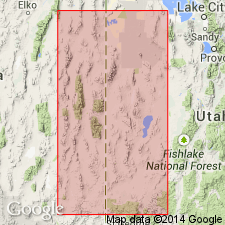
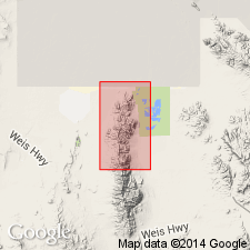
Assigned Early Devonian age in Fish Springs Range, Juab Co, UT, Great Basin province. Age probably based on stratigraphic position. Overlies [unconformably] Middle Silurian Thursday Member (rank reduced) of Laketown Dolomite; underlies Middle Devonian Simonson Dolomite.
Source: GNU records (USGS DDS-6; Denver GNULEX).
- Usage in publication:
-
- Sevy Dolostone*
- Modifications:
-
- [Redefined]
- Dominant lithology:
-
- Dolostone
- AAPG geologic province:
-
- Great Basin province
Summary:
Sevy Dolostone. [Redefined; dolostone is a more appropriate term than dolomite (mineral name).] Is chiefly medium- to light-gray, aphanitic dolostone in beds 3 to 5 feet thick. Weathers light-gray and splits into blocky, angular fragments. A thin bed of fine- to medium-grained quartz sandstone occurs near top. Total thickness about 800 feet. Overlies Laketown Dolostone (Middle and Upper Silurian). Resembles the aphanitic dolostone of overlying Simonson (Middle Devonian). Age is Early and Middle Devonian.
Not separately mapped. Mapped undifferentiated with Simonson Dolostone.
Source: Publication; supplemental information from GNU records (USGS DDS-6; Denver GNULEX).
- Usage in publication:
-
- Sevy Dolostone*
- Modifications:
-
- Age modified
Summary:
Sevy Dolostone. In the northern Grant Range area, east-central Nevada, age modified from Devonian --to-- Late Silurian and Early Devonian.
Source: Modified from GNU records (USGS DDS-6; Menlo GNULEX).
- Usage in publication:
-
- Sevy Dolostone*
- Modifications:
-
- Redescribed
- Dominant lithology:
-
- Dolostone
- AAPG geologic province:
-
- Great Basin province
Summary:
Is redescribed as dolostone. The name "dolostone" is used for rocks composed predominantly of the mineral "dolomite" on Figure 2 and throughout this chapter, although in the literature it has been common practice to use dolomite rather than dolostone in formal names of dolomitic formations and members. Occurs in stratigraphic column for west-central UT (Great Basin province); conformably above unnamed Upper Silurian dolostone; unconformably below Simonson Dolostone (redescribed) (Middle Devonian). In stratigraphic column for east-central NV (Great Basin province); conformably above unnamed Upper Silurian dolostone; unconformably below McColley Canyon Formation (Lower Devonian). Assigned to Lochkovian and Pragian (Lower Devonian).
Source: GNU records (USGS DDS-6; Denver GNULEX).
- Usage in publication:
-
- Sevy Dolomite*
- Modifications:
-
- Age modified
- AAPG geologic province:
-
- Great Basin province
Summary:
Age of the Sevy Dolomite in this area (Silver Zone basin area, Johnson Canyon area) is here revised [from Early Devonian] to: Early and Middle Devonian [based on regional stratigraphic relations].
Source: GNU records (USGS DDS-6; Menlo GNULEX).
For more information, please contact Nancy Stamm, Geologic Names Committee Secretary.
Asterisk (*) indicates published by U.S. Geological Survey authors.
"No current usage" (†) implies that a name has been abandoned or has fallen into disuse. Former usage and, if known, replacement name given in parentheses ( ).
Slash (/) indicates name conflicts with nomenclatural guidelines (CSN, 1933; ACSN, 1961, 1970; NACSN, 1983, 2005, 2021). May be explained within brackets ([ ]).