- Usage in publication:
-
- Seventy-Six Shale Member
- Modifications:
-
- Named
- Dominant lithology:
-
- Shale
- AAPG geologic province:
-
- Ozark uplift
- Illinois basin
Summary:
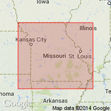
Named as basal member of Bainbridge Formation in southeastern MO and southwestern IL. Named for village of Seventy-Six, Altenburg, MO-IL 7.5-min quad, Perry Co., southeastern MO. Type section is located about 1 mi southwest of Seventy-Six in roadcut on Perry Co Farmmarket Road D, SE1/4NE1/4SW1/4 sec. 29, T25N, R13E, Altenburg, MO-IL 7.5-min quad. Other exposures are at head of drainage in SW1/4SE1/4NW1/4SE1/4 sec. 13, T30N, R13E, Cape Girardeau 7.5-min quad, Cape Girardeau Co., eastern MO; and in bluff east of McClure, IL, near NW1/4NE1/4NW1/4 sec. 12, T14S, R3W, McClure IL-MO 7.5-min quad, Alexander Co., southwestern IL. Appears to be present throughout Silurian outcrop belt in MO, although poorly exposed because of thinness and lithology. Identified in subsurface based on its distinctive electric log signature; has been traced from Cape Girardeau and Perry Cos., MO to Jackson and Hamilton Co., IL. Has been traced to near center of Illinois basin. Consists of green and brick-red, partly fissile, calcareous shale that is extremely glauconitic and contains hematitic "buttons" that may be algal in origin. Thickness ranges from a few inches near McClure, IL, to near 1 ft at type section near Seventy-Six, and up to 2 to 4 ft in subsurface. Overlies Sexton Creek Limestone; underlies limestone beds of Bainbridge Formation. Clearly resembles Price Falls Shale Member of Clarita Formation in Arbuckle Mountain region of southern OK and Craig's (1969) "Button Shale" of upper portion of Cason Shale in vicinity of Batesville, AR. Contains numerous conodont species; comparison with conodonts from Price Falls and "Button Shale" units indicates that all three units fall within NEOSPATHOGNATHODUS CELLONI Zone as all three contained N. Celloni (Walliser). Age is Silurian. Report contains columnar section, cross section, electric logs, and fossil list.
Source: GNU records (USGS DDS-6; Reston GNULEX).

- Usage in publication:
-
- Seventy-Six Shale Member*
- Modifications:
-
- Overview
- AAPG geologic province:
-
- Upper Mississippi embayment
- Illinois basin
Summary:
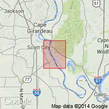
Seventy-Six Shale Member of Bainbridge Formation not noted during mapping but possibly is present. One to two inches of glauconitic shale was measured by Thompson (1993) beneath St. Clair Limestone member just north of Thebes quad in McClure quad. Included in undivided Bainbridge Formation with St. Clair Limestone Member and Moccasin Springs Member. Author follows usage of Thompson (1993) for MO and IL. Age is Silurian (Niagaran).
Source: GNU records (USGS DDS-6; Reston GNULEX).
For more information, please contact Nancy Stamm, Geologic Names Committee Secretary.
Asterisk (*) indicates published by U.S. Geological Survey authors.
"No current usage" (†) implies that a name has been abandoned or has fallen into disuse. Former usage and, if known, replacement name given in parentheses ( ).
Slash (/) indicates name conflicts with nomenclatural guidelines (CSN, 1933; ACSN, 1961, 1970; NACSN, 1983, 2005, 2021). May be explained within brackets ([ ]).

