- Usage in publication:
-
- Setters Ridge quartz schist
- Setters Ridge quartzite
- Modifications:
-
- Original reference
- Dominant lithology:
-
- Schist
- Quartzite
- AAPG geologic province:
-
- Piedmont-Blue Ridge province
Summary:
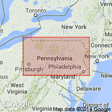
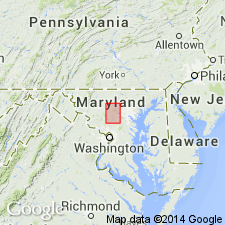
Pg. 130-132. Setters Ridge quartz schist or quartzite. Extensively quarried north of Baltimore, Maryland, and affording at many other places a definite geological horizon. Always perfectly foliated by parallel muscovite-mica layers, at variable distances from each other, with plenty of stretched and broken tourmaline crystals in the foliation planes. [Age is pre-Cambrian (Glenarm).]
Source: US geologic names lexicon (USGS Bull. 896, p. 1958).
- Usage in publication:
-
- Setters quartz schist
- Modifications:
-
- Revised
- AAPG geologic province:
-
- Piedmont-Blue Ridge province
Summary:
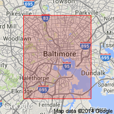
(USGS map of Baltimore and vicinity, to accompany "Guide to Baltimore," prepared for Baltimore meeting Amer. Inst. Mining Engineers Feb. 1892). Setters quartz schist. A peculiar schist composed mostly of quartz and divided into beds of varying thickness by parallel layers of muscovite. Underlies Cockeysville marble and overlies Baltimore hornblende gneiss. Most characteristic occurrence is in Setter's Ridge. [Age is pre-Cambrian (Glenarm).]
Source: US geologic names lexicon (USGS Bull. 896, p. 1958).
- Usage in publication:
-
- Setters quartzite
- Modifications:
-
- Areal extent
- AAPG geologic province:
-
- Piedmont-Blue Ridge province
Clark, W.B., 1904, Harford County atlas [Maryland]: Maryland Geological Survey County Report
Summary:
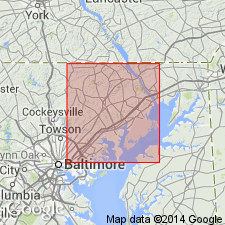
Gave thickness of Setters quartzite as 750 feet.
Source: US geologic names lexicon (USGS Bull. 896, p. 1958).
- Usage in publication:
-
- Setters Formation
- Modifications:
-
- Revised
- AAPG geologic province:
-
- Piedmont-Blue Ridge province
Summary:
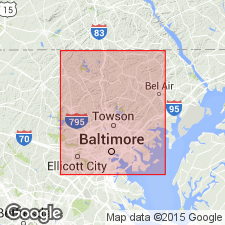
Glenarm raised in rank to Supergroup. Includes Setters Formation, Cockeysville Marble, and Wissahickon Group. Author recognizes a six-fold subdivision of the Setters in this report composed of three unnamed members and three lenses. The entire sequence is not present at any one locality and therefore type localities are designated for each unit. These members (ascending) are referred to as the quartzite member, which includes the conglomerate lens and the schist lens; the gneiss member, which includes the quartzite lens; and the garnet schist member. Thickness of the Setters varies from 0 to 500 m. Each member and lens is well described. Age of the Setters is Cambrian and Ordovician(?).
Source: GNU records (USGS DDS-6; Reston GNULEX).
- Usage in publication:
-
- Setters Formation*
- Modifications:
-
- Revised
- AAPG geologic province:
-
- Piedmont-Blue Ridge province
Summary:
Following Drake (1986, Geological Society of America, Abstracts with Programs, v. 17, no. 7, p. 566), Glenarm Group consists of Setters Formation, Cockeysville Marble, and Loch Raven Schist. The Oella Formation is part of an overlying thrust stack and not part of the Glenarm. Glenarm Group was deposited over Baltimore Gneiss.
Source: GNU records (USGS DDS-6; Reston GNULEX).
- Usage in publication:
-
- Setters Formation*
- Modifications:
-
- Age modified
- AAPG geologic province:
-
- Piedmont-Blue Ridge province
Summary:
Following the usage of Crowley (1976, The geology of the crystalline rocks near Baltimore and its bearing on the evolution of the eastern Maryland Piedmont: Maryland Geological Survey Report of Investigations 27, 38 p.), the age of the Setters Formation is changed to Cambrian and Ordovician(?).
Source: GNU records (USGS DDS-6; Reston GNULEX).
- Usage in publication:
-
- Setters Formation
- Modifications:
-
- Revised
- AAPG geologic province:
-
- Piedmont-Blue Ridge province
Summary:
Use of terms Wissahickon Group and Glenarm Supergroup discontinued in MD. Baltimore terrane cover sequence is described using individual formation names. Setters Formation unconformably overlies the Baltimore Gneiss; conformably(?) underlies the Cockeysville Marble.
Source: GNU records (USGS DDS-6; Reston GNULEX).
- Usage in publication:
-
- Setters Formation
- Modifications:
-
- Overview
- AAPG geologic province:
-
- Piedmont-Blue Ridge province
Summary:
Detailed analysis of field relations at five locations near Doe Run reveal that Wissahickon Group consistently lies above, and with angular contact upon, an overturned stratigraphic sequence of Grenville-aged gneiss above Late Proterozoic to early Paleozoic Setters Formation and Cockeysville Marble, all three assigned here to the Brandywine terrane. Evidence supports the theory that the Wissahickon Group was emplaced after peak metamorphism. Identification of the Doe Run thrust fault at the base of the Wissahickon contradicts the previous assumption of stratigraphic continuity throughout the Glenarm Supergroup of southeastern PA and DE.
Source: GNU records (USGS DDS-6; Reston GNULEX).
- Usage in publication:
-
- Setters Formation*
- Modifications:
-
- Revised
- AAPG geologic province:
-
- Piedmont-Blue Ridge province
Summary:
Loch Raven Schist is here removed from Glenarm Group because current work shows that Loch Raven Schist is thrust over either Cockeysville Marble, Setters Formation, Baltimore Gneiss, or Laurel Formation. The Glenarm sequence consisting of schist of the Setters, quartzite of the Setters, and Cockeysville Marble is exactly the same as that of Pine Mountain Group in AL, which consists of Hollis Quartzite, Manchester Schist, and Chewacla Marble (Higgins and others, 1988), the cover sequence on Laurentian basement in Pine Mountain window.
Source: GNU records (USGS DDS-6; Reston GNULEX).
- Usage in publication:
-
- Setters Formation
- Modifications:
-
- Reference
- Dominant lithology:
-
- Metasediments
- AAPG geologic province:
-
- Piedmont-Blue Ridge province
Summary:
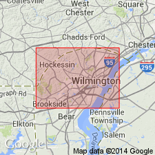
Pg. 4-6, 33, 34; W.S. Schenck and others, 2000, Delaware Geol. Survey, Geol. Map. Ser., no. 10, scale 1:36,000. Setters Formation of Glenarm Group. A metasedimentary unit of quartzite and feldspathic quartz-mica schist and gneiss. In Delaware (New Castle County), is predominantly an impure quartzite and garnet-sillimanite-biotite-microcline schist. Major minerals include microcline, quartz, and biotite with minor plagioclase, and garnet. Mucscovite and sillimanite vary with metamorphic grade. Accessory minerals are iron-titanium oxides, zircon, sphene, and apatite. Is basal formation of Glenarm Group. Overlies Baltimore Gneiss. Underlies Cockeysville Marble of Glenarm Group. Lithologically similar to Wissahickon Formation; the feldspars serve to distinguish it (microcline-rich) from the Wissahickon (plagioclase-rich). Quarried and sold as "Avondale Stone." Age is considered early Paleozoic (Cambrian-Ordovician).
Reference sections: (1) community of Avondale, Chester County, Pennsylvania (locality Ba14-a), where Setters is composed of interlayered quartzites and micaceous schists that commonly contain tourmaline crystals and very large garnets (up to 2 inches), and in (2) Eastburn's quarry, New Castle County, Delaware (locality Cb12-a), where Setters is a quartzite that may contain small garnets.
See also M.O. Plank and W.S. Schenck, 1997, Delaware Geol. Survey Rpt. Inv., no. 56, 16 p. (Setters Formation), and K.D. Woodruff and M.O. Plank, 1995, Delaware Geol. Survey Bull., no. 19, p. 1-25, 1 pl. (Cockeysville Formation).
Source: Publication.
For more information, please contact Nancy Stamm, Geologic Names Committee Secretary.
Asterisk (*) indicates published by U.S. Geological Survey authors.
"No current usage" (†) implies that a name has been abandoned or has fallen into disuse. Former usage and, if known, replacement name given in parentheses ( ).
Slash (/) indicates name conflicts with nomenclatural guidelines (CSN, 1933; ACSN, 1961, 1970; NACSN, 1983, 2005, 2021). May be explained within brackets ([ ]).

