- Usage in publication:
-
- Screven Member
- Modifications:
-
- Named
- Dominant lithology:
-
- Sand
- Clay
- AAPG geologic province:
-
- South GA-North FL sedimentary province
Summary:
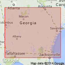
Screven Member, a channel-fill deposit in the upper part of the Altamaha Formation, is here named in southeastern GA. Name was first used informally as Screven formation by Huddlestun (1981). Unit is described as prominently cross-bedded, variably micaceous and feldspathic, argillaceous, pebbly to gravelly sands with clay clasts, and scattered lenses of clay. The member is restricted to the region south of the Altamaha and Ocmulgee Rivers in GA. North of this region, Screven lithologies are erratic, discontinuous, and unmappable, and therefore are referred to as Screven lithofacies. These lithofacies are scattered throughout the formation, in places occurring at the base. Southern limit follows an east-west line from Ware Co. to southern Berrien Co. Grades laterally eastward into undivided Altamaha or the upper part of the Coosawhatchie Formation; grades southward into the upper part of the Statenville Formation (new name). Typically disconformably overlies undifferentiated flood plain deposits of the Altamaha. Member generally lies at the top of the geologic section, but locally disconformably underlies the upper Pliocene Cypresshead Formation. Unit averages less than 50 ft; 24 ft (7 m) exposed at type section; maximum known thickness of 78 ft (24 m) occurs at reference locality. Best estimate of age is early Miocene (Aquitanian) based on correlation and stratigraphic position.
Source: GNU records (USGS DDS-6; Reston GNULEX).
For more information, please contact Nancy Stamm, Geologic Names Committee Secretary.
Asterisk (*) indicates published by U.S. Geological Survey authors.
"No current usage" (†) implies that a name has been abandoned or has fallen into disuse. Former usage and, if known, replacement name given in parentheses ( ).
Slash (/) indicates name conflicts with nomenclatural guidelines (CSN, 1933; ACSN, 1961, 1970; NACSN, 1983, 2005, 2021). May be explained within brackets ([ ]).

