- Usage in publication:
-
- Scott shale*
- Modifications:
-
- Original reference
- Dominant lithology:
-
- Shale
- Sandstone
- Coal
- AAPG geologic province:
-
- Appalachian basin
Summary:
Scott shale [of Pottsville Group]. Mainly argillaceous and sandy shales, but includes many beds of shaly sandstone, a few massive sandstones, and five or six coal seams, all very similar to those of Wartburg sandstone. Contains more shale than sandstone, and sandstones are thinner than in the Wartburg. Thickness is 450 to 600 feet. Overlies Wartburg sandstone and underlies Anderson sandstone. [Age is Pennsylvanian.]
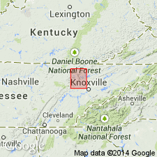
Named from its frequent occurrence in Scott Co., eastern TN.
Source: GNU records (USGS DDS-6; Reston GNULEX).

- Usage in publication:
-
- Scott Formation†
- Modifications:
-
- Abandoned
- AAPG geologic province:
-
- Appalachian basin
Summary:
Scott Formation or Shale of TN abandoned herein. Previously included strata from top of Pioneer Sandstone Member of Jellico Formation (also abandoned herein) to base of Pilot Knob Sandstone Member (now known as Pilot Mountain Sandstone Member of Indian Bluff Formation), including Petree, Pewee, "Walnut Mountain," Red Ash, Beech Grove, Big Mary, Windrock, Upper Pioneer, Lower Pioneer, and Jordan coals. Strata now assigned to Graves Gap Formation, Redoak Mountain Formation, and lower part of Vowell Mountain Formation in TN.
Source: GNU records (USGS DDS-6; Reston GNULEX).
For more information, please contact Nancy Stamm, Geologic Names Committee Secretary.
Asterisk (*) indicates published by U.S. Geological Survey authors.
"No current usage" (†) implies that a name has been abandoned or has fallen into disuse. Former usage and, if known, replacement name given in parentheses ( ).
Slash (/) indicates name conflicts with nomenclatural guidelines (CSN, 1933; ACSN, 1961, 1970; NACSN, 1983, 2005, 2021). May be explained within brackets ([ ]).

