

- Usage in publication:
-
- "Schoolhouse sand"
- Modifications:
-
- Original reference
- Dominant lithology:
-
- Sandstone
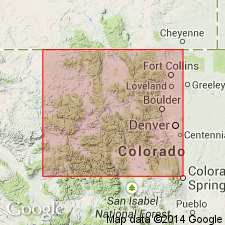
- AAPG geologic province:
-
- Green River basin
- Eagle basin
Summary:
Pg. 72. "Schoolhouse sand" in so-called Weber sand. The so-called Weber sand of Rangely oil field thins eastward gradually and disappears among red sediments on west slope of Gore Range, about 10 miles east of Eagle, Colorado. This sandstone is referred to as "Schoolhouse sand" because of an excellent typical outcrop near a schoolhouse east of Meeker, [Rio Blanco County], Colorado. In certain sections, its lithologic character is remarkably similar to that of Lyons sandstone of eastern Front Range, and its position below thin platy limestones that are almost identical to "Crinkled limestone" [Forelle limestone] of the Front Range, suggest it is approximately = Lyons sandstone. If this correlation is accepted, the "Schoolhouse" becomes upper Weber (probably Coconino). Age is probably [Early] Permian, approximately = Leonard formation of West Texas, [based on stratigraphic relations].
Source: Publication; US geologic names lexicon (USGS Bull. 1200, p. 3496-3497).
- Usage in publication:
-
- Schoolhouse tongue
- Modifications:
-
- Revised
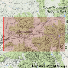
- AAPG geologic province:
-
- Piceance basin
- Eagle basin
Summary:
Schoolhouse tongue of Weber sandstone. "Schoolhouse sand" of Thompson (1949) is renamed. On west side of McCoy area, 59 feet thick and lies between McCoy and State Bridge formation. Thickness 79 feet at South Canyon, near Glenwood Springs; 46 feet, 4 miles north of Eagle ; 27 feet, 10 miles east of Eagle. [Age is Early Permian (Leonardian).]
Source: Publication; US geologic names lexicon (USGS Bull. 1200, p. 3496-3497).
- Usage in publication:
-
- Schoolhouse Tongue
- Modifications:
-
- Areal extent
- AAPG geologic province:
-
- Eagle basin
Summary:
Interfingers and overlies the Maroon Formation at the northwest part of report area. Is as much as 66 m thick in the Eagle basin. Does not occur in the Aspen sub-basin of the Colorado trough. Consists of very fine to fine grained sandstone of eolian origin. Can be distinguished from the Maroon units by its white to gray color and oil staining. Correlation chart. The unconformity between the Maroon and State Bridge has a local angularity of as much as 60 deg and may represent a significant hiatus. The tongue is probably Early Permian, but it could be as old as Pennsylvanian.
Source: GNU records (USGS DDS-6; Denver GNULEX).
- Usage in publication:
-
- Schoolhouse Member*
- Modifications:
-
- Revised
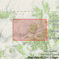
- Areal extent
- AAPG geologic province:
-
- Eagle basin
- Piceance basin
Summary:
Schoolhouse is not a tongue of Weber Sandstone extending eastward into Eagle basin. Only in its northernmost outcrops does it represent a transition from Weber sand sea to Maroon alluvial plain. Primary physical properties (grain size, porosity, permeability) of Maroon and Schoolhouse are alike. Schoolhouse consists of plane-bedded, low-angle bedded, and cross-bedded, fine-grained sandstone of inferred eolian sand-sheet origin with common fluvial interbeds. Member ranges from 0--pinchout well exposed 3 km west of Eagle River section in Eagle Co where yellow-gray beds of Schoolhouse pass laterally into redbeds of Maroon--to 216+ ft at Fawn Creek and at East Rifle Creek. Extends into Piceance basin, although its western limit is uncertain lying somewhere between Thornburg, Wilson Creek, and Meeker on west, and outcrops of Schoolhouse, on Ripple, Fawn, and Miller Creeks to east. Lower contact of Schoolhouse with Maroon redbeds gradational. Its distinction from Maroon is result of its diagenetic history. Acid reducing basinal fluid inferred to have dissolved carbonate cement and hematitic grain coatings and to have bleached sandstone. Schoolhouse thus removed from Weber and reassigned to Maroon Formation as its upper member. Age of Schoolhouse is Early Permian. No diagnostic fossils. Maroon (and Schoolhouse) correlate with Weber of Uinta Mountains and northwest CO. Isopach map; measured sections; stratigraphic chart.
Source: GNU records (USGS DDS-6; Denver GNULEX).
For more information, please contact Nancy Stamm, Geologic Names Committee Secretary.
Asterisk (*) indicates published by U.S. Geological Survey authors.
"No current usage" (†) implies that a name has been abandoned or has fallen into disuse. Former usage and, if known, replacement name given in parentheses ( ).
Slash (/) indicates name conflicts with nomenclatural guidelines (CSN, 1933; ACSN, 1961, 1970; NACSN, 1983, 2005, 2021). May be explained within brackets ([ ]).