

- Usage in publication:
-
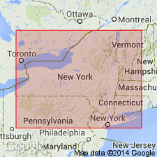
- Schoharie layers
- Modifications:
-
- First used
- AAPG geologic province:
-
- Appalachian basin
Summary:
First used Schoharie layers in eastern NY for abundantly fossiliferous rocks that overlie the argillaceous FUCOIDES CAUDAGALLI (Esopus grit) and underlie the Onondaga limestone.
Source: GNU records (USGS DDS-6; Reston GNULEX).

- Usage in publication:
-
- Schoharie grit
- Modifications:
-
- Named
- Dominant lithology:
-
- Grit
- Sandstone
- AAPG geologic province:
-
- Appalachian basin
Summary:
Named the Schoharie grit for Schoharie, Schoharie Co., eastern NY. Consists of calcareous fine-grained sandstone that is readily recognized by peculiar mineral characters and fossils. Overlies the CAUDA-GALLI grit (Esopus grit) and underlies the Onondaga limestone. The Schoharie is of Middle Devonian age.
Source: GNU records (USGS DDS-6; Reston GNULEX).
- Usage in publication:
-
- Schoharie grit
- Modifications:
-
- Age modified
- Biostratigraphic dating
- AAPG geologic province:
-
- Appalachian basin
Summary:
The age of the Schoharie grit is changed to Early and Middle Devonian (Onesquethawan) in chart 4 based on fossils.
Source: GNU records (USGS DDS-6; Reston GNULEX).
- Usage in publication:
-
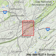
- Schoharie Formation*
- Modifications:
-
- Overview
- AAPG geologic province:
-
- Appalachian basin
Summary:
The Schoharie Formation in eastern PA consists of medium-gray to grayish-black, massive and laminated, evenly bedded, calcareous siltstone and lesser fine-grained sandy siltstone with irregular nodules and lenses of dark-gray chert that becomes more abundant near the top of the formation. Also contains brachiopods and burrow mottling. Thickness is 103 feet at east end of quadrangle. Overlies the Esopus Formation and underlies the Buttermilk Falls Limestone. The Schoharie is of Early Devonian age.
Source: GNU records (USGS DDS-6; Reston GNULEX).

- Usage in publication:
-
- Schoharie Formation
- Modifications:
-
- Revised
- AAPG geologic province:
-
- Appalachian basin
Summary:
Revised the Schoharie Formation in NY to be included in the Tristates Group.
Source: GNU records (USGS DDS-6; Reston GNULEX).
- Usage in publication:
-
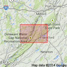
- Schoharie Formation
- Modifications:
-
- Overview
- AAPG geologic province:
-
- Appalachian basin
Summary:
Schoharie Formation mapped in northwestern NJ. Unit is medium- to thick-bedded, silty to shaly, locally dolomitic limestone containing local thin ribs or pods of black chert. Weathers yellowish-gray to locally pale-olive. Grades downward into medium- to dark-gray calcareous siltstone at base. Bioturbated. Thickness approximately 175 ft. Gradational lower contact with Esopus Formation is at the first massive siltstone. Age is Early Devonian.
Source: GNU records (USGS DDS-6; Reston GNULEX).
For more information, please contact Nancy Stamm, Geologic Names Committee Secretary.
Asterisk (*) indicates published by U.S. Geological Survey authors.
"No current usage" (†) implies that a name has been abandoned or has fallen into disuse. Former usage and, if known, replacement name given in parentheses ( ).
Slash (/) indicates name conflicts with nomenclatural guidelines (CSN, 1933; ACSN, 1961, 1970; NACSN, 1983, 2005, 2021). May be explained within brackets ([ ]).