The National Geologic Map Database is migrating to a new infrastructure. We apologize for any service disruptions during this process.
|
|---|


- Usage in publication:
-
- Sawdust Landing Member
- Modifications:
-
- Named
- Dominant lithology:
-
- Sand
- Silt
- Clay
- AAPG geologic province:
-
- Atlantic Coast basin
Summary:
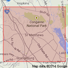
Named as member of Rhems Formation of Black Mingo Group. Named for Sawdust Landing (also known as Trezevant's Landing) on Santee River, Calhoun Co., central SC. Consists of grayish-white, less commonly gray-green or light-blue, medium- to coarse-grained, arkosic and subarkosic sands interbedded with thin silts or sandy clays. Thin clay beds found sporadically throughout unit. Thickness approx. 40 ft (from figure 5). Underlies Lang Syne Member (formally named) of Rhems; underlying formation [probably Peedee Formation] not stated. Text implies that it is updip correlative of Browns Ferry Member of Rhems. Age is Paleocene. Report includes stratigraphic sections.
Source: GNU records (USGS DDS-6; Reston GNULEX).
- Usage in publication:
-
- Sawdust Landing Formation
- Modifications:
-
- Revised
- Overview
- Areal extent
- AAPG geologic province:
-
- Atlantic Coast basin
Summary:
Sawdust Landing Member of the Rhems Formation is here raised in rank to Sawdust Landing Formation of the Black Mingo Group. Authors state formation status is justified because of unit's distinct lithology, great thickness, and wide distribution. Unit consists predominantly of white or cream to light-gray clay, feldspathic, micaceous, clayey, quartzose sand. Quartz granules and pebbles common. Abundant angular feldspar characteristic. Formation is well exposed in central SC along the Congaree and Wateree Rivers. Disappears below the surface downdip just northwest of the toe of the Orangeburg scarp. Updip, extends to town of Red Hill, Lee Co., to the north of Eastover, Richland Co., and to Edmund, Lexington Co. Thickness varies from 15 m in northwestern Calhoun Co. to 21 m along the Wateree River in western Sumter Co. Unconformably overlies Cretaceous Peedee Formation and unconformably underlies upper Paleocene Lang Syne Formation (rank raised). Correlates with Rhems Formation. Danian age based on stratigraphic position.
Source: GNU records (USGS DDS-6; Reston GNULEX).
- Usage in publication:
-
- Sawdust Landing Formation
- Modifications:
-
- Overview
- AAPG geologic province:
-
- Atlantic Coast basin
Summary:
In some wells in the northwestern part of the study area, Sawdust Landing Formation consists of yellow, orange, tan, moderately to poorly sorted, micaceous quartz sands. In other wells it is composed of gray, poorly and moderately sorted, micaceous, silty and clayey quartz sands and pebbly sands with interbedded gray clays. Thickness ranges from about 10 ft near the northwestern boundary of the Site to about 40 ft near the southeastern boundary. Appears to be the lower part of the "Ellenton Formation" of Siple (1967) or the Ellenton Member of Steele (1985), the Black Mingo Formation of Oldham (1981), or the "Rhems Formation" of McClelland (1987). Authors believe name "Ellenton" should be abandoned because unit as originally defined consists of two different sedimentary sequences with different lithologies, deposited during separate cycles of deposition. Term Rhems is not used because the lithology of the unit more closely resembles that of the Sawdust Landing at its type locality. Unconformably overlies Steel Creek Formation (new); underlies Lang Syne Formation. Age is early Paleocene (Midwayan). Correlates with Clayton and Porters Creek Formations of the Gulf Coastal Plain. Palynological dates indicate assignment of NP 3 to 4 or older.
Source: GNU records (USGS DDS-6; Reston GNULEX).
For more information, please contact Nancy Stamm, Geologic Names Committee Secretary.
Asterisk (*) indicates published by U.S. Geological Survey authors.
"No current usage" (†) implies that a name has been abandoned or has fallen into disuse. Former usage and, if known, replacement name given in parentheses ( ).
Slash (/) indicates name conflicts with nomenclatural guidelines (CSN, 1933; ACSN, 1961, 1970; NACSN, 1983, 2005, 2021). May be explained within brackets ([ ]).