The National Geologic Map Database is migrating to a new infrastructure. We apologize for any service disruptions during this process.
|
|---|


- Usage in publication:
-
- Saverton Shale
- Modifications:
-
- Overview
- AAPG geologic province:
-
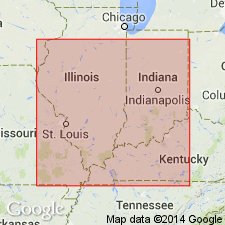
- Illinois basin
Summary:
In the outcrop area, the Saverton is a bluish- to greenish-gray silty shale that contains thin sandstone beds and carbonate beds. Extended to IL by Cluff and others (1981) who recognized lower and upper parts of the unit in the subsurface. In parts of western IL, unit is overlain by Louisiana Limestone or the Horton Creek Formation. Where these formations are absent, it is impossible to differentiate the Saverton from the overlying Hannibal Shale. In western and central IL, the Saverton is recognized as a distinct formation. In the northernmost part of this area, the Saverton reaches 120 ft in thickness. Everywhere conformably overlies the Grassy Creek Shale. In west-central IL, underlies the Horton Creek Formation. Conodonts indicate an age of Late Devonian. The basal part of the Saverton becomes younger to the south and east.
Source: GNU records (USGS DDS-6; Reston GNULEX).
For more information, please contact Nancy Stamm, Geologic Names Committee Secretary.
Asterisk (*) indicates published by U.S. Geological Survey authors.
"No current usage" (†) implies that a name has been abandoned or has fallen into disuse. Former usage and, if known, replacement name given in parentheses ( ).
Slash (/) indicates name conflicts with nomenclatural guidelines (CSN, 1933; ACSN, 1961, 1970; NACSN, 1983, 2005, 2021). May be explained within brackets ([ ]).