- Usage in publication:
-
- Santa Margarita formation*
- Modifications:
-
- Named
- Dominant lithology:
-
- Conglomerate
- Sandstone
- AAPG geologic province:
-
- California Coast Ranges province
Summary:
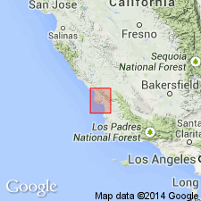
Santa Margarita formation named from town in San Luis Obispo Co, CA. Occurs along central and western portion of Salinas Valley extending many mi northwest of San Luis 30' quad. Consists of conglomerates and coarse sandstone with bed of white and chalky diatomaceous earth over 50 ft thick and associated fine volcanic ash or pumice. Total thickness is about 1500 ft below town of Santa Margarita. Unconformably overlies Monterey shale; unconformably underlies Paso Robles formation and Pleistocene alluvium. Contains OSTREA TITAN (oyster) in beds over 30 ft thick. Age on map legend is Miocene(?) (San Pablo [equivalent]). Considered contemporaneous with Pismo formation (new) to the south.
Source: GNU records (USGS DDS-6; Menlo GNULEX).
- Usage in publication:
-
- Santa Margarita formation*
- Modifications:
-
- Revised
- Areal extent
- AAPG geologic province:
-
- Transverse Ranges province
Summary:
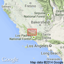
In Cuyama Valley Santa Margarita formation is subdivided into: Redrock Canyon sandstone, Whiterock Bluff shale, and Morales members (all new). Apparently (though locally unconformably) conformably overlies Monterey group; unconformably underlies Cuyama formation (new). Map legend gives age as Miocene.
Source: GNU records (USGS DDS-6; Menlo GNULEX).
- Usage in publication:
-
- Santa Margarita formation*
- Modifications:
-
- Revised
- Age modified
- AAPG geologic province:
-
- Transverse Ranges province
Summary:
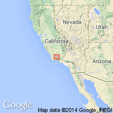
Whiterock Bluff shale member of Santa Margarita formation of English (1916) is herein designated as upper member of Monterey formation. Morales member of Santa Margarita formation of English (1916) is herein removed from Santa Margarita and raised in rank to Morales formation since the two units are so unlike and are separated by an unconformity of regional extent. In Morales Canyon, Santa Margarita sandstone is about 1000 ft thick and consists of fine- to coarse-grained granitic white sandstone in gradational contact with underlying Monterey formation. Is assigned to late Miocene (Mohnian and/or Delmontian) based on megafossils.
Source: GNU records (USGS DDS-6; Menlo GNULEX).
- Usage in publication:
-
- Santa Margarita formation
- Modifications:
-
- Revised
- Biostratigraphic dating
- AAPG geologic province:
-
- California Coast Ranges province
Summary:
Type section designated along Santa Margarita Creek, approximately 10 mi to north of Phoenix-Saucelito area [San Luis Obispo 15' quad, San Luis Obispo Co, CA]. In Phoenix-Saucelito area Santa Margarita formation is nearly 6000 ft thick and is subdivided into (oldest to youngest); Huasna, Phoenix, and Saucelito members. Age is late Miocene and early Pliocene (late Mohnian to late Delmontian microfaunal Stages). List of megafossils included. Upper part of Saucelito member is considered to be early Pliocene. Composite columnar section and geologic map included.
Source: GNU records (USGS DDS-6; Menlo GNULEX).
- Usage in publication:
-
- Santa Margarita Formation*
- Modifications:
-
- Areal extent
- AAPG geologic province:
-
- California Coast Ranges province
Summary:
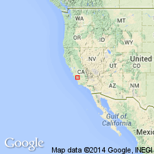
Rocks of Santa Margarita Formation in northern part of Salinas Valley are now assigned to Pancho Rico Formation (new). Santa Margarita Formation is considered appropriate in Salinas Valley only in its type area near town of Santa Margarita and in adjacent areas where beds are similar to typical Santa Margarita in lithologic character and stratigraphic position. In southern part of Salinas Valley Santa Margarita overlies Monterey Shale; further north it intertongues with uppermost part of Monterey. Where Pancho Rico overlies Santa Margarita its lower contact is at top of stratigraphically highest bed that contains OSTREA TITAN (giant oyster characteristic of Santa Margarita).
Source: GNU records (USGS DDS-6; Menlo GNULEX).
- Usage in publication:
-
- Santa Margarita Formation*
- Modifications:
-
- Areal extent
- AAPG geologic province:
-
- Mojave basin
Summary:
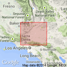
Marine and brackish-water sedimentary beds referred by Wiese (1950) and Crowell (1952) to Santa Margarita Formation are here renamed Quail Lake Formation (new) located at west end of Antelope Valley (western Mojave Desert).
Source: GNU records (USGS DDS-6; Menlo GNULEX).
- Usage in publication:
-
- Santa Margarita Formation*
- Modifications:
-
- Areal extent
- Revised
- AAPG geologic province:
-
- California Coast Ranges province
Summary:
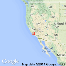
White rock Bluff Shale Member of Santa Margarita Formation of English (1916) is revised as Whiterock Bluff Shale Member of Monterey Shale as defined by Hill and others (1958). Throughout much of region southwest of San Andreas fault, Santa Margarita Formation overlies Monterey Shale where it is about 1500 ft thick and composed mainly of white friable sandstone. In southeastern part of Temblor Range Santa Margarita Formation as referred to by Simonson and Krueger (1942) is 2500 ft thick and includes lenses of breccia and sandstone that intertongue with Belridge Diatomite Member of Monterey Shale.
Source: GNU records (USGS DDS-6; Menlo GNULEX).
- Usage in publication:
-
- Santa Margarita Sandstone*
- Modifications:
-
- Areal extent
- Redescribed
- AAPG geologic province:
-
- California Coast Ranges province
Summary:
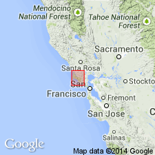
[Santa Margarita Formation referred to as Santa Margarita Sandstone]. Is extended from Santa Cruz Mountains into Point Reyes area [Marin Co] along San Gregorio fault on basis of lithologic and fauna similarities. In Point Reyes area, rocks of Santa Margarita were called the basal sandstone unit of the Drakes Bay Formation by Galloway (1977). Consists of glauconitic sandstone, locally with basal conglomerate. Age is late Miocene based on stratigraphic relations with unconformably underlying Monterey Formation and conformably overlying Santa Cruz Mudstone.
Source: GNU records (USGS DDS-6; Menlo GNULEX).
- Usage in publication:
-
- Santa Margarita Formation*
- Modifications:
-
- Areal extent
- AAPG geologic province:
-
- California Coast Ranges province
Summary:
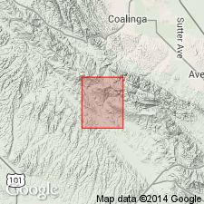
In Parkfield area, Santa Margarita Formation has lower part consisting of conglomerate and conglomeratic sandstone and an upper part of light-colored, well-sorted, fossiliferous sandstone. Sandstone of upper part overlaps west edge of volcanic rocks of Lang Canyon. Megafossils (ASTRODAPSIS, LYROPECTEN, CROASOSTREA) are suggestive of Late Miocene age (J.W. Durham, written commun., 1985). Lower part is inferred to be in fault contact with volcanic rocks of Lang Canyon; however fault contact is concealed in Parkfield quad. Exposures of fault contact do crop out to northwest in Stockdale Mountain quad.
Source: GNU records (USGS DDS-6; Menlo GNULEX).
- Usage in publication:
-
- Santa Margarita Formation*
- Modifications:
-
- Areal extent
- AAPG geologic province:
-
- Mojave basin
Summary:
Santa Margarita Formation geographically extended into western Mojave Desert region [see Dibblee, 1967] at expense of Oso Canyon and Quail Lake Formations. Age is late Miocene in this area.
Source: GNU records (USGS DDS-6; Menlo GNULEX).
For more information, please contact Nancy Stamm, Geologic Names Committee Secretary.
Asterisk (*) indicates published by U.S. Geological Survey authors.
"No current usage" (†) implies that a name has been abandoned or has fallen into disuse. Former usage and, if known, replacement name given in parentheses ( ).
Slash (/) indicates name conflicts with nomenclatural guidelines (CSN, 1933; ACSN, 1961, 1970; NACSN, 1983, 2005, 2021). May be explained within brackets ([ ]).

