

- Usage in publication:
-
- sandfall member*
- Modifications:
-
- Named
- Dominant lithology:
-
- Shale
- Limestone
- AAPG geologic province:
-
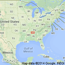
- Black Warrior basin
Summary:
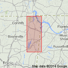
Sandfall member of Pride Mountain formation named in Colbert Co., AL. Consists mainly of noncalcareous to slightly calcareous olive-gray shale, grading upward to calcareous shale and partly oolitic limestone in upper 30 ft. Strata becomes increasingly calcareous eastward, grading completely into limestone in Madison Co., AL. Thickness ranges from 86 ft at type locality to about 65 ft on Cane Creek. Underlies Mynot sandstone member (new); overlies Wagnon member (new). Age is Late Mississippian.
Source: GNU records (USGS DDS-6; Reston GNULEX).
- Usage in publication:
-
- Sandfall Member
- Modifications:
-
- Overview
- AAPG geologic province:
-
- Black Warrior basin
Summary:
Sandfall Member of the Pride Mountain Formation occupies lowermost portion of sequence previously referred to as the Southward Bridge Formation by Morse (1928). Olive gray shale at the base grades upward through a sequence of calcareous, fossiliferous shales into fossiliferous, oolitic limestones and interbedded calcareous shales. The Sandfall is about 70 ft thick in eastern Tishomingo Co., although the entire thickness is not exposed at any single locality. Limestone and shale lithologies of the Sandfall are continuous in Colbert Co. AL. Shale lithologies grade eastward through northern AL into a limestone sequence described in the Monteagle Limestone of northeastern AL. Unit overlies the Southward Spring Sandstone Member; underlies the Mynot Sandstone Member. Age is Late Mississippian (Chesterian).
Source: GNU records (USGS DDS-6; Reston GNULEX).
For more information, please contact Nancy Stamm, Geologic Names Committee Secretary.
Asterisk (*) indicates published by U.S. Geological Survey authors.
"No current usage" (†) implies that a name has been abandoned or has fallen into disuse. Former usage and, if known, replacement name given in parentheses ( ).
Slash (/) indicates name conflicts with nomenclatural guidelines (CSN, 1933; ACSN, 1961, 1970; NACSN, 1983, 2005, 2021). May be explained within brackets ([ ]).