

- Usage in publication:
-
- San Angelo beds
- Modifications:
-
- Named
- Dominant lithology:
-
- Conglomerate
- Quartzite
- Clay
- Sandstone
- AAPG geologic province:
-
- Permian basin
Summary:
Named San Angelo beds [probably for town of San Angelo, in Tom Green Co, TX, Permian basin, though this is not stated]. No type locality designated. Unconformably overlies Permian rocks, and unconformably underlies Lower Cretaceous rocks. At Ben Fielin on the bank of the Middle Concho River overlies a fossiliferous, argillaceous, yellowish magnesian limestone of Permian age and unconformably underlies Trinity sands. Traced northward for nearly 20 mi. San Angelo consists of (ascending): 1) quartz conglomerate, very hard, yellowish red, takes an excellent polish, about 12 ft thick with small, water-worn pebbles bound with a siliceous and irony cement; conglomerate is stratified, dips toward the northwest at a steeper angle than the underlying Permian rocks, and is occasionally interspersed with large blocks of green- and red-speckled quartzite; 2) red- and yellow-colored clays and sandstones about 100 ft thick; and 3) lighter buff- and whitish-colored thin beds of loose, friable sandstones and clays about 50 ft thick. San Angelo beds are considered "a southward thinning out of the Jura and Trias" because of lithologic character and stratigraphic position; no fossils were found for confirmation. Probably formed by strong currents along a coastline. Pre-Cretaceous and post-Permian in age.
Source: GNU records (USGS DDS-6; Denver GNULEX).
- Usage in publication:
-
- San Angelo formation
- Modifications:
-
- Areal extent
- AAPG geologic province:
-
- Permian basin
Summary:
Pg. 7-8. San Angelo beds are = Blowout Mountain sandstone of Wrather [1917], and will replace latter name. [Age is Permian.]
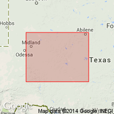
[Report area in Runnels Co., central northern TX.]
Source: US geologic names lexicon (USGS Bull. 896, p. 1902-1903).
- Usage in publication:
-
- San Angelo Formation
- Modifications:
-
- Areal extent
- AAPG geologic province:
-
- Permian basin
- Bend arch
Summary:
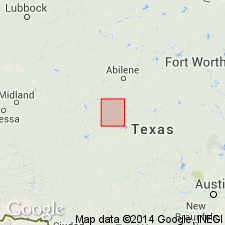
Area of report is central TX; in this area the San Angelo Formation consists of sandstone, shale, and conglomerate. The sandstone is composed of fine-grained quartz, thin bedded to massive, cross-bedded, friable, red, gray, yellow, and brown in color. The shale is sandy in part, indistinctly bedded, red and bluish green in color. A conglomerate of dolomite and siliceous pebbles is associated with the sandstone. Thickness 100-225 ft. Mapped in Runnels, Taylor, and Jones Cos, (on Bend arch) and in Nolan, Fisher, and Stonewall Cos, TX (in Permian basin). Overlies Permian Clear Fork Group; underlies Whitehorse Sandstone, Cloud Chief Gypsum, and Blaine Formation (all Permian, undivided). Geologic map. Of Permian age.
Source: GNU records (USGS DDS-6; Denver GNULEX).
- Usage in publication:
-
- San Angelo Formation
- Modifications:
-
- Overview
- AAPG geologic province:
-
- Bend arch
Summary:
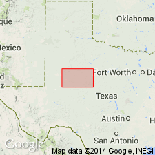
San Angelo Formation is the lowermost formation of the Pease River Group. Area of report is Jones Co, north-central TX on Bend arch. Unconformably overlies Choza Formation, the youngest formation of Clear Fork Group, with a marked erosional unconformity; conformably underlies Blaine Formation of Pease River Group in part; also underlies Quaternary rocks [Seymour Formation] in part. Consists of a nonmarine series of greenish-gray, usually well-consolidated, medium-grained, subangular to well-rounded cross-bedded sandstone near top of unit; lower portion is clay balls, and sandstone as above, interbedded with cherty conglomerates (chert and quartz pebbles), gypsum nodules, streaks of "satin spar" gypsum, and red and green shales. Approximately 110 ft thick in Jones Co. San Angelo is exposed in the prominent escarpment formed by the underlying Merkel Dolomite Member of Choza Formation, and crops out in a belt, approximately 2-5 mi wide, across the western one-third of the western half of Jones Co. Present throughout Jones Co to the west of the outcrop. Dips to the west-northwest at the rate of about 40 ft per mi. Is of Permian age. Chart of geologic units. Geologic map.
Source: GNU records (USGS DDS-6; Denver GNULEX).

- Usage in publication:
-
- San Angelo Formation
- Modifications:
-
- Overview
- Age modified
- Areal extent
- AAPG geologic province:
-
- Permian basin
- Palo Duro basin
Summary:
Area of report is north-central TX; in this area the San Angelo Formation--lowermost formation of Pease River Group of Guadalupe Series--is present in Stonewall, King, and Knox Cos in Permian basin, and Foard and Hardeman Cos in Palo Duro basin. San Angelo overlies Clear Fork Group (undivided) of Leonard Series; underlies Blaine Formation of Pease River Group. Upper part of San Angelo is Flowerpot [Flower-pot] Member (unmapped), 30-60 ft thick. Lower part is Duncan Member (unmapped), 45-70 ft thick; forms moderately prominent escarpment locally obscured by Quaternary deposits. Thickness of San Angelo 90-120 ft. Assigned to the Guadalupe Series [this is an age modification--previous reports assigned San Angelo to the Leonard Series]. Geologic map.
Source: GNU records (USGS DDS-6; Denver GNULEX).

- Usage in publication:
-
- San Angelo Formation
- Modifications:
-
- Mapped 1:250k
- Dominant lithology:
-
- Sandstone
- Shale
- Conglomerate
- AAPG geologic province:
-
- Permian basin
Summary:
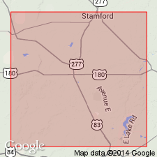
Is Permian formation mapped in southeastern part of map sheet as mostly continuous north-south trending belt in southeastern King and eastern Stonewall Cos, TX (northeastern Permian basin). Overlies Choza Formation (Permian); overlain by Blaine Formation (Permian). Map unit described as sandstone, shale, and conglomerate. Sandstone, fine-grained quartz, thin-bedded to massive, cross-bedded, friable, red, gray. Shale, sandy in part, indistinctly bedded, red, bluish green. Conglomerate of dolomite and siliceous limestone pebbles associated with sandstone. Thickness 50-135 ft.
Source: GNU records (USGS DDS-6; Denver GNULEX).
For more information, please contact Nancy Stamm, Geologic Names Committee Secretary.
Asterisk (*) indicates published by U.S. Geological Survey authors.
"No current usage" (†) implies that a name has been abandoned or has fallen into disuse. Former usage and, if known, replacement name given in parentheses ( ).
Slash (/) indicates name conflicts with nomenclatural guidelines (CSN, 1933; ACSN, 1961, 1970; NACSN, 1983, 2005, 2021). May be explained within brackets ([ ]).